Category:Street junctions in the Royal Borough of Kingston upon Thames
Jump to navigation
Jump to search

Media in category "Street junctions in the Royal Borough of Kingston upon Thames"
The following 36 files are in this category, out of 36 total.
-
 Barnsbury Lane - geograph.org.uk - 1455010.jpg 457 × 640; 314 KB
-
 Canbury School - geograph.org.uk - 2910739.jpg 640 × 480; 100 KB
-
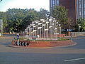 College Roundabout, Kingston upon Thames.jpg 4,032 × 3,024; 1.57 MB
-
 Coombe Road at the junction of Galsworthy Road - geograph.org.uk - 5229976.jpg 2,304 × 1,728; 852 KB
-
 Corner of Woodlands Road and Corkran Road, Surbiton - geograph.org.uk - 2224685.jpg 1,600 × 1,200; 673 KB
-
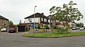
 Crossroads at Malden Rushett - geograph.org.uk - 33868.jpg 640 × 485; 82 KB
-
 Fountain roundabout, New Malden - geograph.org.uk - 31274.jpg 640 × 369; 90 KB
-
 Gloucester Road at the junction of Cambridge Road - geograph.org.uk - 5727370.jpg 2,304 × 1,728; 1.55 MB
-
 Ham Cross, Kingston - geograph.org.uk - 3748755.jpg 2,304 × 1,728; 803 KB
-
 Ham Cross, Kingston - geograph.org.uk - 3787023.jpg 2,304 × 1,728; 869 KB
-

-

-

-
 Kingsdowne Road - geograph.org.uk - 1458014.jpg 640 × 457; 268 KB
-
 Kingston Bypass - geograph.org.uk - 1454587.jpg 640 × 457; 275 KB
-
 Kingston Hill - geograph.org.uk - 1110200.jpg 640 × 480; 100 KB
-
 London Sept 2013 Warren George Rd.JPG 3,072 × 2,304; 1.31 MB
-

-
 Looking over crossroads in Tolworth - geograph.org.uk - 4320373.jpg 800 × 533; 99 KB
-
 Market Place, New Malden - geograph.org.uk - 2877763.jpg 640 × 480; 91 KB
-
 Moor Lane Junction with Gilders Road - geograph.org.uk - 5079128.jpg 4,608 × 3,456; 6.31 MB
-
 Oak Hill Crescent - geograph.org.uk - 1078650.jpg 640 × 480; 77 KB
-
 Our Lady Immaculate Catholic Church - geograph.org.uk - 1455631.jpg 640 × 457; 276 KB
-
 Paper Aeroplanes^ - geograph.org.uk - 3088019.jpg 4,288 × 3,216; 3.87 MB
-
-
 Road junction, Surbiton - geograph.org.uk - 1617095.jpg 640 × 480; 62 KB
-
 Roundabout in Berrylands - geograph.org.uk - 4334007.jpg 1,600 × 1,200; 529 KB
-
 Roundabout, Berrylands - geograph.org.uk - 5154532.jpg 3,072 × 1,706; 1.08 MB
-
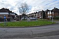 Roundabout, Elmbridge Avenue - geograph.org.uk - 5764620.jpg 640 × 426; 69 KB
-
 Roundabout, Surbiton Hill Park - geograph.org.uk - 5764626.jpg 640 × 426; 73 KB
-
 Surbiton High School - geograph.org.uk - 2757455.jpg 1,600 × 1,200; 651 KB
-
 Thameside and Vicarage Rd junction - geograph.org.uk - 2140805.jpg 640 × 430; 99 KB
-
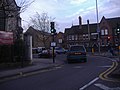
 Tolworth junction - geograph.org.uk - 134858.jpg 640 × 480; 130 KB
-
 Upper Brighton Road - geograph.org.uk - 1077722.jpg 640 × 480; 86 KB
-
 Victoria Road at the junction of Brighton Road, Surbiton - geograph.org.uk - 3502043.jpg 1,600 × 1,200; 705 KB
-
 Warren Drive South - geograph.org.uk - 1454577.jpg 640 × 457; 289 KB


