Category:Street junctions in the London Borough of Havering
Jump to navigation
Jump to search

Media in category "Street junctions in the London Borough of Havering"
The following 28 files are in this category, out of 28 total.
-

-
 Broxhill Road at the junction of Noak Hill Road - geograph.org.uk - 5304569.jpg 2,014 × 1,490; 1.01 MB
-

-
 Central Drive, near Hornchurch - geograph.org.uk - 5523965.jpg 640 × 480; 59 KB
-
 Corbets Tey, Upminster, Essex - geograph.org.uk - 22617.jpg 640 × 480; 80 KB
-
 Corner of Ethelburga Road - geograph.org.uk - 3906306.jpg 640 × 480; 63 KB
-
 Gelsthorpe Road, Collier Row - geograph.org.uk - 1131070.jpg 640 × 426; 54 KB
-
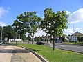 Havering Road, Collier Row, Romford, Essex - geograph.org.uk - 34893.jpg 640 × 480; 135 KB
-
 Junction Chesham Close - Cedar Road - geograph.org.uk - 1114498.jpg 640 × 480; 54 KB
-

-

-

-
 Junction of Popular Street and Mawney Road - geograph.org.uk - 1626297.jpg 3,689 × 2,978; 2.72 MB
-
-

-
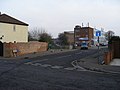
 Junction on the B1421 - geograph.org.uk - 747257.jpg 640 × 438; 61 KB
-

-
 Links Avenue at the junction of Hockley Drive - geograph.org.uk - 5304561.jpg 2,048 × 1,536; 1.02 MB
-

-
 Looking to Cumberland Avenue, Hornchurch - geograph.org.uk - 4859822.jpg 4,608 × 3,456; 3.4 MB
-
 Looking to Cumberland Avenue, Hornchurch - geograph.org.uk - 4859823.jpg 4,608 × 3,456; 3.38 MB
-

-

-

-
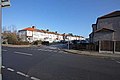
 Road junction, North Ockendon - geograph.org.uk - 5515654.jpg 640 × 480; 78 KB
-

-
 Station Lane at the corner of Mavis Grove - geograph.org.uk - 5575426.jpg 2,304 × 1,728; 856 KB
-
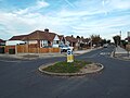
 The Drill Roundabout, Romford, Essex - geograph.org.uk - 24007.jpg 640 × 480; 90 KB


