Category:Southern Upland Way
Jump to navigation
Jump to search

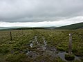
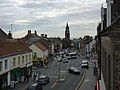
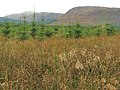
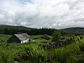
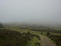
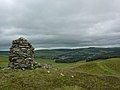
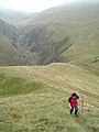
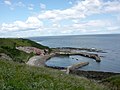
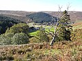
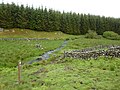
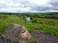
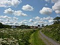
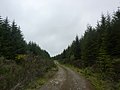
English: The Southern Upland Way — a 212 miles (341 km) coast to coast public footpath in southern Scotland. It runs between Cockburnspath in Scottish Borders on the east, and Portpatrick in Dumfries and Galloway on the west.
Deutsch: Der Southern Upland Way ist ein schottischer Fernwanderweg. Er führt von Portpatrick an Schottlands Westküste nach Cockburnspath an der Ostküste. Es beträgt 337,6 Kilometer (209,8 Meilen), und er ist somit der längste schottische Wanderweg.
long-distance footpath in Scottish Borders and Dumfries and Galloway, Scotland, UK  .jpg) | |||||
| Upload media | |||||
| Instance of |
| ||||
|---|---|---|---|---|---|
| Location |
| ||||
| Has use | |||||
| Length |
| ||||
| Terminus | |||||
| official website | |||||
 | |||||
Subcategories
This category has the following 4 subcategories, out of 4 total.
L
- Lowther Hill Radar Station (14 F)
M
- Monument to James Hogg (4 F)
R
- Robert Burns House in Dumfries (12 F)
T
- The Three Brethren (13 F)
Media in category "Southern Upland Way"
The following 200 files are in this category, out of 636 total.
(previous page) (next page)-
 "Eagle Stone" - geograph.org.uk - 1093153.jpg 480 × 640; 69 KB
-
 'Caves' of Kilhern - geograph.org.uk - 154852.jpg 480 × 640; 115 KB
-
 2014 Landscape Photography Workshop, Northumberland (12039541545).jpg 4,928 × 3,264; 1.68 MB
-
 2014 Landscape Photography Workshop, Northumberland (12039542275).jpg 4,928 × 2,664; 1.23 MB
-
 2014 Landscape Photography Workshop, Northumberland (12039921474).jpg 4,928 × 3,264; 3.78 MB
-
 400 years of the Royal Burgh of Sanquhar (6659834933).jpg 2,736 × 3,648; 5.77 MB
-
 A cairn by the Southern Upland Way - geograph.org.uk - 712953.jpg 640 × 480; 118 KB
-
 A country road - geograph.org.uk - 735171.jpg 640 × 480; 100 KB
-
 A Due Reward (6896146023).jpg 3,648 × 2,736; 4.84 MB
-
 A glimpse of Loch Trool through the trees (6600296359).jpg 3,648 × 2,736; 5.78 MB
-
 A great big giant rock (6606843847).jpg 3,648 × 2,736; 5.89 MB
-
 A Melrose Panoramic (6927818587).jpg 11,250 × 2,289; 12.44 MB
-
 A pile of rubble meets me (6902247255).jpg 3,648 × 2,736; 4.11 MB
-
 A rough track leading to Wanlockhead - geograph.org.uk - 974819.jpg 640 × 481; 62 KB
-
 A row of trees on Fethan Hill (6896168639).jpg 3,648 × 2,736; 5.76 MB
-
 A sign telling you about a sign (6902264905).jpg 3,648 × 2,736; 5.42 MB
-
 Abbotsford (6903408821).jpg 3,648 × 2,736; 4.97 MB
-
 About to cross the A1 (6931261539).jpg 3,648 × 2,736; 5.59 MB
-
 Above Duntercleuch - geograph.org.uk - 1473055.jpg 640 × 480; 92 KB
-
 Access Denied (6928539999).jpg 3,648 × 2,736; 5.61 MB
-
 Allans Cairn (6630493715).jpg 2,736 × 3,648; 5.76 MB
-
 Altarside shelves (6903228935).jpg 3,648 × 2,736; 5.49 MB
-
 Another of those fancy signpost rocks (6743009297).jpg 3,648 × 2,736; 5.64 MB
-
 Another Southern Upland Way kist (6782093240).jpg 3,648 × 2,736; 5.42 MB
-
 Another Southern Upland Way Kist (6782140604).jpg 3,648 × 2,736; 5.81 MB
-
 Another Striding Arch (6630468171).jpg 3,648 × 2,736; 4.63 MB
-
 Another Ulteria (6606829569).jpg 3,648 × 2,736; 5.64 MB
-

-
 Another Walker (6928209565).jpg 3,648 × 2,432; 4.32 MB
-
 Another walker! (6823136255).jpg 3,648 × 2,736; 5.28 MB
-
 Another walker! (6902255145).jpg 3,648 × 2,736; 4.36 MB
-
 Another waymark in a pile of rocks (6928241733).jpg 3,648 × 2,736; 5.56 MB
-
 Another waymerk for the collection (6902218111).jpg 3,648 × 2,736; 3.63 MB
-
 Approach to Wanlockhead - geograph.org.uk - 633989.jpg 640 × 414; 73 KB
-
 Approaching Cove Harbour (6803193384).jpg 3,648 × 2,736; 5.67 MB
-
 Approaching Duntercleuch - geograph.org.uk - 1473205.jpg 640 × 480; 98 KB
-
 Approaching Glengaber Burn - geograph.org.uk - 633983.jpg 640 × 429; 61 KB
-
 Approaching Knowe on Southern Upland Way - panoramio.jpg 1,320 × 1,980; 2.71 MB
-
 Approaching Lowther Hill - geograph.org.uk - 633999.jpg 640 × 429; 42 KB
-
 Ascending Glengaber Hill - geograph.org.uk - 1473344.jpg 640 × 480; 73 KB
-
 Back into the forest (6699882349).jpg 3,648 × 2,432; 3.67 MB
-
 Bargrennan (6587534453).jpg 3,648 × 2,736; 4.56 MB
-
 Beautiful path on Cairn Hill (6630479225).jpg 3,648 × 2,736; 4.44 MB
-
 Beehive Bothy at Laggangarn (6587474471).jpg 3,648 × 2,736; 4.29 MB
-
 Below Glendorch Rig - geograph.org.uk - 1473025.jpg 640 × 480; 118 KB
-
 Below Stake Hill - geograph.org.uk - 633994.jpg 640 × 391; 57 KB
-
 Benbrack up ahead (6630425401).jpg 3,648 × 2,736; 4.23 MB
-
 Berwick Barracks (6952122663).jpg 3,648 × 2,736; 4.48 MB
-
 Berwick Bridge (6805986784).jpg 3,648 × 2,736; 3.63 MB
-
 Berwick Estuary, seen from the old city walls (6952106451).jpg 3,648 × 2,736; 5.14 MB
-
 Berwick Estuary, seen from the old city walls (6952111913).jpg 3,648 × 2,736; 4.84 MB
-
 Berwick High Street (6952133631).jpg 3,648 × 2,736; 4.6 MB
-
 Berwick Railway Station (6806186906).jpg 3,648 × 2,054; 2.88 MB
-
 Berwicks main shopping street seen from the city walls (6806183020).jpg 3,648 × 2,736; 4.53 MB
-
 Big Plantation (6486954107).jpg 3,648 × 2,736; 5.59 MB
-
 Bird flying (6699837501).jpg 3,201 × 2,133; 2.48 MB
-
 Black Loch (6559758215).jpg 3,648 × 2,736; 5.24 MB
-
 Blackhouse Tower (6896118377).jpg 3,648 × 2,736; 5.76 MB
-
 Bloodline (6896059763).jpg 3,648 × 2,736; 5.46 MB
-
 Bloomin road walking (6896183001).jpg 3,648 × 2,736; 5.13 MB
-
 Blythe Water (6928245751).jpg 3,648 × 2,736; 5.72 MB
-
 Boats in Portpatrick Harbour (6486685751).jpg 3,648 × 2,736; 3.63 MB
-
 Bogg (6680814203).jpg 3,648 × 2,432; 3 MB
-
-
 Boots alongside Whare Burn (6782560156).jpg 2,736 × 3,648; 5.64 MB
-
 Boots by the loch (6823262185).jpg 3,648 × 2,736; 5.88 MB
-
 Bothy sign (6742819895).jpg 3,648 × 2,736; 6.18 MB
-
 Brattleburn - geograph.org.uk - 634647.jpg 640 × 405; 70 KB
-
 Brattleburn Bothy (6742804225).jpg 3,648 × 2,736; 4.88 MB
-
 Brattleburn bothy - geograph.org.uk - 508254.jpg 640 × 480; 175 KB
-
 Brattleburn Bothy the next morning (6742788515).jpg 3,648 × 2,736; 3.75 MB
-
 Bridge over the Stroanfreggan Burn - geograph.org.uk - 553939.jpg 640 × 375; 69 KB
-
 Bridge over the Water of Ken - geograph.org.uk - 633412.jpg 640 × 416; 72 KB
-
 Bridge over White Adder Water (6928590631).jpg 3,648 × 2,736; 5.82 MB
-
 Bridge Relics, Wanlock Water - geograph.org.uk - 1473011.jpg 640 × 480; 113 KB
-
 Brown Knowe (6902239477).jpg 3,648 × 2,736; 3.87 MB
-
 Bull In Field (6781691798).jpg 3,648 × 2,736; 5.26 MB
-
 Burns (6612683405).jpg 3,648 × 2,052; 3.53 MB
-
 Burns House (6612667655).jpg 3,648 × 2,736; 4.58 MB
-
 Burns Mausoleum (6612675871).jpg 3,648 × 2,736; 3.59 MB
-
 Burnt heather on Kilhern Moss (6587413247).jpg 3,648 × 2,736; 5.22 MB
-
 By the Black Burn - geograph.org.uk - 1473220.jpg 640 × 480; 109 KB
-
 Cairn on Ardoch Hill. - geograph.org.uk - 512407.jpg 640 × 480; 121 KB
-
 Cairn overlooking Galashiels (6902331421).jpg 3,648 × 2,736; 4.55 MB
-
 Cameron Memorial - Sanquhar Covenanters Monument (6680797795).jpg 2,736 × 3,648; 3.72 MB
-
 Campsite that way? Nope! (6600285887).jpg 3,648 × 2,736; 6.03 MB
-
 Can you tell what this bit used to be? (6903362651).jpg 3,648 × 2,736; 5.73 MB
-
 Capel Fell and Craigmichen Scar - geograph.org.uk - 3221893.jpg 4,608 × 3,456; 6.27 MB
-
 Capel Fell and the Selcoth Burn - geograph.org.uk - 3221727.jpg 4,608 × 3,456; 6.16 MB
-
 Carved Squirrel (6659671923).jpg 3,648 × 2,736; 5.13 MB
-
 Castle Kennedys ruins seen from the Walled Garden (6559836033).jpg 3,648 × 2,736; 5.9 MB
-
 Cat Shoulder - geograph.org.uk - 3221916.jpg 4,478 × 3,276; 5.18 MB
-
 Cat Shoulder - geograph.org.uk - 55536.jpg 480 × 640; 75 KB
-
 Cat Shoulder zig zags - geograph.org.uk - 237455.jpg 640 × 480; 94 KB
-
 Celebrating back home (6952303793).jpg 2,736 × 3,648; 2.6 MB
-
 Chaffinch (6823304225).jpg 3,648 × 2,736; 4.73 MB
-
 Chain Link Bridge (6903349405).jpg 3,648 × 2,736; 4.64 MB
-
 Chain Link Bridge, Melrose (6927795085).jpg 2,736 × 3,648; 5.14 MB
-
 Chalk Memorial Bothy at Polskeoch (6630506135).jpg 3,648 × 2,736; 4.78 MB
-
 Coastal path, Pease Bay - geograph.org.uk - 1523203.jpg 640 × 427; 111 KB
-
 Cogshead (6680840541).jpg 3,648 × 2,736; 4.5 MB
-
 Cogshead Forest (6680821033).jpg 3,648 × 2,432; 2.94 MB
-
 Come too far (6928251595).jpg 3,648 × 2,736; 3.75 MB
-
 Coming in to Lauder (6928234275).jpg 3,648 × 2,736; 5.41 MB
-
 Contents of the kist (6659746283).jpg 3,648 × 2,736; 6.16 MB
-
 Contradictory Arrows (6782107562).jpg 3,648 × 2,736; 5.66 MB
-
 Corse Bridge - geograph.org.uk - 419178.jpg 609 × 475; 124 KB
-
 Counter Terrorist Response Levels System (6806014032).jpg 3,648 × 2,736; 4.24 MB
-
 Cove Harbour (6803152682).jpg 3,648 × 2,736; 4.14 MB
-
 Cove Harbour (6803224870).jpg 3,648 × 2,736; 5.32 MB
-
 Cove Harbour (6949309301).jpg 3,648 × 2,736; 5.67 MB
-
 Cove Harbour Panoramic (6949351579).jpg 8,659 × 2,232; 15.43 MB
-
 Cow shed - geograph.org.uk - 315081.jpg 640 × 480; 79 KB
-
 Cows can be dangerous (6559903703).jpg 3,648 × 2,736; 5.7 MB
-
 Craigbeck Hope (6742994869).jpg 3,648 × 2,736; 5.56 MB
-
 Craigmichen Scar (6743034963).jpg 3,648 × 2,736; 5.05 MB
-
 Craigmichen Scar - geograph.org.uk - 3221880.jpg 4,608 × 3,456; 6.39 MB
-
 Craigmichen Scar - geograph.org.uk - 634809.jpg 640 × 431; 76 KB
-
 Craigmichen Scar and Selcoth Burn - geograph.org.uk - 3221903.jpg 4,608 × 3,456; 5.87 MB
-
 Craignaw from Southern Upland Way - geograph.org.uk - 1252194.jpg 640 × 480; 71 KB
-
 Crosscleuch Farm - geograph.org.uk - 1542745.jpg 640 × 480; 130 KB
-
 Crossing the Stranraer railway line (6559892851).jpg 3,648 × 2,736; 5.67 MB
-
 Culvert under The Southern Upland Way - geograph.org.uk - 1565961.jpg 640 × 480; 148 KB
-
 Cycle route sign at Loch Dee (6600501295).jpg 3,648 × 2,736; 4.83 MB
-
 Daer Reservoir (6699843469).jpg 3,648 × 2,736; 4.34 MB
-
 Daer Reservoir (6699856977).jpg 3,648 × 2,736; 4.47 MB
-
 Daer Reservoir (6699877271).jpg 3,648 × 2,736; 4 MB
-
 Daer Reservoir and Dam (6699865211).jpg 3,648 × 2,736; 3.79 MB
-
 Dalry Parish Church and Gordon Aisle (6612636007).jpg 3,648 × 2,736; 4.82 MB
-
 Dalry Town Hall and Police Station (6612643645).jpg 3,648 × 2,736; 4.29 MB
-
 Dancing doli's - Flickr - S. Rae.jpg 1,988 × 1,800; 957 KB
-
 Dangerous cows (6559911287).jpg 3,648 × 2,736; 4.17 MB
-
 Dargall Lane - geograph.org.uk - 633402.jpg 640 × 419; 49 KB
-
 Descending Lowther Hill (6699777789).jpg 3,648 × 2,736; 3.93 MB
-
 Dipping my boots in the waters of the North Sea (6949328831).jpg 3,648 × 2,736; 5.82 MB
-
 Disco sound system with some phatt tunes (6680909181).jpg 3,648 × 2,736; 4.18 MB
-
 Dog chasing the sheep (6823085465).jpg 3,000 × 1,689; 2.78 MB
-
 Driveway to Dryhope - geograph.org.uk - 1542772.jpg 640 × 480; 121 KB
-
 Dryhope Tower (6896089791).jpg 3,648 × 2,736; 5.01 MB
-
 Dryhope Tower (6896103243).jpg 3,648 × 2,736; 4.84 MB
-
 Duck pond at Glen Trool Holiday Park (6600200963).jpg 3,648 × 2,736; 5.65 MB
-
 DWB Gates at Daer Reservoir (6699849535).jpg 3,648 × 2,736; 4.32 MB
-
 Earls Hill (6823160131).jpg 3,648 × 2,736; 4.92 MB
-
 Earlstoun Burn (6630359251).jpg 3,648 × 2,736; 5.59 MB
-
 East Coast train crossing the Royal Tweed Bridge (6806177324).jpg 3,648 × 2,736; 4.28 MB
-
 Eildon Hill (6927802611).jpg 3,648 × 2,432; 3.53 MB
-
 Emerging from the forest, Ettrick Head - geograph.org.uk - 3221631.jpg 3,074 × 3,074; 5.04 MB
-
 Engraved rock, near Sanquhar Castle (6659801231).jpg 3,648 × 2,736; 5.65 MB
-
 Entering Cockburnspath (6949552505).jpg 3,648 × 2,736; 5.52 MB
-
 Entering the forest at Brockloch Hill (6587454835).jpg 3,648 × 2,736; 4.96 MB
-
 Entrance to Craigbeck Hope - geograph.org.uk - 634799.jpg 640 × 386; 46 KB
-
 Entrance to Stroanpatrick - geograph.org.uk - 633656.jpg 640 × 428; 57 KB
-
 Eristalis pertinax (female) - Flickr - S. Rae (3).jpg 1,840 × 1,564; 918 KB
-
 Eristalis sp. arbustorum^ (male) - Flickr - S. Rae.jpg 1,102 × 920; 401 KB
-
 Eristalis tenax (female) - Drone Fly - Flickr - S. Rae (1).jpg 1,136 × 920; 412 KB
-
 Eupeodes corollae (male) - Flickr - S. Rae (1).jpg 1,215 × 1,038; 448 KB
-
 Eupeodes corollae (male) - Flickr - S. Rae (2).jpg 1,206 × 1,090; 438 KB
-
 Ewe and Yours (6902323185).jpg 3,648 × 2,736; 5.64 MB
-
 Exterior of Melrose Abbey (6903338711).jpg 3,648 × 2,736; 4.53 MB
-
 Eyemouth Disaster memorial (6949297293).jpg 3,648 × 2,736; 5.68 MB
-
 Eyemouth Disaster Memorial at Cove (6803181334).jpg 3,648 × 2,736; 5.78 MB
-
 Eyemouth Disaster Memorial at Cove (6949285557).jpg 3,648 × 2,736; 4.45 MB
-
 Fairy grotto^ - geograph.org.uk - 633406.jpg 640 × 425; 96 KB
-
 Feeling glum at the Information Shelter in St Johns Town of Dalry (6606862261).jpg 3,648 × 2,736; 3.29 MB
-

-
 Flowers in the heather (6896160429).jpg 3,648 × 2,736; 5.6 MB
-
 Footbridge, Southern Upland Way - geograph.org.uk - 195135.jpg 640 × 480; 266 KB
-
 Footpath to Tennyson Down and Needles (6659695767).jpg 3,648 × 2,736; 5.46 MB
-
 Forest at Brockloch Hill (6587460879).jpg 3,648 × 2,736; 4.5 MB
-
 Forest lion - geograph.org.uk - 55590.jpg 480 × 640; 115 KB
-
 Forest road and Southern Upland Way - geograph.org.uk - 1410108.jpg 640 × 501; 78 KB
-
 Forest road and the Rhinns of Kells - geograph.org.uk - 1152585.jpg 640 × 493; 99 KB
-
 Forest Track by Cogshead - geograph.org.uk - 1473296.jpg 640 × 480; 112 KB
-

-
 Forestry road - geograph.org.uk - 1410118.jpg 640 × 464; 99 KB
-
 Former Smelt Mill (6680879307).jpg 3,648 × 2,736; 5.63 MB
-
 Former Smelt Mill (6680889721).jpg 3,648 × 2,736; 4.91 MB
-
 Found another one! (6743086883).jpg 3,648 × 2,736; 5.02 MB
-
 Four Lords Lands - geograph.org.uk - 4815.jpg 640 × 480; 125 KB
-
 Foys Bridge (6742849101).jpg 3,648 × 2,736; 5.79 MB
-
 Free camping?!! (6680900165).jpg 3,648 × 2,736; 4.85 MB
-
 Gala Policies Community Woodland (6902355527).jpg 3,648 × 2,736; 3.72 MB
-
 Galashiels and flowers (6781685760).jpg 3,648 × 2,736; 5.69 MB
-
 Gargoyle of a pig playing the bagpipes (6903291997).jpg 3,648 × 2,736; 4.33 MB
-
 Gargoyles on the roof of Melrose Abbey (6903272989).jpg 3,648 × 2,736; 4.74 MB
-
 Garroch Burn (6606855155).jpg 3,648 × 2,736; 5.32 MB
-
 Gate and Stile on Southern Upland Way - geograph.org.uk - 179500.jpg 640 × 480; 193 KB
-

-
 Get your plaque! (6928554129).jpg 2,736 × 3,648; 3.87 MB
-
 Getting near Over Phawhope (6743137121).jpg 3,648 × 2,736; 4.36 MB
-
 Giant Axe Head (6600345863).jpg 3,648 × 2,736; 6.19 MB
-
 Giant Axe Head (6600357511).jpg 3,648 × 2,736; 5.72 MB
-
 Glengaber Hill (6680848713).jpg 3,648 × 2,736; 4 MB
-
 Glengaber Hill - geograph.org.uk - 1473353.jpg 640 × 480; 102 KB
-
 Glenhead (6600323213).jpg 3,648 × 2,736; 4.95 MB
-
 Glensalloch - geograph.org.uk - 1473247.jpg 640 × 480; 92 KB
-
 Glenwhan Moor (6559854093).jpg 3,648 × 2,736; 4.53 MB
-
 Going under the A1 (6949546491).jpg 3,648 × 2,736; 4.58 MB
-
 Going under the M71 (6742955503).jpg 3,648 × 2,736; 5.74 MB
-
 Going under the railway (6949541617).jpg 3,648 × 2,736; 5.7 MB


.jpg)
.jpg)
.jpg)
.jpg)


.jpg)
.jpg)
.jpg)
.jpg)

.jpg)
.jpg)
.jpg)
.jpg)

.jpg)
.jpg)
.jpg)
.jpg)
.jpg)
.jpg)
.jpg)
.jpg)

.jpg)
.jpg)
.jpg)
.jpg)
.jpg)

.jpg)


.jpg)
.jpg)
.jpg)
.jpg)


.jpg)
.jpg)
.jpg)
.jpg)
.jpg)
.jpg)
.jpg)
.jpg)
.jpg)
.jpg)
.jpg)
.jpg)
.jpg)
.jpg)
.jpg)
.jpg)
.jpg)

.jpg)
.jpg)
.jpg)

.jpg)

.jpg)


.jpg)

.jpg)
.jpg)
.jpg)
.jpg)
.jpg)
.jpg)


.jpg)
.jpg)
.jpg)
.jpg)


.jpg)
.jpg)


.jpg)
.jpg)
.jpg)
.jpg)
.jpg)

.jpg)
.jpg)
.jpg)
.jpg)
.jpg)
.jpg)

.jpg)
.jpg)
.jpg)
.jpg)

.jpg)
.jpg)
.jpg)


.jpg)

.jpg)
.jpg)
.jpg)
.jpg)
.jpg)
.jpg)
.jpg)

.jpg)

.jpg)
.jpg)
.jpg)
.jpg)

.jpg)
.jpg)
.jpg)
.jpg)
.jpg)
.jpg)
.jpg)
.jpg)

.jpg)
.jpg)
.jpg)


_-_Flickr_-_S._Rae_(3).jpg)
_-_Flickr_-_S._Rae.jpg)
_-_Drone_Fly_-_Flickr_-_S._Rae_(1).jpg)
_-_Flickr_-_S._Rae_(1).jpg)
_-_Flickr_-_S._Rae_(2).jpg)
.jpg)
.jpg)
.jpg)
.jpg)
.jpg)

.jpg)

.jpg)

.jpg)
.jpg)


.jpg)
.jpg)
.jpg)

.jpg)
.jpg)
.jpg)
.jpg)
.jpg)
.jpg)
.jpg)


.jpg)
.jpg)
.jpg)
.jpg)
.jpg)

.jpg)

.jpg)
.jpg)
.jpg)
.jpg)
.jpg)
.jpg)