Category:Cockburnspath
Jump to navigation
Jump to search
English: Cockburnspath is a village in Scotland which lies near the North Sea coast between Berwick-upon-Tweed and Edinburgh. It is at the eastern extremity of the Southern Upland Way, a long-distance footpath from the west to east coast of Scotland. At the nearby village of Cove, there is a small fishing harbour.
village in Scottish Borders, Scotland, UK  | |||||
| Upload media | |||||
| Instance of | |||||
|---|---|---|---|---|---|
| Location |
| ||||
| official website | |||||
 | |||||
Subcategories
This category has the following 3 subcategories, out of 3 total.
C
- Cockburnspath Tower (1 F)
P
- Pease Bay (17 F)
Media in category "Cockburnspath"
The following 82 files are in this category, out of 82 total.
-
-
 Coastline Northwest from Cove - geograph.org.uk - 171229.jpg 640 × 480; 78 KB
-
 Cockburnspath Mercat Cross - geograph.org.uk - 147564.jpg 640 × 480; 70 KB
-
 Dunglass Collegiate Church - Flickr - S. Rae.jpg 4,320 × 2,880; 4.39 MB
-
 Dunglass info board - Flickr - S. Rae.jpg 4,235 × 2,954; 3.79 MB
-
 Entering Cockburnspath (6949552505).jpg 3,648 × 2,736; 5.52 MB
-
 Farmland near Old Cambus West Mains - geograph.org.uk - 1764230.jpg 640 × 417; 140 KB
-
 Going under the A1 (6949546491).jpg 3,648 × 2,736; 4.58 MB
-
 Going under the railway (6949541617).jpg 3,648 × 2,736; 5.7 MB
-
 Kirklands - geograph.org.uk - 147559.jpg 640 × 480; 82 KB
-
 Less to see (6785132934).jpg 3,648 × 2,736; 5.67 MB
-
 Marly Brae - geograph.org.uk - 157059.jpg 640 × 480; 82 KB
-
 Me at the end of the Southern Upland Way (6949562165).jpg 3,648 × 2,736; 3.76 MB
-
 Melanostoma scalare (female) - Flickr - S. Rae (6).jpg 1,252 × 972; 389 KB
-
 Melanostoma scalare (male) - Flickr - S. Rae (5).jpg 1,548 × 1,324; 619 KB
-
 Meliscaeva auricollis (male) - Flickr - S. Rae (3).jpg 1,316 × 1,108; 402 KB
-
 Meliscaeva auricollis (male) - Flickr - S. Rae (4).jpg 1,164 × 944; 365 KB
-
 Meliscaeva auricollis (male) - Flickr - S. Rae (5).jpg 1,152 × 932; 360 KB
-
 Meliscaeva auricollis (male) - Flickr - S. Rae (6).jpg 820 × 683; 216 KB
-
 Mercat Cross at Cockburnspath, Berwickshire.JPG 2,557 × 1,880; 975 KB
-
 Ordnance Survey One-Inch Sheet 63 Dunbar, Published 1965.jpg 8,237 × 9,872; 10.2 MB
-
 Ordnance Survey One-Inch Sheet 64 Berwick-upon-Tweed, Published 1947.jpg 10,971 × 12,777; 24.02 MB
-
 Ordnance Survey One-Inch Sheet 64 Berwick-upon-Tweed, Published 1965.jpg 8,598 × 10,667; 14.95 MB
-
 Pease Bridge - geograph.org.uk - 92743.jpg 640 × 480; 131 KB
-
 Phasia hemiptera (Shieldbug Fly) - female - Flickr - S. Rae.jpg 860 × 800; 261 KB
-
 Phasia hemiptera (Shieldbug Fly) - male - Flickr - S. Rae (1).jpg 1,497 × 1,170; 572 KB
-
 Phasia hemiptera (Shieldbug Fly) - male - Flickr - S. Rae.jpg 1,806 × 1,656; 889 KB
-
 St Helens Church board, Cockburnspath - geograph.org.uk - 1764367.jpg 424 × 640; 118 KB
-
 St. Helen's Church, Old Cambus - geograph.org.uk - 157032.jpg 640 × 480; 67 KB
-
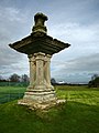 Sundial - geograph.org.uk - 142479.jpg 480 × 640; 77 KB
-
 The East Coast Railway Line, geograph 6395106 by Walter Baxter.jpg 1,024 × 683; 588 KB
-
 The end of the Southern Upland Way (6949557807).jpg 3,648 × 2,736; 4.58 MB
-
 The rucksack takes a rest (6949567665).jpg 3,648 × 2,736; 5.04 MB
-

-

-
 Trig Point and Settlement - geograph.org.uk - 173956.jpg 640 × 480; 124 KB
-
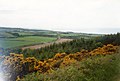
 View East towards Reed Point, near Cove - geograph.org.uk - 195367.jpg 640 × 480; 178 KB
-
 Across Edmond's Dean - geograph.org.uk - 355767.jpg 640 × 480; 90 KB
-
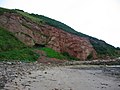
 Beach, west of Reed Point - geograph.org.uk - 1514644.jpg 640 × 427; 145 KB
-
 Blackburn - geograph.org.uk - 355293.jpg 480 × 640; 68 KB
-
 Bluebells, Pease Dean - geograph.org.uk - 234213.jpg 640 × 480; 174 KB
-
 Byres, Blackburn - geograph.org.uk - 223135.jpg 640 × 480; 64 KB
-
 Byres, Blackburn - geograph.org.uk - 355297.jpg 640 × 480; 91 KB
-
 Chesterfield Road - geograph.org.uk - 174120.jpg 640 × 480; 94 KB
-

-
 Cockburnspath - geograph.org.uk - 72270.jpg 640 × 480; 255 KB
-
 Cockburnspath Church - geograph.org.uk - 147588.jpg 480 × 640; 76 KB
-
 Cove - geograph.org.uk - 171238.jpg 640 × 480; 93 KB
-
 Cove coast Southern Upland Way - geograph.org.uk - 137255.jpg 640 × 480; 73 KB
-
 Cove Harbour - geograph.org.uk - 195362.jpg 640 × 480; 82 KB
-
 Cove Harbour - geograph.org.uk - 195364.jpg 640 × 497; 134 KB
-
 Cove harbour - geograph.org.uk - 450243.jpg 640 × 480; 107 KB
-
 Cove Harbour - geograph.org.uk - 572990.jpg 640 × 480; 69 KB
-
 Cove Harbour - geograph.org.uk - 636239.jpg 640 × 422; 57 KB
-
 Cove Harbour - geograph.org.uk - 718184.jpg 640 × 480; 101 KB
-
 Cows, Old Cambus - geograph.org.uk - 157066.jpg 640 × 480; 95 KB
-
 Dragging Rock, Cove - geograph.org.uk - 171218.jpg 640 × 480; 117 KB
-
 Dunglas Bridge - geograph.org.uk - 148669.jpg 640 × 480; 88 KB
-

-

-
 Farm Track and Field - geograph.org.uk - 173965.jpg 640 × 480; 136 KB
-
 Fields near Cove - geograph.org.uk - 92742.jpg 640 × 480; 104 KB
-
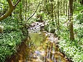
 Footbridge, Pease Dean - geograph.org.uk - 92735.jpg 640 × 480; 134 KB
-
 Footpath - geograph.org.uk - 173977.jpg 640 × 480; 132 KB
-
 Greenheugh Bay, Old Cambus - geograph.org.uk - 157043.jpg 640 × 458; 97 KB
-
 Harbour Mouth - geograph.org.uk - 572961.jpg 640 × 480; 74 KB
-
 Hog's Law - geograph.org.uk - 147832.jpg 640 × 379; 79 KB
-
 Leaving Blackburn - geograph.org.uk - 636229.jpg 640 × 435; 60 KB
-
 Neeps...or Swedes - geograph.org.uk - 147552.jpg 640 × 480; 116 KB
-
 Neuk Farm, near Cockburnspath - geograph.org.uk - 151430.jpg 640 × 480; 76 KB
-
 Pease Dean - geograph.org.uk - 233695.jpg 640 × 480; 164 KB
-
 Pease Dean woodland - geograph.org.uk - 636236.jpg 640 × 434; 54 KB
-
 Ploughed field, Tower Farm - geograph.org.uk - 147828.jpg 640 × 480; 124 KB
-
 Potato fields, Pease Bridge. - geograph.org.uk - 233693.jpg 640 × 480; 120 KB
-
 Road to Cockburnspath - geograph.org.uk - 147562.jpg 640 × 480; 83 KB
-
 Sand Pit - geograph.org.uk - 151444.jpg 640 × 480; 76 KB
-
 The end of the tunnel - geograph.org.uk - 571296.jpg 640 × 480; 71 KB
-
 Tower Burn - geograph.org.uk - 234218.jpg 640 × 480; 171 KB
-
 Track to Closehead and Belvidere Wood - geograph.org.uk - 147553.jpg 640 × 480; 93 KB
-
 Tracks, Blackburn - geograph.org.uk - 355761.jpg 640 × 480; 67 KB
-
 Trees, Blackburn - geograph.org.uk - 450202.jpg 640 × 480; 106 KB
-
 Winding steps - geograph.org.uk - 92739.jpg 480 × 640; 124 KB


.jpg)

.jpg)
.jpg)

.jpg)

.jpg)
_-_Flickr_-_S._Rae_(6).jpg)
_-_Flickr_-_S._Rae_(5).jpg)
_-_Flickr_-_S._Rae_(3).jpg)
_-_Flickr_-_S._Rae_(4).jpg)
_-_Flickr_-_S._Rae_(5).jpg)
_-_Flickr_-_S._Rae_(6).jpg)


_-_female_-_Flickr_-_S._Rae.jpg)
_-_male_-_Flickr_-_S._Rae_(1).jpg)
_-_male_-_Flickr_-_S._Rae.jpg)


.jpg)
.jpg)


