Category:September 2018 in the East Riding of Yorkshire
Jump to navigation
Jump to search
Ceremonial counties of England: Bedfordshire · Berkshire · Buckinghamshire · Cambridgeshire · Cheshire · Cornwall · Cumbria · Derbyshire · Devon · Dorset · Durham · East Riding of Yorkshire · East Sussex · Essex · Gloucestershire · Greater London · Greater Manchester · Hampshire · Herefordshire · Hertfordshire · Isle of Wight · Kent · Lancashire · Leicestershire · Lincolnshire · Merseyside · Norfolk · North Yorkshire · Northamptonshire · Northumberland · Nottinghamshire · Oxfordshire · Shropshire · Somerset · South Yorkshire · Staffordshire · Suffolk · Surrey · Warwickshire · West Midlands · West Sussex · West Yorkshire ·
City-counties: Bristol ·
Former historic counties:
Other former counties:
City-counties: Bristol ·
Former historic counties:
Other former counties:
Deutsch: Bilder, die im September 2018 in the East Riding of Yorkshire aufgenommen worden sind. Bitte beachten Sie, dass dies weder das Datum des Uploads noch das Datum des Scannens eines Fotos ist.
English: Images/pictures taken in the East Riding of Yorkshire during September 2018. Note this is not the date of the upload, nor the date a photo was scanned.
Español: Fotografías o imágenes tomadas en the East Riding of Yorkshire durante septiembre 2018. No es la fecha de subida ni escaneo, sino la fecha en que las fotografías o imágenes se crearon.
Esperanto: Bildoj faritaj en the East Riding of Yorkshire en septembro 2018. Tio ne estas la dato, kiam la bildoj estis alŝutitaj aŭ skanitaj.
Français : Photographies ou images prises en the East Riding of Yorkshire durant septembre 2018. Ce n'est pas la date du téléchargement ou du scan.
Galego: Fotografías ou imaxes tomadas en the East Riding of Yorkshire durante setembro 2018. Non é a data de subida nin escaneamento, senón a data na que se crearon as fotografías ou imaxes.
Italiano: Fotografie o immagini scattate a the East Riding of Yorkshire nel settembre 2018. Nota bene: la data non si riferisce né a quella di upload né a quella in cui la foto è stata digitalizzata.
Norsk bokmål: Bilder tatt i the East Riding of Yorkshire i løpet av september 2018. Merk at dette ikke er datoen for opplasting, eller når et bilde har blitt skannet.
Norsk nynorsk: Bilete teke i the East Riding of Yorkshire i løpet av september 2018. Merk at dette ikkje er datoen for opplasting, eller når eit bilete har vorte skanna.
Русский: Изображения, сделанные в the East Riding of Yorkshire в течение сентябрь 2018 (не дата загрузки изображения).
Українська: Зображення, зроблені в the East Riding of Yorkshire протягом вересень 2018. Зауважте, що це не дата завантаження чи дата сканування фотографії.
| September 2017 | ← | September 2018 | → | September 2019 | |||||||
| Jan | Feb | Mar | Apr | May | Jun | Jul | Aug | Sep | Oct | Nov | Dec |
| 95 | 47 | 36 | 62 | 47 | 47 | 38 | 24 | 42 | 100 | 23 | 51 |
|---|---|---|---|---|---|---|---|---|---|---|---|
Subcategories
This category has only the following subcategory.
Media in category "September 2018 in the East Riding of Yorkshire"
The following 41 files are in this category, out of 41 total.
-
 A1079 York Road - geograph.org.uk - 5923791.jpg 1,024 × 741; 142 KB
-
 A1079 York Road near Bishop Burton College - geograph.org.uk - 5923800.jpg 1,024 × 739; 102 KB
-
 A1174 York Road by Beverley Racecourse - geograph.org.uk - 5923840.jpg 1,024 × 764; 79 KB
-
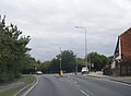
 A164 near Willerby Bottom (geograph 5924982).jpg 1,024 × 769; 117 KB
-
 A164 nears Willerby Roundabout (geograph 5924972).jpg 1,024 × 788; 121 KB
-
 A164 Queensgate, Beverley (geograph 5923853).jpg 1,024 × 755; 118 KB
-
 A164 Victoria Road, Beverley (geograph 5923859).jpg 1,024 × 746; 137 KB
-
 Boulder clay cliff south of Withernsea (geograph 6054962).jpg 3,461 × 2,585; 1.28 MB
-
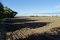
 Boulder clay mounds on the beach (geograph 6054965).jpg 1,600 × 1,262; 434 KB
-
 Clifftop, Withernsea (geograph 6054884).jpg 1,600 × 1,200; 338 KB
-
 Coastal erosion south of Withernsea (geograph 6054927).jpg 1,600 × 1,200; 190 KB
-
 Concrete pads on the cliff (geograph 6054964).jpg 1,600 × 1,147; 264 KB
-
 Farmland beside Beckside Road (geograph 5904851).jpg 1,024 × 683; 221 KB
-
 Farmland beside Bishop Wilton Beck (geograph 5979725).jpg 1,024 × 683; 225 KB
-
 Footpath alongside the Scurf Dike (geograph 5924795).jpg 1,024 × 768; 186 KB
-
 Footpath to Watton (geograph 5924733).jpg 1,024 × 768; 237 KB
-
 Goodwin Caravan Park, Withernsea (geograph 6054899).jpg 1,600 × 1,091; 288 KB
-
 Holiday chalet bases at top and bottom of the cliff (geograph 6054963).jpg 1,600 × 1,294; 294 KB
-
 Holiday chalets south of Withernsea (geograph 6054974).jpg 1,600 × 1,200; 150 KB
-
 Hull Reform Synagogue (geograph 5908115).jpg 1,600 × 1,064; 568 KB
-
 Humber Sloop off South Ferriby Sluice (geograph 5891780).jpg 1,024 × 878; 194 KB
-
 Loaningdale Bottom (geograph 5900501).jpg 4,608 × 3,456; 5.26 MB
-
 Pacer Farewell (33184007268).jpg 6,000 × 4,000; 13.21 MB
-
 Pacer Farewell (47059266261).jpg 4,000 × 6,000; 14.68 MB
-
 Pillbox on beach (geograph 6054919).jpg 1,600 × 1,260; 218 KB
-
 Pillbox on the beach (geograph 6054922).jpg 1,600 × 1,200; 206 KB
-
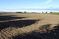
 Ploughed field alongside the A164 (geograph 5924730).jpg 1,024 × 768; 256 KB
-
 Rip-rap south of Withernsea (geograph 6054969).jpg 1,600 × 1,200; 308 KB
-
 Scurf Dike and footpath to Cranswick (geograph 5924790).jpg 1,024 × 768; 271 KB
-
 South Promenade, Withernsea (geograph 6054897).jpg 1,600 × 1,200; 159 KB
-
 Southernmost groyne, Withernsea (geograph 6054893).jpg 1,600 × 1,200; 288 KB
-
 Southernmost groyne, Withernsea (geograph 6054980).jpg 1,600 × 1,200; 178 KB
-
 St Albans, Withernwick (geograph 5917702).jpg 1,600 × 1,064; 602 KB
-
 Tesco, Withernsea (geograph 6054902).jpg 1,600 × 1,188; 195 KB
-
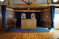 The Bimah in Hull Reform Synagogue (geograph 5908125).jpg 1,600 × 1,064; 571 KB
-
 The Vermuyden, Bridge Street, Goole (geograph 5920809).jpg 1,600 × 1,064; 604 KB
-
 The Vermuyden, Bridge Street, Goole (geograph 5920811).jpg 1,600 × 1,064; 562 KB
-
 War memorial on Aldbrough Road, Withernwick (geograph 5917821).jpg 1,030 × 1,600; 700 KB
-
 West Lambwath Road, Withernwick (geograph 5917714).jpg 1,600 × 1,064; 789 KB
-
 Windvane at St Albans, Withernwick (geograph 5917707).jpg 1,600 × 1,064; 272 KB
-
 Woodland Hill Track (geograph 5901382).jpg 4,608 × 3,456; 4.32 MB


.jpg)
.jpg)
.jpg)
.jpg)
.jpg)
.jpg)
.jpg)
.jpg)
.jpg)
.jpg)
.jpg)
.jpg)
.jpg)
.jpg)
.jpg)
.jpg)
.jpg)
.jpg)
.jpg)
.jpg)
.jpg)
.jpg)
.jpg)
.jpg)
.jpg)
.jpg)
.jpg)
.jpg)
.jpg)
.jpg)
.jpg)
.jpg)
.jpg)
.jpg)
.jpg)
.jpg)
.jpg)
.jpg)