Category:April 2018 in the East Riding of Yorkshire
Jump to navigation
Jump to search
Ceremonial counties of England: Bedfordshire · Berkshire · Buckinghamshire · Cambridgeshire · Cheshire · Cornwall · Cumbria · Derbyshire · Devon · Dorset · Durham · East Riding of Yorkshire · East Sussex · Essex · Gloucestershire · Greater London · Greater Manchester · Hampshire · Herefordshire · Isle of Wight · Kent · Lancashire · Leicestershire · Merseyside · Norfolk · North Yorkshire · Northamptonshire · Northumberland · Nottinghamshire · Oxfordshire · Shropshire · Somerset · South Yorkshire · Staffordshire · Suffolk · Surrey · Warwickshire · West Midlands · West Sussex · West Yorkshire · Wiltshire ·
City-counties: Bristol ·
Former historic counties:
Other former counties:
City-counties: Bristol ·
Former historic counties:
Other former counties:
Deutsch: Bilder, die im April 2018 in the East Riding of Yorkshire aufgenommen worden sind. Bitte beachten Sie, dass dies weder das Datum des Uploads noch das Datum des Scannens eines Fotos ist.
English: Images/pictures taken in the East Riding of Yorkshire during April 2018. Note this is not the date of the upload, nor the date a photo was scanned.
Español: Fotografías o imágenes tomadas en the East Riding of Yorkshire durante abril 2018. No es la fecha de subida ni escaneo, sino la fecha en que las fotografías o imágenes se crearon.
Esperanto: Bildoj faritaj en the East Riding of Yorkshire en aprilo 2018. Tio ne estas la dato, kiam la bildoj estis alŝutitaj aŭ skanitaj.
Français : Photographies ou images prises en the East Riding of Yorkshire durant avril 2018. Ce n'est pas la date du téléchargement ou du scan.
Galego: Fotografías ou imaxes tomadas en the East Riding of Yorkshire durante abril 2018. Non é a data de subida nin escaneamento, senón a data na que se crearon as fotografías ou imaxes.
Italiano: Fotografie o immagini scattate a the East Riding of Yorkshire nel aprile 2018. Nota bene: la data non si riferisce né a quella di upload né a quella in cui la foto è stata digitalizzata.
Norsk bokmål: Bilder tatt i the East Riding of Yorkshire i løpet av april 2018. Merk at dette ikke er datoen for opplasting, eller når et bilde har blitt skannet.
Norsk nynorsk: Bilete teke i the East Riding of Yorkshire i løpet av april 2018. Merk at dette ikkje er datoen for opplasting, eller når eit bilete har vorte skanna.
Русский: Изображения, сделанные в the East Riding of Yorkshire в течение апрель 2018 (не дата загрузки изображения).
Українська: Зображення, зроблені в the East Riding of Yorkshire протягом квітень 2018. Зауважте, що це не дата завантаження чи дата сканування фотографії.
| April 2017 | ← | April 2018 | → | April 2019 | |||||||
| Jan | Feb | Mar | Apr | May | Jun | Jul | Aug | Sep | Oct | Nov | Dec |
| 95 | 47 | 36 | 62 | 47 | 47 | 38 | 24 | 42 | 100 | 23 | 51 |
|---|---|---|---|---|---|---|---|---|---|---|---|
Subcategories
This category has only the following subcategory.
- April 2018 in Kingston upon Hull (47 F)
Media in category "April 2018 in the East Riding of Yorkshire"
The following 61 files are in this category, out of 61 total.
-
 Approaching Willerby Square roundabout (geograph 5756525).jpg 3,573 × 2,712; 2.95 MB
-
 Approaching Yapham Mill (geograph 5745768).jpg 640 × 476; 378 KB
-
 Beck between Millington and Pocklington (geograph 5744458).jpg 491 × 640; 194 KB
-
 Beckside, Wilberfoss (geograph 5739364).jpg 1,024 × 768; 249 KB
-
 Beverley Road into Kirk Ella (geograph 5756511).jpg 2,940 × 2,114; 2.56 MB
-
 Beverley Road Kirk Ella (geograph 5756517).jpg 3,812 × 2,847; 3.19 MB
-
 Beverley Road Willerby toward the A164 (geograph 5756543).jpg 3,844 × 2,880; 5.4 MB
-
 Bolton Hill Farm (geograph 5740807).jpg 1,024 × 748; 272 KB
-
 Bottom of Grimthorpe Hill, near Millington (geograph 5744303).jpg 640 × 486; 346 KB
-
 Bovine reflection, near Wilberfoss (geograph 5744799).jpg 489 × 640; 159 KB
-
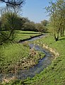
 Butterbur growing by the Foss Beck (geograph 5739349).jpg 1,024 × 768; 446 KB
-
 Car park, Garden Centre (geograph 5746705).jpg 640 × 480; 75 KB
-
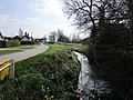
 Church Bridge over the Foss Beck, Wilberfoss (geograph 5738092).jpg 1,024 × 768; 250 KB
-
 Cliff top shelter, Sewerby (geograph 5745870).jpg 1,024 × 768; 170 KB
-
 Cottages, Middle Street, Wilberfoss (geograph 5739240).jpg 1,024 × 768; 244 KB
-
 Course of the former Beverley to York railway line (geograph 5738104).jpg 1,024 × 768; 207 KB
-
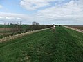
 East Level Bank (geograph 5748910).jpg 640 × 480; 59 KB
-
 Entrance to a poultry unit, Bolton Lane (geograph 5738096).jpg 1,024 × 768; 229 KB
-
 Evergreen Drive, Hull (geograph 5743196).jpg 640 × 417; 127 KB
-
 Farm entrance near Yapham Common (geograph 5746600).jpg 480 × 640; 447 KB
-
 Farm entrance, near Bolton (E Yorks) (geograph 5746036).jpg 640 × 480; 407 KB
-
 Field adjacent to Newbridge Lane (geograph 5740821).jpg 1,024 × 768; 217 KB
-
 Field edge near Four Wynds (geograph 5737149).jpg 1,024 × 768; 206 KB
-
 Footpath between Ings Lane and Middle Street, Wilberfoss (geograph 5739239).jpg 1,024 × 768; 157 KB
-
 Footpath between Main Street and Back Lane, Wilberfoss (geograph 5739153).jpg 1,024 × 737; 223 KB
-
 Foss Beck and Church Bridge (geograph 5739267).jpg 1,024 × 768; 313 KB
-
 Frost Butchers, Main Street, Wilberfoss (geograph 5739163).jpg 1,024 × 768; 160 KB
-
 Grassed area, Storking Lane, Wilberfoss (geograph 5739219).jpg 1,024 × 768; 323 KB
-
 Hen, cabins, near Yapham Common (geograph 5746017).jpg 640 × 518; 193 KB
-

-
 Junction of Tudor Court and Beverley Road B1232 (geograph 5756549).jpg 3,050 × 2,276; 1.82 MB
-
 Kiddies Corner Day Nursery, Wilberfoss (geograph 5739232).jpg 1,024 × 677; 116 KB
-
 Lambert Hall (from Lawns Centre steps).jpg 4,320 × 3,240; 5.55 MB
-
 Lane from Fordon to Wold Newton at North Cotes Triangulation Pillar (geograph 5751030).jpg 4,000 × 3,000; 2.36 MB
-
 Meltonby Lane - The Square, Yapham (geograph 5746060).jpg 640 × 409; 139 KB
-
 Meridian Monument (geograph 5740715).jpg 640 × 480; 61 KB
-
 New farmhouse, near Yapham (geograph 5746067).jpg 473 × 640; 274 KB
-
 Newbridge Lane (geograph 5738102).jpg 1,024 × 745; 259 KB
-
 Outstray Farm (geograph 5740724).jpg 640 × 480; 86 KB
-
 Outstray Road (geograph 5740732).jpg 640 × 480; 67 KB
-
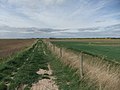
 Path on Welwick Bank (geograph 5748941).jpg 640 × 480; 97 KB
-
 Ridings Beck, near Millington (geograph 5744453).jpg 640 × 427; 189 KB
-
 River Hull toward High Baswick (geograph 5745123).jpg 5,152 × 3,864; 4.43 MB
-
 Roundabout with five exits (geograph 5756500).jpg 2,920 × 2,085; 2.51 MB
-
 Sand Lane, Yapham Common (geograph 5746005).jpg 549 × 640; 190 KB
-
 Sheep grazing near Millington (geograph 5744262).jpg 640 × 465; 174 KB
-
 South Lodge (geograph 5740819).jpg 1,024 × 768; 180 KB
-
 Stubble field and Manor Farm (geograph 5740816).jpg 1,024 × 768; 271 KB
-
 The Church of St. John the Baptist, Wilberfoss (geograph 5739321).jpg 1,024 × 836; 183 KB
-
 The Foss Beck, Wilberfoss (geograph 5739357).jpg 1,024 × 768; 255 KB
-
 The Mile, Pocklington (geograph 5745642).jpg 640 × 480; 369 KB
-
 The Old School, Wilberfoss (geograph 5739207).jpg 1,024 × 721; 183 KB
-
 The Villa, Wilberfoss (geograph 5739200).jpg 1,024 × 716; 199 KB
-
 View towards Fangfoss (geograph 5740811).jpg 1,024 × 768; 214 KB
-
 War memorial and Community Centre, Wilberfoss (geograph 5739396).jpg 1,024 × 768; 240 KB
-
 Waterlogged field near Sails Bridge (geograph 5738094).jpg 1,024 × 768; 187 KB
-
 Weeton Bank (geograph 5748934).jpg 640 × 480; 66 KB
-
 Weeton Bank (geograph 5748937).jpg 640 × 480; 67 KB
-
 Weeton Fleet (geograph 5748919).jpg 640 × 480; 56 KB
-

-
 Yapham Mill (geograph 5745783).jpg 640 × 501; 417 KB
.jpg)
.jpg)
.jpg)
.jpg)
.jpg)
.jpg)
.jpg)
.jpg)
.jpg)
.jpg)
.jpg)
.jpg)
.jpg)
.jpg)
.jpg)
.jpg)
.jpg)
.jpg)
.jpg)
.jpg)
_(geograph_5746036).jpg)
.jpg)
.jpg)
.jpg)
.jpg)
.jpg)
.jpg)
.jpg)
.jpg)
.jpg)
.jpg)
.jpg)
.jpg)
.jpg)
.jpg)
.jpg)
.jpg)
.jpg)
.jpg)
.jpg)
.jpg)
.jpg)
.jpg)
.jpg)
.jpg)
.jpg)
.jpg)
.jpg)
.jpg)
.jpg)
.jpg)
.jpg)
.jpg)
.jpg)
.jpg)
.jpg)
.jpg)
.jpg)
.jpg)
_Primary_School_(geograph_5738066).jpg)
.jpg)