Category:SVG maps of Texas
Jump to navigation
Jump to search
States of the United States: Alabama · Alaska · Arizona · Arkansas · California · Colorado · Connecticut · Delaware · Florida · Georgia · Hawaii · Idaho · Illinois · Indiana · Iowa · Kansas · Kentucky · Louisiana · Maine · Maryland · Massachusetts · Michigan · Minnesota · Mississippi · Missouri · Montana · Nebraska · Nevada · New Hampshire · New Jersey · New Mexico · New York · North Carolina · North Dakota · Ohio · Oklahoma · Oregon · Pennsylvania · Rhode Island · South Carolina · South Dakota · Tennessee · Texas · Utah · Vermont · Virginia · Washington · West Virginia · Wisconsin · Wyoming – Washington, D.C.
American Samoa · Guam · Northern Mariana Islands · Puerto Rico – Navassa Island · Palmyra Atoll
American Samoa · Guam · Northern Mariana Islands · Puerto Rico – Navassa Island · Palmyra Atoll
Subcategories
This category has only the following subcategory.
Media in category "SVG maps of Texas"
The following 49 files are in this category, out of 49 total.
-

-
-

-

-
 Boca Chica Village and Starbase Tracking Station.svg 3,400 × 1,736; 4.01 MB
-
 CentralTexas.svg 512 × 512; 305 KB
-
 Chihuahuan Desert map.svg 1,712 × 1,992; 369 KB
-
 City of West, Texas Fertilizer Plant explosion.svg 1,151 × 1,574; 2.55 MB
-
 Coahuila y Texas in Mexico (1824).svg 1,509 × 1,288; 901 KB
-
 Dallasmap downtown.svg 1,850 × 1,388; 77 KB
-
 EastTexas.svg 512 × 512; 305 KB
-
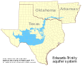 Edwards-Trinity aquifer system v1.svg 821 × 661; 636 KB
-
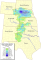
 High plains fresh groundwater usage 2000.svg 747 × 946; 1.48 MB
-
 Image-Blank map of Texas.svg 2,250 × 1,545; 184 KB
-
 LGBT flag map of Texas.svg 12,472 × 11,855; 131 KB
-
 Map of 2020 coronavirus pandemic in Texas latest.svg 12,473 × 11,855; 228 KB
-

-
 Map of Texas Fr.svg 2,122 × 1,640; 549 KB
-
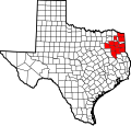 Map of Texas highlighting NET RMA.svg 12,473 × 11,855; 546 KB
-
 Map of Texas highlighting Swisher County.svg 12,473 × 11,855; 304 KB
-
 Map of Texas precipitations.svg 2,122 × 1,640; 461 KB
-
 Map of Texas temperatures.svg 2,305 × 1,584; 371 KB
-
 Map of USA TX.svg 286 × 186; 167 KB
-

-
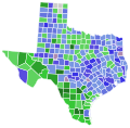
 Most spoken language in Texas by county in 2016.svg 343 × 336; 92 KB
-
 NorthTexas.svg 512 × 512; 305 KB
-
 Ogallala saturated thickness 1997-sattk97-v2.svg 656 × 960; 1.36 MB
-
 Piney Woods Forests map.svg 1,712 × 1,992; 337 KB
-
 Regions of Texas.svg 512 × 512; 307 KB
-
 SouthTexas.svg 512 × 512; 305 KB
-
 SpaceX South Texas Launch Site.svg 1,530 × 781; 3.67 MB
-
 Starbase Build Site.svg 1,724 × 880; 3.51 MB
-
 Starbase.svg 3,474 × 1,774; 6 MB
-
 Texas county map, cb 500k.svg 810 × 769; 86 KB
-
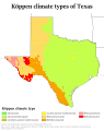 Texas Köppen.svg 990 × 1,247; 940 KB
-
 Texas Precipitation Map.svg 774 × 500; 1.98 MB
-
 Texas racial and ethnic map.svg 322 × 315; 72 KB
-
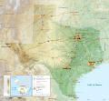 Texas topographic map-en.svg 2,164 × 2,000; 13.78 MB
-
 Texas topographic map-es.svg 2,164 × 2,000; 14.83 MB
-
 Texas Triangle, Cities and Counties Map.svg 3,250 × 3,250; 743 KB
-
 Texas Triangle, Cities and Counties map.svg 3,250 × 3,250; 802 KB
-
 Texas-gsusa.svg 15,188 × 11,855; 672 KB
-
 TexasGulfCoast.svg 512 × 512; 305 KB
-
 TexasPanhandle.svg 512 × 512; 305 KB
-
 TexasRegions.svg 512 × 512; 307 KB
-
 TexasSouthPlains.svg 512 × 512; 305 KB
-
 TexasValley.svg 512 × 512; 305 KB
-
 TransPecosTexas.svg 512 × 512; 305 KB
-
 WestTexas.svg 512 × 512; 305 KB


.svg)


.svg)


.svg)


