Category:Road signs in the London Borough of Islington
Jump to navigation
Jump to search

Media in category "Road signs in the London Borough of Islington"
The following 18 files are in this category, out of 18 total.
-
 20 mph sign, Rosebery Avenue - Garnault Place, EC1 - geograph.org.uk - 6111278.jpg 1,024 × 1,024; 218 KB
-
 Archway - geograph.org.uk - 615425.jpg 480 × 640; 110 KB
-
 Archway Road - geograph.org.uk - 616019.jpg 640 × 480; 129 KB
-
 Archway roundabout road sign.JPG 2,082 × 2,534; 1.2 MB
-
 Canonbury Park South, Canonbury - geograph.org.uk - 862427.jpg 640 × 480; 130 KB
-
 Central Street between Mitchell Street and Wenlake Estate view south 01.jpg 2,736 × 3,648; 3.41 MB
-
 City Road - geograph.org.uk - 1403208.jpg 480 × 640; 103 KB
-
 City Road, EC1 - geograph.org.uk - 1064963.jpg 640 × 480; 114 KB
-
 Ecclesbourne Road, Islington - geograph.org.uk - 2072067.jpg 960 × 1,280; 222 KB
-
 Golden Lane junction with Fortune Street view south 01.jpg 3,648 × 2,736; 3.94 MB
-
 London (47376695471).jpg 5,184 × 3,456; 7.71 MB
-
 London's complex parking restrictions.jpg 3,024 × 4,032; 3.37 MB
-
 Max Load 5 CWTS.jpg 3,072 × 2,304; 1.47 MB
-
 No through road sign Highbury 2024-04-26.jpg 4,032 × 3,024; 2.66 MB
-
 Shop and K2 telephone box, Rosebery Avenue - geograph.org.uk - 3947351.jpg 2,008 × 2,406; 1.23 MB
-
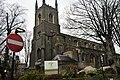 St Paul's Church - geograph.org.uk - 5385291.jpg 640 × 426; 110 KB
-
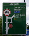
 The North A1 sign - geograph.org.uk - 5839461.jpg 640 × 480; 79 KB
-
 Wharfdale Road, King's Cross - geograph.org.uk - 778641.jpg 480 × 640; 106 KB


.jpg)


