Category:Road signs in the London Borough of Hackney
Jump to navigation
Jump to search

Media in category "Road signs in the London Borough of Hackney"
The following 15 files are in this category, out of 15 total.
-
 20mph zone, Powerscroft Road, E5 April 2009.jpg 1,152 × 864; 181 KB
-
 5 mph speed limit sign London E5.jpg 3,264 × 2,448; 1.6 MB
-
 Ashwin St E8 - geograph.org.uk - 171141.jpg 640 × 480; 126 KB
-
 Cow Bridge, E5.jpg 1,306 × 979; 328 KB
-
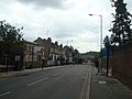 Kenworthy Road, London E9 - geograph.org.uk - 1978764.jpg 3,072 × 2,304; 2.31 MB
-
 New Flats, Southwold Road, E5 Jan 2009.jpg 1,152 × 864; 178 KB
-
 Original Worboys direction sign Hackney - geograph.org.uk - 2207148.jpg 1,069 × 800; 244 KB
-
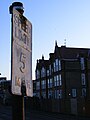 Pre-Worboys Speed Limit, 5 MPH.jpg 1,200 × 1,600; 162 KB
-
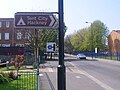
 Road sign Dalston Lane, Hackney - geograph.org.uk - 2281846.jpg 1,600 × 1,200; 656 KB
-
 Sign to a vanished Motorway in name,Homerton High Street.jpg 1,152 × 864; 178 KB
-
 Southwold Rd E5.jpg 2,133 × 1,600; 464 KB
-
 St Mary of Eton Church, Hackney Wick.jpg 1,600 × 2,133; 472 KB
-
 Tabernacle Street - geograph.org.uk - 1162917.jpg 427 × 640; 162 KB
-
 The former Tent City, Marsh Hill E9 Apr 2009.jpg 1,152 × 864; 179 KB
-
 Urban scene on Dalston Lane - geograph.org.uk - 2346439.jpg 1,600 × 1,200; 544 KB


