Category:Rail transport maps of Rhode Island
Jump to navigation
Jump to search
States of the United States: Alaska · Arizona · California · Colorado · Connecticut · Delaware · Florida · Georgia · Idaho · Illinois · Indiana · Iowa · Kentucky · Maine · Maryland · Massachusetts · Michigan · Minnesota · Mississippi · Missouri · Nevada · New Hampshire · New Jersey · New Mexico · New York · North Dakota · Ohio · Oregon · Pennsylvania · Rhode Island · Texas · Utah · Vermont · Virginia · Washington · Wisconsin – Washington, D.C.
Media in category "Rail transport maps of Rhode Island"
The following 39 files are in this category, out of 39 total.
-
 1828 Boston and Providence Railroad survey.jpg 12,928 × 2,416; 7.44 MB
-
 1838 Southern New England railroad map.jpg 7,204 × 6,096; 39.17 MB
-
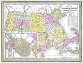
 1849 Railroad Map of New England & Eastern New York.jpg 7,882 × 9,884; 19.41 MB
-
-
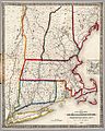
 1854 Rail Road Map of the New England States.jpg 10,752 × 9,328; 29.53 MB
-
 1854 Telegraph and Rail Road Map of the New England States.jpg 8,192 × 7,841; 20.52 MB
-
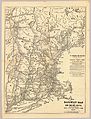
 1855 Telegraph and Rail Road Map of the New England States.jpg 10,147 × 9,760; 21.05 MB
-
 1860 Shore Line.jpg 11,328 × 9,184; 20.38 MB
-
 1867 New Haven, Middletown and Boston Railroad map.jpg 8,479 × 7,920; 16.44 MB
-
 1871 Connecticut & Western.jpg 8,432 × 4,258; 8.36 MB
-
 1871 New England railroad map.jpg 4,772 × 6,252; 6.68 MB
-
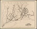
 1875 Rhode Island railroads map.jpg 3,080 × 4,160; 4.24 MB
-
 1879 B&M map.jpg 6,585 × 7,199; 11.21 MB
-
 1881 Boston and Maine Railroad map.png 3,500 × 2,957; 13.86 MB
-
 1886 Boston & Lowell RR map.jpg 4,448 × 5,408; 8.99 MB
-
 1894 New York, New Haven and Hartford Railroad map.jpg 5,761 × 4,560; 3.01 MB
-
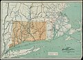 1895 Connecticut railroad map.jpg 10,157 × 7,340; 9.12 MB
-
 1898 Boston and Maine Railroad.jpg 9,232 × 6,832; 15.69 MB
-

-
 1902 map of Providence, Warren and Bristol Branch electrification.jpg 1,266 × 2,211; 243 KB
-
 1906 New York, New Haven and Hartford Railroad map.png 2,048 × 1,342; 3.75 MB
-
 1909 New York, New Haven and Hartford Railroad map.png 3,000 × 1,610; 5.29 MB
-
 1910 Rhode Island railroad map.png 2,836 × 3,500; 13.43 MB
-
 Connecticut railroad map, circa 1912.png 4,880 × 3,500; 28.87 MB
-
 1923 New York, New Haven and Hartford Railroad map.png 1,500 × 913; 1.22 MB
-
 New Haven Railroad 1940 system map.jpg 3,107 × 1,752; 1.07 MB
-
 1956 New Haven railroad MA RI track map.jpg 1,422 × 1,600; 1.2 MB
-
 1969 New Haven region map from Penn Central.jpg 1,841 × 1,024; 632 KB
-
 1970 NYNH&H map.png 6,772 × 5,508; 1.84 MB
-
 Beacon Hill.svg 1,800 × 1,350; 86 KB
-
 Cape Codder map.png 1,674 × 1,089; 171 KB
-
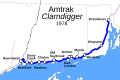 Clamdigger 1978.svg 1,500 × 1,000; 76 KB
-

-

-
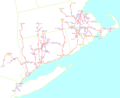
 MBTA Commuter Rail and funding district and CTrail lines.svg 848 × 518; 2.34 MB
-
 New Haven Map.png 2,439 × 1,466; 1.16 MB
-
 New Haven Map1.png 2,439 × 1,466; 1.14 MB
-
 NYNH&H on US map cropped.png 445 × 367; 26 KB
-
 US FTA RI South County Commuter Rail Warwick Wickford.jpg 1,497 × 1,049; 262 KB


.jpg)


