Category:Rail transport maps of Iowa
Jump to navigation
Jump to search
States of the United States: Alaska · Arizona · California · Colorado · Connecticut · Delaware · Florida · Georgia · Idaho · Illinois · Indiana · Iowa · Kentucky · Maine · Maryland · Massachusetts · Michigan · Minnesota · Mississippi · Missouri · Nevada · New Hampshire · New Jersey · New Mexico · New York · North Dakota · Ohio · Oregon · Pennsylvania · Rhode Island · Texas · Utah · Vermont · Virginia · Washington · Wisconsin – Washington, D.C.
Media in category "Rail transport maps of Iowa"
The following 8 files are in this category, out of 8 total.
-

-
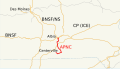 Appanoose County Community Railroad system map.svg 1,400 × 800; 405 KB
-
 Galbraith Rail Service Map1897.png 457 × 327; 339 KB
-
 Iatr-map.png 870 × 317; 12 KB
-
 Map of Chicago Central and Pacific Railroad.png 2,000 × 1,555; 11.87 MB
-
 MSTL Map.png 1,038 × 933; 275 KB
-
 The Commercial and financial chronicle (1910) (14577820978).jpg 2,532 × 4,180; 2.18 MB
-
 The street railway review (1891) (14760985592).jpg 3,488 × 2,474; 568 KB
.jpg)


_(14577820978).jpg)
_(14760985592).jpg)