Category:OpenStreetMap maps of Sri Lanka
Jump to navigation
Jump to search
Countries of Asia: Armenia‡ · Azerbaijan‡ · Bangladesh · Cambodia · People's Republic of China · Cyprus‡ · East Timor · Egypt‡ · Georgia‡ · India · Indonesia‡ · Iran · Iraq · Israel · Japan · Jordan · Kazakhstan‡ · Kuwait · Kyrgyzstan · Lebanon · Malaysia · Mongolia · Myanmar · Nepal · North Korea · Pakistan · Philippines · Qatar · Russia‡ · Saudi Arabia · Singapore · South Korea · Sri Lanka · Syria · Thailand · Republic of Türkiye‡ · Turkmenistan · United Arab Emirates · Uzbekistan · Vietnam · Yemen
Limited recognition: Taiwan · State of Palestine – Other territories: Hong Kong · Macau
‡: partly located in Asia
Limited recognition: Taiwan · State of Palestine – Other territories: Hong Kong · Macau
‡: partly located in Asia
Media in category "OpenStreetMap maps of Sri Lanka"
The following 41 files are in this category, out of 41 total.
-
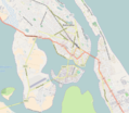
 Location map of central Batticaloa.png 773 × 692; 443 KB
-
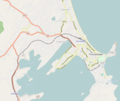
 Location map of greater Batticaloa.png 787 × 685; 417 KB
-
 Location map of Chavakachcheri.png 902 × 622; 103 KB
-
 Location map of central Colombo.png 1,041 × 698; 680 KB
-
 Location map of greater Colombo.png 1,025 × 689; 815 KB
-
 Location map of Colombo municipality.png 409 × 700; 307 KB
-
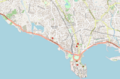 Location map of central Galle.png 1,041 × 683; 520 KB
-
 Location map of greater Galle.png 1,065 × 674; 602 KB
-
 Location map of central Gampaha.png 1,055 × 676; 757 KB
-
 Location map of greater Gampaha.png 1,030 × 691; 792 KB
-
 Location map of central Hambantota.png 1,059 × 684; 217 KB
-
 Location map of greater Hambantota.png 1,063 × 687; 334 KB
-
 Location map of central Jaffna.png 792 × 607; 322 KB
-
 Location map of greater Jaffna.png 784 × 590; 309 KB
-
 Location map of central Kalutara.png 932 × 683; 282 KB
-
 Location map of greater Kalutara.png 851 × 684; 293 KB
-
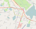
 Location map of central Kandy.png 803 × 682; 587 KB
-
 Location map of greater Kandy.png 874 × 691; 570 KB
-
 Location map of central Kilinochchi.png 817 × 688; 149 KB
-
 Location map of greater Kilinochchi.png 1,103 × 703; 282 KB
-
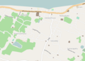
 Location map of central Kurunegala.png 971 × 678; 721 KB
-
 Location map of greater Kurunegala.png 1,025 × 687; 514 KB
-
 Location map of Mannar.png 1,014 × 692; 215 KB
-
 Map of Baseline Road (Sri Lanka).png 330 × 592; 123 KB
-
 Map of Neduntheevu.svg 601 × 613; 136 KB
-
 Location map of central Matara.png 1,048 × 686; 690 KB
-
 Location map of greater Matara.png 1,034 × 680; 568 KB
-
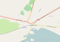
 Location map of Mullaitivu.png 616 × 550; 61 KB
-
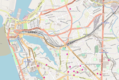
 Location map of central Negombo.png 1,046 × 668; 428 KB
-
 Location map of greater Negombo.png 1,053 × 688; 521 KB
-
 Nord- ovest Sri Lanka.png 395 × 448; 84 KB
-
 Location map of central Nuwara Eliya.png 1,054 × 687; 336 KB
-
 Location map of greater Nuwara Eliya.png 1,051 × 686; 341 KB
-
 Location map of Point Pedro.png 844 × 604; 168 KB
-
 Sri Lanka Parliament location.jpg 404 × 489; 33 KB
-
 SriLanka2022OSM.png 4,261 × 6,412; 9.74 MB
-
 Location map of central Trincomalee.png 817 × 635; 234 KB
-
 Location map of greater Trincomalee.png 756 × 636; 245 KB
-
 Location map of Valvettithurai.png 681 × 491; 108 KB
-
 Location map of central Vavuniya.png 868 × 687; 314 KB
-
 Location map of greater Vavuniya.png 828 × 667; 350 KB


.png)


