Category:OpenStreetMap maps of North Korea
Jump to navigation
Jump to search
(a.k.a. ClosedStreetMaps)
Media in category "OpenStreetMap maps of North Korea"
The following 8 files are in this category, out of 8 total.
-
 Kaesong Industrial Region OpenStreetMap.png 1,136 × 575; 140 KB
-
 Map of Pyongyang Folklore Park.png 1,928 × 1,688; 1.18 MB
-
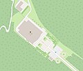 National Gift Exhibition - OpenStreetMap april 2024.jpg 792 × 680; 89 KB
-
 OSM Map Pyongyang 2012.jpg 2,173 × 1,813; 601 KB
-
 Pubyok Pavilion OSM.png 852 × 578; 145 KB
-
 Swiss Cooperation Office In North Korea - OpenStreetMap october 2023.png 566 × 569; 125 KB
-
 Unha Scientists Street Pyongyang North Korea - OpenStreetMap.jpg 1,432 × 988; 430 KB
-
 Yeonpyeong shelling.png 1,059 × 1,049; 62 KB


