Category:Old maps of Northern Ireland
Jump to navigation
Jump to search
Constituent countries of the United Kingdom: England · Northern Ireland · Scotland · Wales – British Crown dependencies: Bailiwick of Guernsey · Isle of Man · Jersey
British overseas territories: Bermuda · Falkland Islands · Gibraltar · Pitcairn Islands · South Georgia and the South Sandwich Islands
British overseas territories: Bermuda · Falkland Islands · Gibraltar · Pitcairn Islands · South Georgia and the South Sandwich Islands
Subcategories
This category has the following 3 subcategories, out of 3 total.
*
O
Media in category "Old maps of Northern Ireland"
The following 23 files are in this category, out of 23 total.
-
 100 of '(Our own country. Descriptive, historical, pictorial.)' (11175981394).jpg 1,879 × 1,523; 805 KB
-

-
 70 of 'Rigby's Illustrated Guide to Belfast and the North of Ireland' (11230979666).jpg 1,952 × 1,253; 378 KB
-
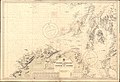 Admiralty Chart No 1577 Western approaches to the Firth of Clyde, Published 1913.jpg 16,242 × 11,122; 53.29 MB
-
 Admiralty Chart No 45 Lough Carlingford to Lough Larne, Published 1890.jpg 24,206 × 16,278; 118.08 MB
-
 Beaufort's Dyke, cropped from Admiralty Chart No 1577, Published 1913.jpg 4,634 × 3,039; 4.52 MB
-
 Boom hall map 1777.png 653 × 719; 901 KB
-
 Boom hall map 1860.png 1,877 × 897; 271 KB
-
 Cassell & Co.(1891) p03.238 - Map of Antrim.jpg 970 × 1,561; 459 KB
-
 Cassell & Co.(1898) p05.238 - Map of Antrim.jpg 956 × 1,548; 441 KB
-
 Detail from the map showing Ballyartan, Glebe, etc. (31830825200).jpg 4,608 × 3,456; 5.75 MB
-
 Detail from the map showing Cahor, Derrynoyd and Moycheeran (31396202653).jpg 4,608 × 3,456; 5.73 MB
-
 Dungannon Castle and the stone chair at Tullyhogue, Co. Tyrone.png 1,207 × 2,000; 4.85 MB
-
 Dungiven Town Plan, 1740 (32057803242).jpg 4,608 × 3,456; 10.03 MB
-
 Ireland-Northern Ireland Terrain and Railroads - DPLA - 20c3891031a93aaed7698e4c9c5bbf37.jpg 6,696 × 8,109; 5.44 MB
-
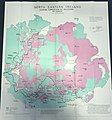
 Irish Boundary Commission final report map (1925) - religious distribution.png 1,078 × 1,182; 2.31 MB
-
 Irish Boundary Commission final report map (1925).jpg 2,016 × 1,512; 1,016 KB
-
 Large map - Religions.jpg 3,004 × 3,225; 1.67 MB
-
 Map of the north of Ireland RMG F2012.tiff 6,861 × 5,130; 100.7 MB
-
 Siege of derry boom.png 685 × 821; 620 KB
-
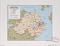 United Kingdom, Northern Ireland. LOC 89693217.jpg 4,379 × 3,395; 1.54 MB
-
 United Kingdom, Northern Ireland. LOC 89693217.tif 4,379 × 3,395; 42.53 MB
-
 Vltoniae orientalis (5375553429).jpg 1,024 × 839; 741 KB
%27_(11175981394).jpg)
.jpg)
.jpg)


_p03.238_-_Map_of_Antrim.jpg)
_p05.238_-_Map_of_Antrim.jpg)
.jpg)
.jpg)

.jpg)

_-_religious_distribution.png)
.jpg)


.jpg)