Category:Old maps of Brunei
Jump to navigation
Jump to search
Countries of Asia: Afghanistan · Armenia‡ · Azerbaijan‡ · Bahrain · Bangladesh · Bhutan · Brunei · Cambodia · People's Republic of China · Cyprus‡ · East Timor · Egypt‡ · Georgia‡ · India · Indonesia‡ · Iran · Iraq · Israel · Japan · Jordan · Kazakhstan‡ · Kuwait · Kyrgyzstan · Laos · Lebanon · Malaysia · Maldives · Mongolia · Myanmar · Nepal · Oman · Pakistan · Philippines · Qatar · Russia‡ · Saudi Arabia · Singapore · Sri Lanka · Syria · Tajikistan · Thailand · Turkey‡ · Turkmenistan · United Arab Emirates · Uzbekistan · Vietnam · Yemen
Limited recognition: Taiwan · State of Palestine – Other territories: Hong Kong · Macau
‡: partly located in Asia
Limited recognition: Taiwan · State of Palestine – Other territories: Hong Kong · Macau
‡: partly located in Asia
Use the right category for your map showing all or a large part of Brunei. See subcategories for smaller areas.
Use the appropriate category for maps showing all or a large part of Brunei. See subcategories for smaller areas:
| If the map shows | Category to use |
|---|---|
| Brunei on a recently created map | Category:Maps of Brunei or its subcategories |
| Brunei on a map created more than 70 years ago | Category:Old maps of Brunei or its subcategories |
| the history of Brunei on a recently created map | Category:Maps of the history of Brunei or its subcategories |
| the history of Brunei on a map created more than 70 years ago | Category:Old maps of the history of Brunei or its subcategories |
Media in category "Old maps of Brunei"
The following 8 files are in this category, out of 8 total.
-
 Northern Borneo map 1881.png 1,521 × 1,024; 2.49 MB
-
 A map of British North Borneo LOC 2007630402.tif 13,687 × 9,140; 357.91 MB
-
 The Natives of Sarawak and British North Borneo 1896.png 4,958 × 5,254; 26.63 MB
-
 A map of British North Borneo (III).jpg 1,643 × 1,168; 385 KB
-
 A map of British North Borneo LOC 2007627502.jpg 13,139 × 9,344; 14.51 MB
-
 A map of British North Borneo (II).jpg 9,932 × 6,812; 69.04 MB
-
 Sketch Map of Sarawak 1908.png 6,850 × 4,759; 28.75 MB
-
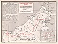 Indo Malay border.jpg 1,002 × 753; 264 KB


.jpg)

.jpg)

