Category:Old county maps of Cornwall
Jump to navigation
Jump to search
Ceremonial counties of England: Bedfordshire · Berkshire · Buckinghamshire · Cambridgeshire · Cheshire · Cornwall · Derbyshire · Devon · Dorset · Durham · East Riding of Yorkshire · Essex · Gloucestershire · Hampshire · Herefordshire · Hertfordshire · Kent · Lancashire · Leicestershire · Lincolnshire · Norfolk · Northamptonshire · Northumberland · Nottinghamshire · Oxfordshire · Rutland · Shropshire · Somerset · Staffordshire · Suffolk · Surrey · Warwickshire · Wiltshire · Worcestershire
City-counties:
Former historic counties: Cumberland · Huntingdonshire · Middlesex · North Riding of Yorkshire · Sussex · West Riding of Yorkshire · Westmorland · Yorkshire
Other former counties:
City-counties:
Former historic counties: Cumberland · Huntingdonshire · Middlesex · North Riding of Yorkshire · Sussex · West Riding of Yorkshire · Westmorland · Yorkshire
Other former counties:
Media in category "Old county maps of Cornwall"
The following 30 files are in this category, out of 30 total.
-
 Cornwall - Christopher Saxton, 1579, 5 - BL.jpg 1,469 × 1,166; 939 KB
-
 Old Map of Cornwall c.1610.jpg 1,410 × 1,068; 2.24 MB
-
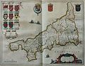
 John Speed - Map of Cornwall - 1614 - 001.jpg 2,972 × 2,240; 3.49 MB
-
 Atlas Van der Hagen-KW1049B11 005-CORNUBIA. sive CORNWALLIA.jpeg 5,500 × 4,149; 3.57 MB
-
 Old map of Cornwall - 001.jpg 3,000 × 2,263; 4.37 MB
-
 Map of the Kingdom of Wessex by Nicolas Sanson (1654).png 1,642 × 2,267; 6.23 MB
-
 "Cornubia sive Cornwallia" (22064850718).jpg 3,871 × 3,036; 1.92 MB
-

-
 Maps of England circa 1670, Cornwal 8 of 40 (13433812923).jpg 6,565 × 4,925; 4.19 MB
-
 Cornubia sive Cornwallia - CBT 6599280.jpg 5,646 × 4,312; 6.75 MB
-
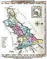
 Aikin(1800) p426 - Cornwall.jpg 1,949 × 1,184; 415 KB
-
 LYSONS(1806) p03.19 - Cornwall.jpg 5,094 × 4,774; 4.24 MB
-
 LYSONS(1806) p03.19b - Cornwall.jpg 4,758 × 4,314; 2.16 MB
-
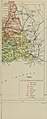
 A topographical dictionary of the United Kingdom (1808) (14782750764).jpg 2,796 × 1,648; 1.5 MB
-
 Gray1824.cornwall.jpg 791 × 981; 123 KB
-
 CAPPER(1825) p01.273 - Cornwall.jpg 2,375 × 1,360; 970 KB
-
 Pigot and Co (1842) p1.106 - Map of Cornwall.jpg 2,160 × 1,293; 787 KB
-
 Cruchley's Railway Map of Cornwall.jpg 2,336 × 1,650; 3.56 MB
-
 Thomas Moule - Historical Map of Cornwall - 1850 - 001.jpg 3,000 × 2,324; 3.23 MB
-
 DANIELL(1894) p5 - Cornwall.jpg 5,557 × 3,908; 4.04 MB
-
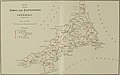
 The Victoria history of the county of Cornwall (1906) (14590841540).jpg 3,324 × 3,008; 1.01 MB
-
 The Victoria history of the county of Cornwall (1906) (14591059377).jpg 3,262 × 2,881; 842 KB
-
 The Victoria history of the county of Cornwall (1906) (14591062107).jpg 3,022 × 2,326; 424 KB
-
 The Victoria history of the county of Cornwall (1906) (14591082390).jpg 4,120 × 2,564; 575 KB
-
 The Victoria history of the county of Cornwall (1906) (14777201822).jpg 1,592 × 4,038; 672 KB
-
 Promontorium …. Proiectum Cornubia dicitur.jpg 4,388 × 3,447; 4.55 MB
-
 Promontorium …. Proiectum Cornubia dicitur.tif 8,775 × 6,893; 105 MB
-
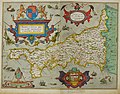
 Sc Saxton Wiltonia.tiff 8,394 × 7,399; 97.92 MB
-
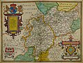 Warwicum lecestria Atlas.jpg 9,417 × 7,137; 21.97 MB
-
 Warwicum Lecestria Atlas.tif 9,417 × 7,137; 111.22 MB


.png)
.jpg)
.5.(4).jpg)
.jpg)

_p426_-_Cornwall.jpg)
_p03.19_-_Cornwall.jpg)
_p03.19b_-_Cornwall.jpg)
_(14782750764).jpg)

_p01.273_-_Cornwall.jpg)
_p1.106_-_Map_of_Cornwall.jpg)


_p5_-_Cornwall.jpg)
_(14590841540).jpg)
_(14591059377).jpg)
_(14591062107).jpg)
_(14591082390).jpg)


_(14777201822).jpg)