Category:October 2008 in the East Riding of Yorkshire
Jump to navigation
Jump to search
Ceremonial counties of England: Berkshire · Buckinghamshire · Cambridgeshire · Cheshire · Cornwall · Cumbria · Derbyshire · Devon · Dorset · Durham · East Riding of Yorkshire · East Sussex · Essex · Gloucestershire · Greater London · Greater Manchester · Hampshire · Herefordshire · Hertfordshire · Isle of Wight · Kent · Lancashire · Leicestershire · Lincolnshire · Merseyside · Norfolk · North Yorkshire · Northamptonshire · Northumberland · Nottinghamshire · Oxfordshire · Rutland · Shropshire · Somerset · South Yorkshire · Staffordshire · Suffolk · Surrey · Tyne and Wear · Warwickshire · West Midlands · West Sussex · West Yorkshire · Wiltshire · Worcestershire
City-counties: Bristol ·
Former historic counties:
Other former counties:
City-counties: Bristol ·
Former historic counties:
Other former counties:
Deutsch: Bilder, die im Oktober 2008 in the East Riding of Yorkshire aufgenommen worden sind. Bitte beachten Sie, dass dies weder das Datum des Uploads noch das Datum des Scannens eines Fotos ist.
English: Images/pictures taken in the East Riding of Yorkshire during October 2008. Note this is not the date of the upload, nor the date a photo was scanned.
Español: Fotografías o imágenes tomadas en the East Riding of Yorkshire durante octubre 2008. No es la fecha de subida ni escaneo, sino la fecha en que las fotografías o imágenes se crearon.
Esperanto: Bildoj faritaj en the East Riding of Yorkshire en oktobro 2008. Tio ne estas la dato, kiam la bildoj estis alŝutitaj aŭ skanitaj.
Français : Photographies ou images prises en the East Riding of Yorkshire durant octobre 2008. Ce n'est pas la date du téléchargement ou du scan.
Galego: Fotografías ou imaxes tomadas en the East Riding of Yorkshire durante outubro 2008. Non é a data de subida nin escaneamento, senón a data na que se crearon as fotografías ou imaxes.
Italiano: Fotografie o immagini scattate a the East Riding of Yorkshire nel ottobre 2008. Nota bene: la data non si riferisce né a quella di upload né a quella in cui la foto è stata digitalizzata.
Norsk bokmål: Bilder tatt i the East Riding of Yorkshire i løpet av oktober 2008. Merk at dette ikke er datoen for opplasting, eller når et bilde har blitt skannet.
Norsk nynorsk: Bilete teke i the East Riding of Yorkshire i løpet av oktober 2008. Merk at dette ikkje er datoen for opplasting, eller når eit bilete har vorte skanna.
Русский: Изображения, сделанные в the East Riding of Yorkshire в течение октябрь 2008 (не дата загрузки изображения).
Українська: Зображення, зроблені в the East Riding of Yorkshire протягом жовтень 2008. Зауважте, що це не дата завантаження чи дата сканування фотографії.
| October 2007 | ← | October 2008 | → | October 2009 | |||||||
| Jan | Feb | Mar | Apr | May | Jun | Jul | Aug | Sep | Oct | Nov | Dec |
| 269 | 503 | 525 | 507 | 737 | 327 | 436 | 406 | 149 | 154 | 319 | 181 |
|---|---|---|---|---|---|---|---|---|---|---|---|
Subcategories
This category has only the following subcategory.
Media in category "October 2008 in the East Riding of Yorkshire"
The following 153 files are in this category, out of 153 total.
-
 'The Villa', Sledmere - geograph.org.uk - 1012164.jpg 640 × 400; 60 KB
-
 'U' Tree at the side of Mill Beck - geograph.org.uk - 1000327.jpg 480 × 640; 182 KB
-
 Large House at South Cave. - geograph.org.uk - 1025613.jpg 640 × 480; 88 KB
-
 Market Place Farm. - geograph.org.uk - 1025617.jpg 640 × 480; 76 KB
-
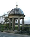
 South Cave Clock Tower - geograph.org.uk - 1025713.jpg 640 × 531; 111 KB
-
 South Cave Town Hall Clock - geograph.org.uk - 1025614.jpg 640 × 474; 67 KB
-
 A Beverley Bridleway - geograph.org.uk - 1000337.jpg 480 × 640; 116 KB
-
 A building on Main Street, Tibthorpe - geograph.org.uk - 1046392.jpg 640 × 427; 337 KB
-
 A wind break west of Kirkburn - geograph.org.uk - 1013213.jpg 640 × 427; 233 KB
-
 A163 - B1248 Junction, south of Bainton - geograph.org.uk - 1013153.jpg 640 × 427; 167 KB
-
 A165 Whitecross Road near Riston Grange - geograph.org.uk - 1022389.jpg 640 × 431; 197 KB
-
 After the harvest^ - geograph.org.uk - 1383745.jpg 640 × 480; 61 KB
-
 An erratic wall - geograph.org.uk - 1013439.jpg 640 × 467; 127 KB
-
 Arnold and Long Riston Drain - geograph.org.uk - 1013224.jpg 640 × 607; 201 KB
-
 Arras Wold - geograph.org.uk - 1003886.jpg 640 × 480; 213 KB
-
 Ashfield Farm - geograph.org.uk - 1013124.jpg 640 × 377; 184 KB
-
 Ashfield Farm - geograph.org.uk - 1013130.jpg 640 × 380; 182 KB
-
 Autumnal Tree next to Burstwick Drain - geograph.org.uk - 1013669.jpg 640 × 462; 132 KB
-
 Bainton Road, Tibthorpe - geograph.org.uk - 1013201.jpg 640 × 427; 166 KB
-
 Bainton Road, Tibthorpe - geograph.org.uk - 1046373.jpg 640 × 427; 418 KB
-
 Balk Lane Arnold.jpg 640 × 480; 180 KB
-
 Barmston Manor Farmhouse - geograph.org.uk - 1013433.jpg 640 × 427; 72 KB
-
 Barmston Sands - geograph.org.uk - 1012622.jpg 640 × 480; 69 KB
-
 Barmston Sands - looking north - geograph.org.uk - 1013406.jpg 640 × 480; 48 KB
-
 Barton Haven - geograph.org.uk - 1011289.jpg 640 × 480; 81 KB
-

-
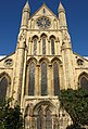 Beverley Minster's South Transept - geograph.org.uk - 1000342.jpg 435 × 640; 120 KB
-
 Birds on Far Bank's Power Line - geograph.org.uk - 1008653.jpg 640 × 428; 45 KB
-
 Bollards in the Sun - geograph.org.uk - 1013672.jpg 480 × 640; 94 KB
-
 Bowlams Dike near Little Catwick.jpg 482 × 640; 206 KB
-
 Burn House, Kirkburn - geograph.org.uk - 1013206.jpg 640 × 427; 248 KB
-
 Butchers shop, Sledmere - geograph.org.uk - 1012129.jpg 640 × 557; 91 KB
-
 Carr Lane, near Long Riston - geograph.org.uk - 1013222.jpg 621 × 640; 184 KB
-
 Church Lane, Catwick - geograph.org.uk - 1012345.jpg 640 × 556; 210 KB
-
 Cinquefoil Brow - geograph.org.uk - 1012094.jpg 640 × 480; 67 KB
-
 Clifftop cabins at Skipsea - geograph.org.uk - 1012552.jpg 640 × 480; 77 KB
-
 Clifftop cabins at Skipsea - geograph.org.uk - 1012584.jpg 640 × 490; 73 KB
-
 Clock tower Sledmere - geograph.org.uk - 1012185.jpg 480 × 640; 72 KB
-
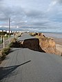 Coast erosion at Cobble Gap - geograph.org.uk - 1012471.jpg 480 × 640; 64 KB
-

-

-
 Collapsed defences at Cobble Gap - geograph.org.uk - 1012529.jpg 640 × 480; 71 KB
-
 Copse Leaf - geograph.org.uk - 999356.jpg 594 × 640; 96 KB
-
 Dog Kennel Farm - geograph.org.uk - 1013144.jpg 640 × 427; 197 KB
-
 Doorway, Barmston Church - geograph.org.uk - 1014565.jpg 480 × 640; 113 KB
-
 Early Morning George Street Chimneys - geograph.org.uk - 1008684.jpg 640 × 430; 83 KB
-
 Earthworks at Barmston - geograph.org.uk - 1014579.jpg 640 × 480; 87 KB
-
 Electricity Sub Station - geograph.org.uk - 999350.jpg 640 × 480; 107 KB
-
 Entering Bainton from the south - geograph.org.uk - 1046047.jpg 640 × 427; 296 KB
-
 Entering Long Riston.jpg 640 × 445; 184 KB
-
 Erosion at Tranmere Cliff - geograph.org.uk - 1012478.jpg 480 × 640; 72 KB
-
 Estate Lodges, Sledmere - geograph.org.uk - 1012140.jpg 640 × 384; 72 KB
-
 Farming at Leven Grange.jpg 516 × 640; 198 KB
-
 Field Edge - geograph.org.uk - 1000333.jpg 640 × 480; 134 KB
-
 Fish and chip shop at Cobble Gap - geograph.org.uk - 1012486.jpg 640 × 440; 54 KB
-
 Fisherman on the beach at Barmston - geograph.org.uk - 1013408.jpg 640 × 480; 51 KB
-
 Footpath to Rise - geograph.org.uk - 1013192.jpg 640 × 442; 161 KB
-
 Fouracres, Camerton - geograph.org.uk - 994798.jpg 640 × 438; 114 KB
-
 Fouracres, Camerton - geograph.org.uk - 994803.jpg 640 × 419; 94 KB
-
 Fragment of a "Hogback" - geograph.org.uk - 1014570.jpg 481 × 640; 76 KB
-
 Galleon Beach - geograph.org.uk - 1012540.jpg 640 × 480; 77 KB
-
 Giant Spiders^ - geograph.org.uk - 1000346.jpg 640 × 395; 82 KB
-
 Godmans Lane, Kirk Ella - geograph.org.uk - 999873.jpg 640 × 464; 109 KB
-
 Goodmanham Dale - geograph.org.uk - 1003687.jpg 480 × 640; 171 KB
-
 Goodmanham Road - geograph.org.uk - 1003850.jpg 640 × 480; 183 KB
-

-
 Greenland Slack - geograph.org.uk - 1012088.jpg 640 × 480; 66 KB
-
 Hands Up Jerry^ - geograph.org.uk - 1014530.jpg 640 × 480; 120 KB
-
 Harbour Farm Chimneys in Silhouette - geograph.org.uk - 1008661.jpg 640 × 480; 13 KB
-

-

-
-

-
 Hedon's new Retirement Village - geograph.org.uk - 1010656.jpg 640 × 476; 100 KB
-
 Hornsea Road Leven.jpg 640 × 463; 217 KB
-
 Houses at Arras - geograph.org.uk - 1003986.jpg 640 × 480; 174 KB
-
 Hull Golf Club - geograph.org.uk - 1000040.jpg 640 × 470; 134 KB
-
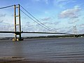 Humber Bridge - geograph.org.uk - 1028625.jpg 640 × 480; 55 KB
-
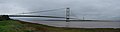 Humber Bridge Panorama October 2008.jpg 11,129 × 2,972; 12.51 MB
-
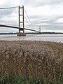 Humber Foreshore Reedbed - geograph.org.uk - 1011298.jpg 480 × 640; 97 KB
-
 Low tide at Cobble Gap - geograph.org.uk - 1012531.jpg 640 × 290; 24 KB
-
 Main Road Camerton.jpg 640 × 428; 72 KB
-
 Main Street Tibthorpe 1.jpg 640 × 427; 174 KB
-
 Main Street, Catwick - geograph.org.uk - 1012386.jpg 640 × 414; 196 KB
-
 Main Street, Goodmanham - geograph.org.uk - 1003807.jpg 640 × 403; 174 KB
-
 Main Street, Swanland - geograph.org.uk - 1000407.jpg 640 × 457; 66 KB
-
 Market Weighton School.jpg 640 × 428; 167 KB
-
 MOD Debris at Withow Gap - geograph.org.uk - 1014552.jpg 640 × 480; 81 KB
-
 No parking on double yellow lines - geograph.org.uk - 1012450.jpg 480 × 640; 66 KB
-
 North Field Farm - geograph.org.uk - 999934.jpg 640 × 490; 112 KB
-
 Nunburnholme to Warter lane - geograph.org.uk - 1027576.jpg 640 × 480; 116 KB
-
 Old Volvo - geograph.org.uk - 1008672.jpg 640 × 464; 71 KB
-
 One Brief Moment in Time..... - geograph.org.uk - 999340.jpg 480 × 640; 82 KB
-
 Orchard Lea, Swanland - geograph.org.uk - 1000389.jpg 640 × 503; 136 KB
-
 Ornamental Well, Sledmere - geograph.org.uk - 1012135.jpg 510 × 640; 61 KB
-
 Parish Council Office, Thorngumbald - geograph.org.uk - 994847.jpg 480 × 640; 142 KB
-
 Part of No 2 Main Street, Tibthorpe - geograph.org.uk - 1013182.jpg 640 × 427; 207 KB
-
 Pitt Lane, Ryehill - geograph.org.uk - 994791.jpg 640 × 485; 109 KB
-
 Please drive carefully - geograph.org.uk - 1013411.jpg 640 × 425; 51 KB
-
 Plougher and Power - geograph.org.uk - 1000316.jpg 640 × 453; 110 KB
-
 Pond at Old Hall Farm - geograph.org.uk - 1014582.jpg 640 × 480; 119 KB
-
 Power Pylon Trio - geograph.org.uk - 1000309.jpg 640 × 540; 105 KB
-
 Prospect House Farm, near Long Riston - geograph.org.uk - 1012608.jpg 640 × 454; 182 KB
-
 Remains of Cliff Top Farm - geograph.org.uk - 1012505.jpg 640 × 480; 75 KB
-
 Road closed at Cobble Gap - geograph.org.uk - 1012459.jpg 640 × 480; 69 KB
-
 Road end at Barmston - geograph.org.uk - 1012613.jpg 480 × 640; 60 KB
-
 Robert Sharp of South Cave - geograph.org.uk - 1025705.jpg 640 × 474; 106 KB
-
 Rosehips after the Rain - geograph.org.uk - 1029540.jpg 640 × 434; 74 KB
-
 Sancton Wold - geograph.org.uk - 1003949.jpg 640 × 480; 211 KB
-
 Seaways Cafe Fridaythorpe.jpg 640 × 480; 72 KB
-
 Sheep near Goodmanham - geograph.org.uk - 1003763.jpg 640 × 413; 166 KB
-
 Skipsea Beach Club - geograph.org.uk - 1012495.jpg 640 × 480; 62 KB
-
 Skipsea Sands - geograph.org.uk - 1012570.jpg 640 × 267; 24 KB
-
 Sledmere Estate Office and cottage - geograph.org.uk - 1012169.jpg 640 × 417; 56 KB
-
 Sledmere House from the churchyard - geograph.org.uk - 1012122.jpg 640 × 448; 62 KB
-
 South Cave Cemetery - geograph.org.uk - 1025612.jpg 640 × 480; 87 KB
-
 South Cave Cottage - geograph.org.uk - 1025615.jpg 640 × 470; 88 KB
-
 Southfield, Hessle - geograph.org.uk - 1021574.jpg 640 × 481; 161 KB
-
 St Andrew's Church, Kirk Ella - geograph.org.uk - 999881.jpg 640 × 480; 86 KB
-
 St Mary Cowlam.jpg 640 × 480; 84 KB
-
 St Mary's Church, Cowlam - geograph.org.uk - 1012080.jpg 640 × 480; 84 KB
-
 St Mary, Sledmere.jpg 640 × 423; 62 KB
-
 Swanland Nurseries - geograph.org.uk - 1000395.jpg 640 × 471; 104 KB
-
 Swanland Pond - geograph.org.uk - 1000409.jpg 640 × 498; 114 KB
-
 The beach at Cobble Gap - geograph.org.uk - 1012513.jpg 640 × 480; 78 KB
-
 The Beverley 20 long distance footpath - geograph.org.uk - 1000303.jpg 640 × 480; 139 KB
-
 The Black Bull at Barmston - geograph.org.uk - 1013429.jpg 640 × 480; 86 KB
-
 The Early Crow at Harbour Farm - geograph.org.uk - 1017653.jpg 640 × 480; 95 KB
-
 The Fairway, West Ella - geograph.org.uk - 1000359.jpg 640 × 475; 120 KB
-
 The Lights of Bond Street - geograph.org.uk - 1013664.jpg 640 × 511; 115 KB
-
 The long and winding ex-(rail)road - geograph.org.uk - 1013649.jpg 480 × 640; 177 KB
-
 The Old and the New - geograph.org.uk - 1013642.jpg 640 × 480; 94 KB
-
 The old Hedon Station's Fence - geograph.org.uk - 1013654.jpg 640 × 497; 147 KB
-
 The Old Rectory, Sledmere - geograph.org.uk - 1012156.jpg 640 × 480; 78 KB
-
 The Sands holiday centre, Barmston - geograph.org.uk - 1013420.jpg 640 × 342; 41 KB
-
 The Triton Inn, Sledmere - geograph.org.uk - 1012173.jpg 640 × 410; 70 KB
-
 Thorngumbald Junior School.jpg 640 × 476; 101 KB
-
 Thorngumbald Village Hall.jpg 640 × 471; 115 KB
-
 Tibthorpe Crossroads - geograph.org.uk - 1013189.jpg 640 × 481; 180 KB
-
 Totally Stumped - geograph.org.uk - 1004917.jpg 640 × 459; 160 KB
-
 Track to Walkington - geograph.org.uk - 1013137.jpg 640 × 427; 165 KB
-
 Warter pond toward St James' Church - geograph.org.uk - 1027527.jpg 640 × 480; 89 KB
-
 Warter village from Mill Lane - geograph.org.uk - 1027513.jpg 640 × 480; 50 KB
-
 Well Street, Tibthorpe - geograph.org.uk - 1013197.jpg 640 × 427; 159 KB
-
 West Ella Methodist Church.jpg 640 × 479; 114 KB
-
 West Ella Road - geograph.org.uk - 1000369.jpg 640 × 496; 124 KB
-
 West Ella Road - geograph.org.uk - 1000382.jpg 541 × 640; 78 KB
-
 West End, Swanland - geograph.org.uk - 1000417.jpg 640 × 477; 88 KB
-
 Who Goes There^ - geograph.org.uk - 1014536.jpg 640 × 401; 92 KB
-
 Willerby Bottom - geograph.org.uk - 999910.jpg 640 × 480; 156 KB
-
 Willow Croft, near Catwick - geograph.org.uk - 1012546.jpg 640 × 396; 206 KB
-
 Yorkshire Wolds Way half way point.jpg 640 × 480; 126 KB
-
 Yorkshire Wolds Way near Arras - geograph.org.uk - 1003988.jpg 640 × 614; 187 KB


road_-_geograph.org.uk_-_1013649.jpg)


