Category:New Century Atlas of Greater Buffalo, Vol. 3: Suburban Section
Jump to navigation
Jump to search
Media in category "New Century Atlas of Greater Buffalo, Vol. 3: Suburban Section"
The following 28 files are in this category, out of 28 total.
-

-
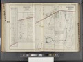 Buffalo, V. 3, Double Page Plate No. 11 (Map bounded by Main St., Williamsville Rd., Bailey Ave.) NYPL2056957.tiff 7,210 × 5,407, 2 pages; 111.8 MB
-

-
 Buffalo, V. 3, Double Page Plate No. 13 (Map bounded by William St., Cayuga Creek, Clinton St., Cochrane St.) NYPL2056959.tiff 7,167 × 5,375, 2 pages; 110.48 MB
-
 Buffalo, V. 3, Double Page Plate No. 14 (Map bounded by Town of Hamburg, 5th Ave., 7th Ave., Maple Ave., Woodlawn) NYPL2056960.tiff 7,154 × 5,365, 2 pages; 110.07 MB
-
 Buffalo, V. 3, Double Page Plate No. 15 (Map bounded by Main St., Harlem Ave., Yorktown Rd.) NYPL2056961.tiff 7,154 × 5,365, 2 pages; 110.07 MB
-
 Buffalo, V. 3, Double Page Plate No. 16 (Map bounded by Azenovia Creek, City of Buffalo) NYPL2056962.tiff 7,181 × 5,386, 2 pages; 110.92 MB
-
 Buffalo, V. 3, Double Page Plate No. 17 (Map bounded by Big Buffalo Creek, Edson Ave., City of Buffalo) NYPL2056963.tiff 7,207 × 5,406, 2 pages; 111.73 MB
-

-
 Buffalo, V. 3, Double Page Plate No. 19 (Map bounded by Warsaw St., Broadway, William St.) NYPL2056965.tiff 7,184 × 5,388, 2 pages; 111.01 MB
-
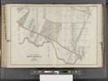
 Buffalo, V. 3, Double Page Plate No. 2 (Map bounded by City of Buffalo, Olcott Ave., Lake Erie) NYPL2056948.tiff 7,215 × 5,411, 2 pages; 111.96 MB
-

-
 Buffalo, V. 3, Double Page Plate No. 21 (Map bounded by Abbott St., Amher St., Davis Ave., Crescent St.) NYPL2056967.tiff 7,175 × 5,382, 2 pages; 110.75 MB
-
 Buffalo, V. 3, Double Page Plate No. 22 (Map bounded by Kenilworth Ave., Kenmore Ave., Belmont Ave.) NYPL2056968.tiff 7,175 × 5,382, 2 pages; 110.75 MB
-
 Buffalo, V. 3, Double Page Plate No. 23 (Map bounded by Kenmore Ave., Salvini Ave., Military State Rd.) NYPL2056969.tiff 7,175 × 5,382, 2 pages; 110.75 MB
-
 Buffalo, V. 3, Double Page Plate No. 24 (Map bounded by Ferry Rd., E. Branch Niagara River, W. Branch Niagara River) NYPL2056970.tiff 7,196 × 5,397, 2 pages; 111.38 MB
-

-
 Buffalo, V. 3, Double Page Plate No. 26 (Map of Town of Tonawanda) NYPL2056972.tiff 7,196 × 5,397, 2 pages; 111.38 MB
-
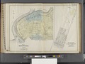
 Buffalo, V. 3, Double Page Plate No. 27 (Map of Town of Grand Island, Part of the town of Amherst) NYPL2056973.tiff 7,207 × 5,406, 2 pages; 111.73 MB
-
 Buffalo, V. 3, Double Page Plate No. 3 (Map bounded by Olcott Ave., Erie Rail Rd., Town of Hamburg, Lake Erie) NYPL2056949.tiff 7,178 × 5,384, 2 pages; 110.83 MB
-
 Buffalo, V. 3, Double Page Plate No. 4 (Map bounded by City of Buffalo, Town of West Seneca, Erie Rail Rd.) NYPL2056950.tiff 7,132 × 5,349, 2 pages; 109.41 MB
-
 Buffalo, V. 3, Double Page Plate No. 5 (Map bounded by Town of Hamburg, Erie Rail Rd.) NYPL2056951.tiff 7,132 × 5,349, 2 pages; 109.41 MB
-
 Buffalo, V. 3, Double Page Plate No. 6 (Map bounded by Delaware St., North Tonawanda, Town of Tonawanda, Bannard St.) NYPL2056952.tiff 7,168 × 5,376, 2 pages; 110.51 MB
-
 Buffalo, V. 3, Double Page Plate No. 7 (Map bounded by Niagara River, Erie Rail Rd., Delaware St., Town of Tonawanda) NYPL2056953.tiff 7,215 × 5,411, 2 pages; 111.96 MB
-
 Buffalo, V. 3, Double Page Plate No. 8 (Map bounded by Niagara River, State Ditch, 10th Ave., Two mile Creek Rd.) NYPL2056954.tiff 7,145 × 5,359, 2 pages; 109.81 MB
-

-
 Buffalo, V. 3, Double Page Plate No.1 (Map of outline Greater Buffalo New York) NYPL2056947.tiff 7,163 × 5,372, 2 pages; 110.36 MB
-
 The new century atlas of Greater Buffalo. Vol. 3. Suburban Section. Century Atlas co., Philadelphia, 1915. NYPL2056946.tiff 5,404 × 7,205, 2 pages; 111.66 MB