Category:Maps showing the 1730s
Jump to navigation
Jump to search
| Maps showing the 18th century:
←1700s 1710s 1720s 1730s 1740s 1750s 1760s 1770s 1780s 1790s → |
Not to be confused with maps made in the 1730s.
Subcategories
This category has the following 6 subcategories, out of 6 total.
- Maps showing 1731 (1 F)
- Maps showing 1735 (2 F)
- Maps showing 1736 (2 F)
- Maps showing 1737 (1 F)
- Maps showing 1739 (1 F)
Media in category "Maps showing the 1730s"
The following 2 files are in this category, out of 2 total.
-
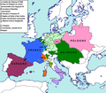 Conséquences territoriales du traité de Vienne (1738).png 2,012 × 1,761; 222 KB
-
 Political Evolution of Central America and the Caribbean 1733 na.png 1,000 × 750; 82 KB
.png)
