Category:Maps showing the 1700s
Jump to navigation
Jump to search
| Maps showing the 18th century:
←1700s 1710s 1720s 1730s 1740s 1750s 1760s 1770s 1780s 1790s → |
Not to be confused with maps made in the 1700s.
Subcategories
This category has the following 6 subcategories, out of 6 total.
- Maps showing 1700 (3 F)
- Maps showing 1703 (1 F)
- Maps showing 1704 (1 F)
- Maps showing 1709 (1 F)
M
- Maps of the Battle of Poltava (24 F)
Media in category "Maps showing the 1700s"
The following 9 files are in this category, out of 9 total.
-
 Great Britain and Ireland 1700.svg 120 × 170; 212 KB
-
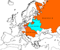
 1700'de Habsburglar.png 1,152 × 812; 203 KB
-
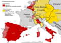
 Alaouites apogée 1700.jpg 870 × 863; 127 KB
-
 Europe, 1700—1714.png 1,590 × 1,086; 1.07 MB
-
 Habsburg dominions 1700.png 1,152 × 812; 226 KB
-
 La Pologne-Lituanie face à la Russie, la Prusse & l'Autriche.png 1,962 × 1,631; 98 KB
-
 Political Evolution of Central America and the Caribbean 1700 na.png 1,000 × 750; 82 KB
-
 Political Evolution of Central America and the Caribbean 1702 na.png 1,000 × 750; 84 KB
-
 Russian map of Ukraine showing 1695-1711.jpg 1,514 × 1,557; 235 KB


