Category:Maps showing 1890
Jump to navigation
Jump to search
| ← 1890 1892 1894 1895 1896 1897 1898 1899→ |
English: Maps showing the year 1890 (i.e. history maps)
See also category: 1890 maps. and 1890s maps for more maps showing this year usually created not long after the given year.
See also category: 1890 maps. and 1890s maps for more maps showing this year usually created not long after the given year.
Subcategories
This category has only the following subcategory.
Media in category "Maps showing 1890"
The following 7 files are in this category, out of 7 total.
-
 Administrative Division of Siamese Kingdom in 1890.jpg 10,000 × 15,000; 8.27 MB
-
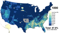
 Asian Americans 1890 County.png 7,750 × 4,650; 9.02 MB
-
 Black Americans 1890 County.png 15,610 × 8,900; 17.06 MB
-
 Brunei territories (1890).jpg 1,920 × 960; 397 KB
-
 Brunei territories (1890).png 1,920 × 960; 284 KB
-
 Map of Siamese Kingdom in 1890.jpg 10,000 × 15,000; 5.67 MB
-
 White Americans 1890 County.png 15,610 × 8,900; 9.94 MB


.jpg)
.png)

