Category:Maps showing 1900
Jump to navigation
Jump to search
| ← 1900 1901 1902 1903 1904 1905 1906 1907 1908 1909→ |
English: Maps showing the year 1900 (i.e. history maps)
See also category: 1900 maps. and 1900s maps for old maps created in this time.
See also category: 1900 maps. and 1900s maps for old maps created in this time.
Subcategories
This category has only the following subcategory.
Media in category "Maps showing 1900"
The following 13 files are in this category, out of 13 total.
-
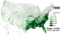 Black Americans 1900 County.png 15,610 × 8,900; 17.25 MB
-
 Blankmapoftheworld1900.png 1,425 × 625; 37 KB
-
 China-1900-es.svg 1,000 × 850; 204 KB
-

-
 Flag map of Ottoman Empire (1900).png 1,726 × 1,188; 32 KB
-
 Flag Map of The World (1900).png 4,974 × 2,519; 1.25 MB
-
 Franco-Americans in Western Massachusetts 1900.svg 412 × 649; 159 KB
-
 Hessen 1900.svg 2,736 × 3,652; 9.17 MB
-
 Map of China during Boxer Rebellion.png 350 × 492; 113 KB
-
 Ottoman Empire Flag-map 1900s.png 836 × 668; 23 KB
-
 Variación de la población española entre 1900 y 2000.png 778 × 529; 180 KB
-
 Variación de la población española entre 1900 y 2000.svg 568 × 387; 1.5 MB
-
 White Americans 1900 County.png 15,610 × 8,900; 10.18 MB


.jpg)
.png)
.png)


