Category:Maps of trade winds
Jump to navigation
Jump to search
Subcategories
This category has the following 3 subcategories, out of 3 total.
Media in category "Maps of trade winds"
The following 13 files are in this category, out of 13 total.
-
 Isole nel mare di Sur scoperte nel 1617 . ..jpg 1,600 × 1,041; 1.28 MB
-

-
 Ley chart II.jpg 1,156 × 795; 350 KB
-
 Ley chart IV.jpg 1,185 × 807; 388 KB
-
 Field, laboratory, and library manual in physical geography (1906) (14760249416).jpg 2,272 × 1,358; 373 KB
-
 Elementary physical geography (1907) (14585237670).jpg 1,702 × 2,014; 612 KB
-
 AMH-8038-KB Map of the winds in the Pacific Ocean.jpg 2,400 × 1,524; 880 KB
-
 Corrientes ecuatoriales del Pacífico.png 2,036 × 696; 103 KB
-
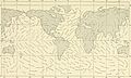
 Map prevailing winds on earth.png 1,425 × 625; 157 KB
-
 Mean Wind Speed.png 2,864 × 1,246; 3.66 MB
-
 Normal rev1 500.jpg 500 × 315; 37 KB
-
 Vientos alisios.png 1,600 × 1,436; 1.95 MB
-
 Winds from the Bella Storm in the English Channel.jpg 3,511 × 2,543; 4.53 MB


_(14760249416).jpg)
_(14585237670).jpg)


