Category:Maps of rivers of Bolivia
Jump to navigation
Jump to search
Subcategories
This category has only the following subcategory.
D
Media in category "Maps of rivers of Bolivia"
The following 22 files are in this category, out of 22 total.
-
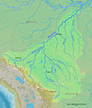
 Beni Lowlands.jpg 5,560 × 4,000; 2.29 MB
-
 Bermejorivermap.png 1,000 × 1,000; 274 KB
-
 Bl-map.png 327 × 350; 12 KB
-
 Cotacajesrivermap.jpg 1,217 × 1,429; 751 KB
-
 Cotocajesrivermap.jpg 1,217 × 1,429; 750 KB
-
 Cuenca del Plata.png 836 × 601; 651 KB
-
 Cuenca-01020-01030-01040-B.svg 1,115 × 1,102; 3.84 MB
-
 Dobrizhoffer Paraguay.jpg 1,590 × 1,993; 623 KB
-
 El imperio del caucho - Rogers Becerra Casanovas (cover).png 2,930 × 3,961; 20.65 MB
-
 Flussnetz Río Matucaré.jpg 4,724 × 5,906; 2.1 MB
-
 Madeirarivermap.jpg 1,217 × 1,429; 750 KB
-
 Negrillos.png 1,993 × 1,813; 3.97 MB
-
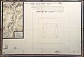 Plano del fuerte en Saipurú, Bolivia.jpg 2,802 × 1,925; 725 KB
-
 Río Chico map (Chuquisaca).jpg 568 × 568; 514 KB
-
 Río de la Paz map.jpg 2,989 × 2,989; 8.13 MB
-
 Río de la Paz map.png 1,500 × 1,500; 836 KB
-
 Río-cosapilla.png 747 × 1,596; 3.51 MB
-
 Río-lauca.svg 570 × 521; 694 KB
-
 Río-loa-(origen).svg 890 × 592; 1.04 MB
-
 Sistema endorreico Titicaca-Desaguadero-Poopó-Salar de Coipasa.svg 1,431 × 2,953; 224 KB
-
 Sistema endorreico Titicaca-Desaguadero-Poopó-Salar de Coipasa2.svg 1,285 × 1,938; 150 KB
-
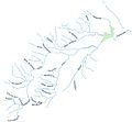 Tolomosa watershed.jpg 663 × 616; 35 KB


.png)


.jpg)


.svg)


