Category:Maps of rivers of Argentina
Jump to navigation
Jump to search
Subcategories
This category has the following 2 subcategories, out of 2 total.
M
- Maps of the Uruguay River (11 F)
R
Media in category "Maps of rivers of Argentina"
The following 25 files are in this category, out of 25 total.
-
 Argentina hydrographic map.png 321 × 529; 29 KB
-
 Bermejorivermap.png 1,000 × 1,000; 274 KB
-
 Chubut River Argentina basin map.png 1,200 × 1,068; 1.53 MB
-
 CnalMartinGarcia.PNG 407 × 550; 7 KB
-
 Coast Patagonia.jpg 298 × 400; 48 KB
-
 Colorado arg rivermap.png 1,000 × 1,000; 694 KB
-
 Colorado River Argentina basin map.png 1,105 × 1,395; 1.71 MB
-
 Comité Interjurisdiccional de la Cuenca del Río Carcarañá.jpg 3,040 × 2,149; 1.48 MB
-
 Cuenca del Plata.png 836 × 601; 651 KB
-
 Map of Concepción del bermejo.png 855 × 528; 56 KB
-
 Map of the Uruguay River from Yapeyu to the Farm of Sn. Gregorio WDL189.png 1,024 × 1,399; 1.82 MB
-
 Map-Northern Patagonia-Argentina-political.png 1,731 × 1,218; 663 KB
-
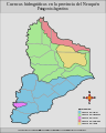 Mapa de las cuencas hidrograficas de la provincia del neuquen.svg 400 × 500; 318 KB
-
 Mapa Riacho Arazá.svg 384 × 586; 17 KB
-
 Muestreo-contaminacion-rio-turbio-gallegos.gif 684 × 325; 40 KB
-

-
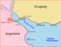 Plata buenos aires montevideo map-fr.svg 697 × 540; 39 KB
-
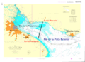
 Plata buenos aires montevideo map.PNG 698 × 539; 22 KB
-
 Plata buenos aires montevideo map.svg 698 × 539; 38 KB
-
 Rio Negro Argentina map.png 1,200 × 949; 1.42 MB
-
 Rio timonel.png 1,667 × 1,211; 1.22 MB
-
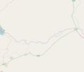 Rio-quilquihue.png 1,062 × 906; 79 KB
-
 River uruguay map.PNG 866 × 1,302; 34 KB
-
 Río Santa María.png 496 × 428; 310 KB
-
 Saladonorterivermap.png 1,000 × 1,000; 275 KB


