Category:Maps of provinces of Belgium
Jump to navigation
Jump to search
Countries of Europe: Armenia‡ · Belarus · Belgium · Bulgaria · France‡ · Republic of Ireland · Italy · Kazakhstan‡ · Netherlands‡ · Serbia · Spain‡ · Sweden · Turkey‡
‡: partly located in Europe
‡: partly located in Europe
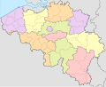
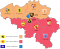
Provinces of Belgium: Province of Antwerp · Brussels-Capital Region · East Flanders · Flemish Brabant · Hainaut · Province of Liege · Luxembourg · Province of Namur · Walloon Brabant · West Flanders
Subcategories
This category has the following 12 subcategories, out of 12 total.
A
E
F
H
L
N
W
Media in category "Maps of provinces of Belgium"
The following 53 files are in this category, out of 53 total.
-
 1815-VerenigdKoninkrijkNederlanden-en.svg 791 × 1,112; 209 KB
-
 Belgia regioner og provinser.png 1,200 × 1,011; 186 KB
-
 Belgia regioner og provinser.svg 921 × 744; 134 KB
-
 Belgian provincial deputations 2012-2018.svg 1,650 × 1,344; 461 KB
-
 Belgie-provincie.PNG 401 × 337; 14 KB
-
 Belgien plan ohne Südosten.png 877 × 641; 74 KB
-
 Belgique régionale.png 400 × 337; 47 KB
-
 Belgische gewesten en provincies met vlag.jpg 1,250 × 1,024; 488 KB
-
 Belgische provincies.png 712 × 600; 126 KB
-
 Belgium administrative.svg 1,370 × 1,113; 267 KB
-
 Belgium location map.svg 1,136 × 988; 120 KB
-
 Belgium provinces blank.png 1,000 × 818; 11 KB
-
 Belgium provinces blank.svg 974 × 797; 20 KB
-
 Belgium provinces EN.png 1,000 × 818; 38 KB
-
 Belgium Provinces map-blank.svg 1,090 × 892; 81 KB
-
 Belgium provinces map.svg 920 × 871; 31 KB
-
 Belgium provinces thai.png 1,000 × 818; 31 KB
-
 Belgium provinces.svg 1,370 × 1,113; 10 KB
-
 Belgium regions dutch.png 400 × 337; 14 KB
-
 Belgium regions he.svg 400 × 330; 65 KB
-
 Belgium regions hebrew.svg 400 × 330; 60 KB
-
 Belgium RegProv He.png 400 × 337; 20 KB
-
 Belgium RegProv hu.svg 400 × 337; 231 KB
-
 Belgium RegProv.bg.png 400 × 337; 17 KB
-
 Belgium RegProv.png 400 × 337; 14 KB
-
 Belgium relief location map.jpg 1,136 × 988; 255 KB
-
 Belgium ukr.png 1,000 × 824; 161 KB
-
 Belgium's Provinces.png 400 × 337; 13 KB
-
 Belgium.geohive.png 620 × 531; 48 KB
-
 Belgiumlux.png 1,118 × 895; 135 KB
-
 Belgän provins.png 1,200 × 1,011; 179 KB
-
 Bélgica división administrativa.png 405 × 333; 10 KB
-
 Carte des provinces belges.svg 921 × 744; 24 KB
-
 Governors of Belgian provinces current.svg 1,650 × 1,344; 250 KB
-
 Kaart Belgische provincies en gewesten met vlaggen.jpg 1,250 × 1,024; 499 KB
-
 Kaart van Belgische Provincies.png 719 × 592; 116 KB
-
 Kaart van Belgische Provincies.svg 719 × 592; 159 KB
-
 Karte Belgien Regionen Provinzen mit Fahnen.jpg 1,250 × 1,024; 411 KB
-
 Map of Belgium provinces.png 399 × 335; 5 KB
-
 Map of Belgium Provinces.svg 512 × 484; 23 KB
-
 Map of Belgium.svg 1,650 × 1,344; 832 KB
-
 Provinces of Belgium with CoA-el.svg 1,000 × 819; 1.67 MB
-
 Provinces of Belgium with CoA-en.svg 1,000 × 819; 995 KB
-
 Provinces of Belgium.svg 307 × 251; 237 KB
-
 Provinces of Flanders.svg 879 × 341; 17 KB
-
 Provinces of Wallonia.svg 938 × 544; 19 KB
-
 Províncias de Belgica.svg 921 × 744; 24 KB
-
 Reino Unido de los Países Bajos en 1815-es.svg 791 × 1,112; 527 KB
-
 River map of Belgium.svg 920 × 871; 68 KB
-
 VlaanderenProvincies.png 270 × 135; 3 KB
-
 WalloniëProvincies.png 810 × 477; 47 KB
-
 Бельгия-АТД.png 828 × 746; 131 KB
-
 Провинции на Белгия.png 1,824 × 1,469; 371 KB


