Category:Maps of districts of Budapest
Jump to navigation
Jump to search
Subcategories
This category has the following 23 subcategories, out of 23 total.
0
- Maps of Budapest District I (10 F)
- Maps of Budapest District II (9 F)
- Maps of Budapest District IV (5 F)
- Maps of Budapest District V (14 F)
- Maps of Budapest District VI (6 F)
- Maps of Budapest District VIII (10 F)
- Maps of Budapest District IX (6 F)
1
- Maps of Budapest District X (6 F)
- Maps of Budapest District XI (11 F)
- Maps of Budapest District XIII (16 F)
- Maps of Budapest District XIV (11 F)
- Maps of Budapest District XV (5 F)
- Maps of Budapest District XVII (11 F)
- Maps of Budapest District XVIII (27 F)
2
- Maps of Budapest District XX (5 F)
Media in category "Maps of districts of Budapest"
The following 17 files are in this category, out of 17 total.
-
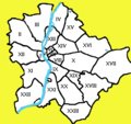
 Budapest colors numbers.png 837 × 747; 88 KB
-
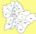
 Budapest colors numbers2.png 801 × 683; 86 KB
-
 Budapest colors numbers2.svg 834 × 660; 35 KB
-
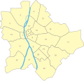
 Budapest districts blank.png 531 × 510; 48 KB
-
 Budapest districts map.svg 600 × 566; 31 KB
-
 Budapest districts.png 531 × 510; 41 KB
-
 Budapest districts2.png 531 × 510; 38 KB
-
 Budapest keruletei1.png 440 × 414; 19 KB
-
 Budapest Metro Lines.SVG 600 × 566; 25 KB
-
 Budapest Metro Map.SVG 256 × 225; 38 KB
-
 Budapesti kínai lakosság aránya kerületenként 2022.svg 600 × 566; 41 KB
-
 Districts of Budapest.png 220 × 207; 27 KB
-
 Hungary budapest districts notext.PNG 564 × 537; 58 KB
-
 Hungary budapest districts-an.svg 562 × 537; 18 KB
-
 Hungary budapest districts.jpg 564 × 537; 72 KB
-
 Hungary budapest districts.svg 562 × 537; 18 KB
-
 KalvinterkornyekeRomaikorban.jpg 512 × 385; 22 KB


