<nowiki>Category:Maps of Budapest District XIII; categoría de Wikimedia; kategori Wikimedia; Wikimedia category; د ويکيمېډيا وېشنيزه; Vikimedya kategorisi; ویکیمیڈیا زمرہ; kategória projektov Wikimedia; категорія проєкту Вікімедіа; 维基媒体分类; Wikimedia-Kategorie; kategorie na projektech Wikimedia; kategorija na Wikimediji; विकिपीडिया:श्रेणी; page de catégorie de Wikimedia; kategorija na Wikimediji; विकिपीडिया वर्ग; категорија на Викимедији; Wikimedia-Kategorie; Wikimedia-kategori; kategori Wikimédia; تصنيف ويكيميديا; pajenn rummata eus Wikimedia; Wikimedia:ကဏ္ဍခွဲခြင်း; 維基媒體分類; Wikimedia категориясы; categoría de Wikimedia; Wikimedia-Kategorie; Wikimedia-Kategorie; tudalen categori Wikimedia; Viciméid catagóir; Վիքիմեդիայի նախագծի կատեգորիա; 维基媒体分类; Wikimedia-kategori; ვიკიპედია:კატეგორიზაცია; ウィキメディアのカテゴリ; categoria Wikimedia; تصنيف بتاع ويكيميديا; විකිමීඩියා ප්රභේද පිටුව; categoria Vicimediorum; विकिमीडिया श्रेणी; Wikimedia-luokka; Wikimedia category; guruhi Vikimedia; катэгорыя ў праекце Вікімэдыя; Викимедиа проектындагы төркем; catigurìa di nu pruggettu Wikimedia; หน้าหมวดหมู่วิกิมีเดีย; Wikimedia:Kategorija; Wikimedia-Kategorie; Wikimedia:Klassys; категория на Уикимедия; categorie a unui proiect Wikimedia; categurìa 'e nu pruggette Wikimedia; Wikimedia-kategori; kawan Wikimèdia; гурӯҳи Викимедиа; 위키미디어 분류; Wikimedia-bólkur; kategorio en Vikimedio; kategori Wikimedia; Wikimedia:Ronnaghys; উইকিমিডিয়া বিষয়শ্রেণী; kategori Wikimedia; 维基媒体分类; וויקימעדיע קאַטעגאָריע; kategorija w projektach Wikimedije; thể loại Wikimedia; Wikimedia projekta kategorija; kategoria ti Wikimedia; categoria de um projeto da Wikimedia; 维基媒体分类; категорияд Ангилал; Wikimedia-kategori; kategori Wikimedia; پۆلی ویکیمیدیا; Wikimedia category; Vikimédia ñemohenda; Wikimédia-kategória; વિકિપીડિયા શ્રેણી; Wikimediako kategoria; категория в проекте Викимедиа; Wikimedia-Kategorie; катэгорыя ў праекце Вікімедыя; Wikimedia-kategorie; Wîkîmediya:Kategorî; विकिमिडिया श्रेणी; Wikimedia-Kategorie; קטגוריה במיזמי ויקימדיה; Викимедиа проектындагы төркем; κατηγορία εγχειρημάτων Wikimedia; विकिमिडिया श्रेणी; kategoria w projekcie Wikimedia; Wikimedia-kategoriija; гурӯҳи Викимедиа; Wikimedia-categorie; categoría de Wikimedia; Wikimedia-categorie; categoria di un progetto Wikimedia; Kategoriya ning Wikimedia; Wikimedia category; 維基媒體分類; Wikimedia kategooria; categoria de Wikimedia; Vikipidiya:Shopni; kategorya ng Wikimedia; 維基媒體分類; ẹ̀ka Wikimedia; Викимедиина категорија; categoria de um projeto da Wikimedia; Wikimedia-Kategorie; ردهٔ ویکیپدیا; tumbung Wikimedia; Wikimedia-kategorie; kategorija Wikimedie; Wikimedia proyektındağı törkem; Wikimedia-categorie; Викимедиа категорияһы; kategori Wikimedia; jamii ya Wikimedia; വിക്കിമീഡിയ വർഗ്ഗം; 維基媒體分類; kategori Wikimedia; விக்கிமீடியப் பகுப்பு; زمرو:وڪيپيڊيا زمرا بندي; kategori e Wikimedias; categoría de Wikimedia; Wikimedia-kategory; 维基媒体分类; 維基媒體分類</nowiki>
Category:Maps of Budapest District XIII Wikimedia category |
| Upload media |
|
| Instance of | |
|---|
| Category combines topics | |
|---|
| Budapest District XIII |
|---|
district in Budapest |
|
| Instance of | |
|---|
| Location | Budapest, Hungary |
|---|
| School district | - Közép-Pesti Tankerületi Központ
|
|---|
| Head of government | |
|---|
| Has part(s) | |
|---|
| Inception | |
|---|
| Population | |
|---|
| Area | |
|---|
| Follows | |
|---|
| Followed by | |
|---|
| Different from | |
|---|
| official website |
 47° 32′ 11.04″ N, 19° 04′ 18.84″ E 47° 32′ 11.04″ N, 19° 04′ 18.84″ E |
 |
|
|


 Angyalföld bp13.svg 394 × 503; 14 KB
 Budapest Bezirk13.svg 600 × 566; 87 KB
 Budapest district13.svg 600 × 566; 78 KB
 Budapest XIII.kerület aktuális.png 986 × 930; 143 KB
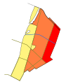
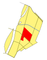 Erdőtelkek bp13.svg 394 × 503; 14 KB
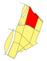 Felsőbikarét bp13.svg 394 × 503; 13 KB
 GÁVK bp13.svg 394 × 503; 13 KB
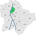 Hungary budapest district 13.jpg 564 × 537; 73 KB
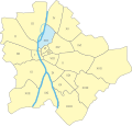 Hungary budapest district13.svg 562 × 537; 15 KB
 Kikötődűlő bp13.svg 394 × 503; 13 KB
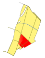 Lőportárdűlő bp13.svg 394 × 503; 13 KB
 Map budapest district13.svg 251 × 251; 157 KB
 Margitsziget bp13.svg 394 × 503; 14 KB
 Népsziget bp13.svg 394 × 503; 14 KB
 Vizafogó bp13.svg 394 × 503; 13 KB
 Újlipótváros bp13.svg 394 × 503; 13 KB


