Category:Maps of census statistical areas in Rhode Island
Jump to navigation
Jump to search
States of the United States: Alabama · Alaska · Arizona · Arkansas · California · Colorado · Connecticut · Delaware · Florida · Georgia · Idaho · Illinois · Indiana · Iowa · Kansas · Kentucky · Louisiana · Maine · Maryland · Massachusetts · Michigan · Minnesota · Mississippi · Missouri · Montana · Nebraska · Nevada · New Hampshire · New Jersey · New Mexico · New York · North Carolina · North Dakota · Ohio · Oklahoma · Oregon · Pennsylvania · Rhode Island · South Carolina · South Dakota · Tennessee · Texas · Utah · Vermont · Virginia · Washington · West Virginia · Wisconsin
Puerto Rico
Puerto Rico
Media in category "Maps of census statistical areas in Rhode Island"
The following 4 files are in this category, out of 4 total.
-
 Greaterboston.png 400 × 400; 40 KB
-
 Greaterboston2.png 500 × 500; 68 KB
-
 Rhode Island population map (magyar).png 620 × 450; 30 KB
-
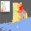 Rhode Island population map.png 600 × 600; 124 KB


.png)
