Category:Maps of census statistical areas in Illinois
Jump to navigation
Jump to search
States of the United States: Alabama · Alaska · Arizona · Arkansas · California · Colorado · Connecticut · Delaware · Florida · Georgia · Idaho · Illinois · Indiana · Iowa · Kansas · Kentucky · Louisiana · Maine · Maryland · Massachusetts · Michigan · Minnesota · Mississippi · Missouri · Montana · Nebraska · Nevada · New Hampshire · New Jersey · New Mexico · New York · North Carolina · North Dakota · Ohio · Oklahoma · Oregon · Pennsylvania · Rhode Island · South Carolina · South Dakota · Tennessee · Texas · Utah · Vermont · Virginia · Washington · West Virginia · Wisconsin
Puerto Rico
Puerto Rico
Subcategories
This category has only the following subcategory.
C
Media in category "Maps of census statistical areas in Illinois"
The following 22 files are in this category, out of 22 total.
-
 Champaign-Urbana Metropolitan Area.png 298 × 494; 20 KB
-
 Charleston-Mattoon Micropolitan Area.png 298 × 494; 20 KB
-
 Chicagoland Map.svg 2,082 × 3,418; 362 KB
-
 Greaterstl.png 924 × 904; 202 KB
-
 Illinois CBSAs 2020.png 4,392 × 4,004; 1.34 MB
-
 Jacksonville Micropolitan Area.png 298 × 494; 20 KB
-
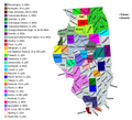
 Map of Illinois Counties Covering the Metro Lakeland communities.png 3,453 × 6,157; 715 KB
-
 Map of the USA highlighting Greater Saint Louis.gif 4,200 × 3,105; 1.78 MB
-
 Modified.png 1,024 × 768; 104 KB
-
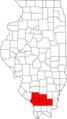
 Mount Vernon Micropolitan Area.png 298 × 494; 20 KB
-
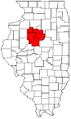
 Ottawa-Streator Micropolitan Area.png 298 × 494; 20 KB
-
 Peoria metropolitan area.svg 3,453 × 6,157; 87 KB
-
 Peoria MSA.png 268 × 451; 5 KB
-
 Peoria-Canton CSA.png 268 × 451; 5 KB
-
 Quad Cities.png 300 × 289; 22 KB
-
 Quad Cities.svg 155 × 156; 69 KB
-
 Rockford-Freeport-Rochelle CSA.png 298 × 494; 20 KB
-
 Springfield, IL Metropolitan Area.png 298 × 494; 20 KB
-
 St Louis map 8.png 418 × 464; 89 KB
-
 St Louis MSA.png 416 × 298; 17 KB
-
 St. Louis MSA-fr.svg 416 × 298; 38 KB
-
 St. Louis MSA.svg 416 × 298; 39 KB


