Category:Maps of Werl
Jump to navigation
Jump to search
Kreis Soest  Anröchte · Bad Sassendorf · Ense · Erwitte · Geseke · Lippetal · Lippstadt · Möhnesee · Rüthen · Soest · Warstein · Welver · Werl · Wickede (Ruhr) ·
Wikimedia category | |||||
| Upload media | |||||
| Instance of | |||||
|---|---|---|---|---|---|
| Category combines topics | |||||
| Werl | |||||
town in the district of Soest in North Rhine-Westphalia, Germany     | |||||
| Instance of |
| ||||
| Name in native language |
| ||||
| Location | Soest, Arnsberg Government Region, North Rhine-Westphalia, Germany | ||||
| Population |
| ||||
| Area |
| ||||
| Elevation above sea level |
| ||||
| Different from | |||||
| official website | |||||
 | |||||
Subcategories
This category has the following 2 subcategories, out of 2 total.
M
- Messtischblatt Werl (8 F)
T
- Teilung der Hilbecker Erlen (4 F)
Media in category "Maps of Werl"
The following 5 files are in this category, out of 5 total.
-
 DB 2112 railway map.png 1,583 × 1,087; 1.95 MB
-
 Hilbeck Werl dgk5 1-5000 Grundriss (cropped).png 6,649 × 6,711; 763 KB
-
 Hilbeck Werl dgk5 1-5000 Grundriss.png 19,200 × 19,200; 8.87 MB
-
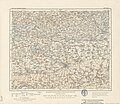 Karte des Deutschen Reiches - 356 - Soest (1902).jpg 7,449 × 6,467; 18.06 MB
-
 Werl. Kartenausschnitt aus Ducatus Westfalia, Mathäus Seutter um 1740.jpg 10,345 × 8,565; 15.44 MB

.png)

.jpg)
