<nowiki>Category:Maps of Paris 6e arrondissement; categoría de Wikimedia; kategori Wikimedia; Wikimedia category; د ويکيمېډيا وېشنيزه; Vikimedya kategorisi; ویکیمیڈیا زمرہ; kategória projektov Wikimedia; категорія проєкту Вікімедіа; 维基媒体分类; Wikimedia-Kategorie; Викимедиина категорија; kategorija na Wikimediji; विकिपीडिया:श्रेणी; page de catégorie de Wikimedia; kategorija na Wikimediji; विकिपीडिया वर्ग; категорија на Викимедији; Wikimedia-Kategorie; Wikimedia-kategori; kategori Wikimédia; تصنيف ويكيميديا; pajenn rummata eus Wikimedia; Wikimedia:ကဏ္ဍခွဲခြင်း; 維基媒體分類; Wikimedia категориясы; categoría de Wikimedia; categoria de Wikimedia; Викимедиа категорияһы; tudalen categori Wikimedia; Viciméid catagóir; ردهٔ ویکیپدیا; 维基媒体分类; Wikimedia-kategory; ვიკიპედია:კატეგორიზაცია; ウィキメディアのカテゴリ; categoria Wikimedia; تصنيف بتاع ويكيميديا; විකිමීඩියා ප්රභේද පිටුව; categoria Vicimediorum; विकिमीडिया श्रेणी; Wikimedia-luokka; Wikimedia category; guruhi Vikimedia; катэгорыя ў праекце Вікімэдыя; Викимедиа проектындагы төркем; catigurìa di nu pruggettu Wikimedia; หน้าหมวดหมู่วิกิมีเดีย; Wikimedia:Kategorija; Wikimedia-Kategorie; Wikimedia:Klassys; категория на Уикимедия; categorie a unui proiect Wikimedia; 維基媒體分類; Wikimedia-kategori; kawan Wikimèdia; 維基媒體分類; 위키미디어 분류; Wikimedia-bólkur; kategorio en Vikimedio; kategori Wikimedia; Wikimedia:Ronnaghys; উইকিমিডিয়া বিষয়শ্রেণী; kategori Wikimedia; 维基媒体分类; וויקימעדיע קאַטעגאָריע; kategorija w projektach Wikimedije; thể loại Wikimedia; Wikimedia projekta kategorija; Wikimedia-kategorie; categoria de um projeto da Wikimedia; Wikimedia category; категорияд Ангилал; Wikimedia-kategori; kategori Wikimedia; پۆلی ویکیمیدیا; Wikimedia category; Vikimédia ñemohenda; Wikimédia-kategória; વિકિપીડિયા શ્રેણી; Wikimediako kategoria; категория в проекте Викимедиа; Wikimedia-Kategorie; Kategoriya ning Wikimedia; Wikimedia-kategorie; Wîkîmediya:Kategorî; विकिमिडिया श्रेणी; Wikimedia-Kategorie; קטגוריה במיזמי ויקימדיה; Викимедиа проектындагы төркем; Wikimedia-categorie; विकिमिडिया श्रेणी; κατηγορία εγχειρημάτων Wikimedia; Wikimedia-kategoriija; гурӯҳи Викимедиа; kategoria w projekcie Wikimedia; categoría de Wikimedia; Wikimedia-Kategorie; categoria di un progetto Wikimedia; Vikipidiya:Shopni; 维基媒体分类; categurìa 'e nu pruggette Wikimedia; Wikimedia kategooria; Wikimedia-categorie; Wikimedia-kategori; kategorya ng Wikimedia; гурӯҳи Викимедиа; ẹ̀ka Wikimedia; kategorie na projektech Wikimedia; categoria de um projeto da Wikimedia; Wikimedia-Kategorie; Վիքիմեդիայի նախագծի կատեգորիա; tumbung Wikimedia; kategoria ti Wikimedia; kategorija Wikimedie; Wikimedia proyektındağı törkem; Wikimedia-Kategorie; Wikimedia-categorie; kategori Wikimedia; jamii ya Wikimedia; വിക്കിമീഡിയ വർഗ്ഗം; 維基媒體分類; kategori Wikimedia; 維基媒體分類; زمرو:وڪيپيڊيا زمرا بندي; kategori e Wikimedias; categoría de Wikimedia; விக்கிமீடியப் பகுப்பு; 维基媒体分类; катэгорыя ў праекце Вікімедыя</nowiki>
Subcategories
This category has the following 7 subcategories, out of 7 total.


 6th arrondissement of Paris - OSM 2020.svg 1,545 × 1,642; 1.42 MB
 La chartreuse de Paris.jpg 2,203 × 1,666; 2.76 MB
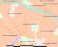 Map commune FR insee code 75106.png 756 × 605; 77 KB
 Map of the 6th arrondissement of Paris - OSM 2020.svg 1,545 × 1,642; 1.45 MB
 Metro 6to arrondissement.png 1,398 × 1,263; 287 KB
 Paris 6e arr jms.gif 850 × 700; 239 KB
 Paris 6th arrondissement map with listings 2.png 3,460 × 3,008; 1.1 MB
 Paris 6th arrondissement map with listings.png 3,460 × 3,008; 961 KB
 Paris 6th arrondissement map with listings.svg 512 × 445; 3.34 MB
 Paris 6th.png 1,200 × 1,293; 178 KB
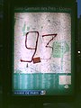 Paris 75006 Boulevard Raspail no 052 Street map display vandalized 2006.jpg 960 × 1,280; 123 KB
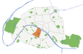 Paris orange & beige 75006.svg 512 × 329; 27 KB


