Category:Maps of Marquette County, Michigan
Jump to navigation
Jump to search
Counties of Michigan: Alcona · Alger · Allegan · Alpena · Antrim · Arenac · Baraga · Barry · Bay · Benzie · Berrien · Branch · Calhoun · Cass · Charlevoix · Cheboygan · Chippewa · Clare · Clinton · Crawford · Delta · Dickinson · Eaton · Emmet · Genesee · Gladwin · Gogebic · Grand Traverse · Gratiot · Hillsdale · Houghton · Huron · Ingham · Ionia · Iosco · Iron · Isabella · Jackson · Kalamazoo · Kalkaska · Kent · Keweenaw · Lake · Lapeer · Leelanau · Lenawee · Livingston · Luce · Mackinac · Macomb · Manistee · Marquette · Mason · Mecosta · Menominee · Midland · Missaukee · Monroe · Montcalm · Montmorency · Muskegon · Newaygo · Oakland · Oceana · Ogemaw · Ontonagon · Osceola · Oscoda · Otsego · Ottawa · Presque Isle · Roscommon · Saginaw · Sanilac · Schoolcraft · Shiawassee · St. Clair · St. Joseph · Tuscola · Van Buren · Washtenaw · Wayne · Wexford
Wikimedia category | |||||
| Upload media | |||||
| Instance of | |||||
|---|---|---|---|---|---|
| Category combines topics | |||||
| Marquette County | |||||
county in the Upper Peninsula of Michigan, United States   | |||||
| Instance of |
| ||||
| Named after | |||||
| Location | Michigan | ||||
| Located in or next to body of water | |||||
| Capital | |||||
| Item operated |
| ||||
| Inception |
| ||||
| Population |
| ||||
| Area |
| ||||
| Different from | |||||
| official website | |||||
 | |||||
Subcategories
This category has only the following subcategory.
O
Media in category "Maps of Marquette County, Michigan"
The following 44 files are in this category, out of 44 total.
-
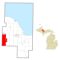
 Champion Township, MI location.png 2,500 × 2,500; 274 KB
-
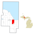
 Chocolay Township, MI location.png 2,500 × 2,500; 274 KB
-
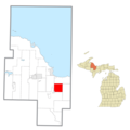
 Ely Township, MI location.png 2,500 × 2,500; 274 KB
-
 Ewing Township, MI location.png 2,500 × 2,500; 274 KB
-
 Forsyth Township, MI location.png 2,500 × 2,500; 274 KB
-
 Gwinn (community), MI location.png 2,500 × 2,500; 273 KB
-
 Harvey (community), MI location.png 2,500 × 2,500; 273 KB
-
 Humboldt Township, MI location.png 2,500 × 2,500; 274 KB
-
 Ishpeming Township, MI location.png 2,500 × 2,500; 274 KB
-
 K.I. Sawyer Air Force Base (Marquette), MI location.png 2,500 × 2,500; 273 KB
-
 L'Anse Indian Reservation location.png 2,344 × 2,560; 216 KB
-
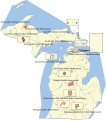
 Map of Michigan highlighting Marquette County.svg 6,256 × 7,325; 205 KB
-
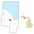
 Marquette Charter Township (Marquette), MI location.png 2,500 × 2,500; 274 KB
-

-

-
-

-

-

-

-

-

-

-

-

-
 Marquette County, MI census map.png 1,500 × 2,500; 280 KB
-
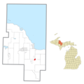
 Marquette, MI location.png 2,500 × 2,500; 273 KB
-
 Michigan Senate District 38 (2010).png 3,200 × 3,450; 703 KB
-
 MichiganIndianReservations.svg 535 × 606; 130 KB
-
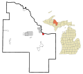
 MIMap-doton-Gwinn.PNG 261 × 300; 13 KB
-
 Negaunee Township, MI location.png 2,500 × 2,500; 273 KB
-
 Negaunee, MI location.png 2,500 × 2,500; 273 KB
-
 Palmer (Marquette community) location, MI.png 2,500 × 2,500; 273 KB
-
 Powell Township, MI location.png 2,500 × 2,500; 273 KB
-
 Republic Township, MI location.png 2,500 × 2,500; 273 KB
-
 Richmond Township (Marquette), MI location.png 2,500 × 2,500; 273 KB
-
 Sands Township, MI location.png 2,500 × 2,500; 273 KB
-
 Skandia Township, MI location.png 2,500 × 2,500; 273 KB
-
 Tilden Township, MI location.png 2,500 × 2,500; 274 KB
-
 Trowbridge Park, MI location.png 2,500 × 2,500; 273 KB
-
 Turin Township, MI location.png 2,500 × 2,500; 274 KB
-
 Wells Township (Marquette), MI location.png 2,500 × 2,500; 274 KB
-
 West Branch Township (Marquette), MI.png 2,500 × 2,500; 273 KB
-
 West Ishpeming, MI location.png 2,500 × 2,500; 273 KB


,_MI_location.png)
,_MI_location.png)


,_MI_location.png)

,_MI_location.png)


.png)


_location,_MI.png)


,_MI_location.png)


,_MI_location.png)
,_MI.png)
