Category:Maps of Alger County, Michigan
Jump to navigation
Jump to search
Counties of Michigan: Alcona · Alger · Allegan · Alpena · Antrim · Arenac · Baraga · Barry · Bay · Benzie · Berrien · Branch · Calhoun · Cass · Charlevoix · Cheboygan · Chippewa · Clare · Clinton · Crawford · Delta · Dickinson · Eaton · Emmet · Genesee · Gladwin · Gogebic · Grand Traverse · Gratiot · Hillsdale · Houghton · Huron · Ingham · Ionia · Iosco · Iron · Isabella · Jackson · Kalamazoo · Kalkaska · Kent · Keweenaw · Lake · Lapeer · Leelanau · Lenawee · Livingston · Luce · Mackinac · Macomb · Manistee · Marquette · Mason · Mecosta · Menominee · Midland · Missaukee · Monroe · Montcalm · Montmorency · Muskegon · Newaygo · Oakland · Oceana · Ogemaw · Ontonagon · Osceola · Oscoda · Otsego · Ottawa · Presque Isle · Roscommon · Saginaw · Sanilac · Schoolcraft · Shiawassee · St. Clair · St. Joseph · Tuscola · Van Buren · Washtenaw · Wayne · Wexford
Wikimedia category | |||||
| Upload media | |||||
| Instance of | |||||
|---|---|---|---|---|---|
| Category combines topics | |||||
| Alger County | |||||
county in Michigan, United States  Alger County Courthouse Complex  | |||||
| Instance of | |||||
| Named after | |||||
| Location | Michigan | ||||
| Located in or next to body of water | |||||
| Capital | |||||
| Inception |
| ||||
| Population |
| ||||
| Area |
| ||||
| official website | |||||
 | |||||
Subcategories
This category has only the following subcategory.
O
Media in category "Maps of Alger County, Michigan"
The following 15 files are in this category, out of 15 total.
-

-

-
 Alger County, MI census map 2020.png 2,012 × 3,296; 222 KB
-
 Alger County, MI census map.png 2,012 × 3,296; 221 KB
-
 Burt Township (Alger), MI location2.png 3,300 × 3,400; 260 KB
-
 Burt Township, MI location.png 2,760 × 3,368; 178 KB
-
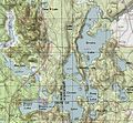 Corner-Straits Chain and Blue Lake.jpg 726 × 670; 334 KB
-
 Lake Stella Topo.jpg 723 × 577; 336 KB
-
 Map of Michigan highlighting Alger County.svg 6,256 × 7,325; 205 KB
-
 Michigan Senate District 38 (2010).png 3,200 × 3,450; 703 KB
-
 MIMap-doton-AuTrain.PNG 261 × 300; 13 KB
-
 MIMap-doton-Chatham.PNG 261 × 300; 13 KB
-
 MIMap-doton-Limestone.PNG 261 × 300; 13 KB
-
 MIMap-doton-Shingleton.PNG 261 × 300; 13 KB
-
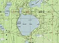 Round Lake Topo.jpg 813 × 588; 419 KB


,_MI_location2.png)


.png)


