Category:Maps of Grand Teton National Park
Jump to navigation
Jump to search
United States national parks: Acadia · American Samoa · Arches · Badlands · Big Bend · Biscayne · Black Canyon of the Gunnison · Bryce Canyon · Canyonlands · Capitol Reef · Carlsbad Caverns · Channel Islands · Congaree · Crater Lake · Cuyahoga Valley · Death Valley · Denali · Dry Tortugas · Everglades · Gateway Arch · Gates of the Arctic · Glacier · Glacier Bay · Grand Canyon · Grand Teton · Great Basin · Great Smoky Mountains · Guadalupe Mountains · Haleakalā · Hawaii Volcanoes · Hot Springs · Indiana Dunes · Isle Royale · Joshua Tree · Kenai Fjords · Kings Canyon · Kobuk Valley · Lake Clark · Lassen Volcanic · Mammoth Cave · Mesa Verde · Mount Rainier · North Cascades · Olympic · Petrified Forest · Pinnacles · Redwood · Rocky Mountain · Saguaro · Sequoia · Shenandoah · Theodore Roosevelt · Virgin Islands · Voyageurs · White Sands · Wind Cave · Wrangell-St. Elias · Yellowstone · Yosemite · Zion
Wikimedia category | |||||
| Upload media | |||||
| Instance of | |||||
|---|---|---|---|---|---|
| Category combines topics | |||||
| Grand Teton National Park | |||||
United States National Park in northwestern Wyoming  | |||||
| Instance of | |||||
| Location | Teton County, Wyoming | ||||
| Visitor center | |||||
| Operator | |||||
| IUCN protected areas category | |||||
| Inception |
| ||||
| Mountain range | |||||
| Highest point | |||||
| Area |
| ||||
| Visitors per year |
| ||||
| official website | |||||
 | |||||
Subcategories
This category has the following 2 subcategories, out of 2 total.
Media in category "Maps of Grand Teton National Park"
The following 55 files are in this category, out of 55 total.
-
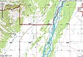 Grand Teton National Park - Fish Creek map.jpg 1,123 × 774; 207 KB
-
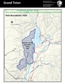 Grand Teton National Park Boundaries in 1929.pdf 1,275 × 1,650; 1.19 MB
-
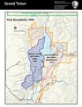 Grand Teton National Park Boundaries in 1943.pdf 1,275 × 1,650; 1.2 MB
-
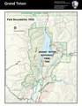 Grand Teton National Park Boundaries in 1950.pdf 1,275 × 1,650; 1.21 MB
-
 Grand Teton NP historic structures NPS1.jpg 792 × 1,032; 1.22 MB
-
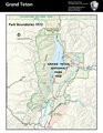 Grand Teton Park Boundaries in 1972.pdf 1,275 × 1,650; 1.21 MB
-
 Grand-teton-map.jpg 668 × 1,007; 100 KB
-
 HFCA 1607 NPS Employees, Women 515.jpg (1b3a1ce8a0894ab29b279294b18ae76c).jpg 7,771 × 5,174; 2.11 MB
-
 LocMap grand teton np.png 280 × 183; 40 KB
-
 LocMap Grand Teton.png 280 × 183; 31 KB
-
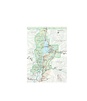
 Map of Grand Teton National Park.jpg 789 × 1,112; 289 KB
-
 Map Wyoming NPS sites USA.gif 500 × 429; 15 KB
-
 NPS craters-of-the-moon-regional-map.jpg 865 × 918; 154 KB
-
 NPS craters-of-the-moon-regional-map.pdf 370 × 393; 752 KB
-
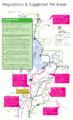
 NPS grand-teton-backcountry-trail-map.gif 2,703 × 3,339; 947 KB
-
 NPS grand-teton-bicycle-map.gif 1,445 × 2,207; 271 KB
-
 NPS grand-teton-camping-zone-cascade-canyon-north-fork-map.gif 955 × 1,312; 219 KB
-
 NPS grand-teton-camping-zone-cascade-canyon-south-fork-map.gif 959 × 1,263; 193 KB
-
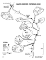 NPS grand-teton-camping-zone-death-canyon-map.gif 1,000 × 1,312; 267 KB
-
 NPS grand-teton-camping-zone-garnet-canyon-map.gif 1,243 × 1,590; 296 KB
-
 NPS grand-teton-camping-zone-granite-open-canyon-map.gif 1,312 × 913; 188 KB
-
 NPS grand-teton-camping-zone-holly-lake-map.gif 1,250 × 1,000; 147 KB
-
 NPS grand-teton-camping-zone-lower-paintbrush-map.gif 950 × 1,312; 140 KB
-
 NPS grand-teton-camping-zone-marion-lake-map.gif 1,250 × 717; 165 KB
-
 NPS grand-teton-camping-zone-phelps-lake-map.gif 1,225 × 531; 71 KB
-
 NPS grand-teton-camping-zone-surprise-lake-map.gif 1,125 × 750; 164 KB
-
 NPS grand-teton-camping-zone-upper-paintbrush-map.gif 1,024 × 1,250; 234 KB
-
 NPS grand-teton-classic-map.jpg 1,536 × 2,124; 730 KB
-
 NPS grand-teton-classic-map.pdf 1,316 × 1,818; 3.18 MB
-
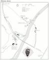
 NPS grand-teton-colter-bay-detail-map.gif 1,293 × 1,604; 141 KB
-
 NPS grand-teton-colter-bay-winter-map.gif 616 × 489; 36 KB
-
 NPS grand-teton-death-canyon-trail-topo-map.gif 1,298 × 1,638; 287 KB
-
 NPS grand-teton-fishing-map.gif 1,445 × 1,847; 234 KB
-
 NPS grand-teton-flagg-ranch-trail-map.gif 562 × 1,135; 55 KB
-
 NPS grand-teton-flagg-ranch-winter-map.gif 617 × 781; 47 KB
-
 NPS grand-teton-granite-canyon-trail-topo-map.gif 1,305 × 1,638; 259 KB
-
 NPS grand-teton-hermitage-point-trail-map.gif 1,302 × 1,644; 215 KB
-
 NPS grand-teton-jenny-lake-trail-topo-map.gif 1,302 × 1,641; 293 KB
-
 NPS grand-teton-leigh-lake-trail-topo-map.gif 1,305 × 1,641; 286 KB
-
 NPS grand-teton-lupine-meadows-trail-topo-map.gif 1,302 × 1,644; 318 KB
-
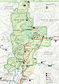
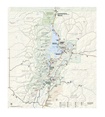
 NPS grand-teton-map.jpg 2,950 × 3,357; 1.62 MB
-
 NPS grand-teton-map.pdf 2,527 × 2,877; 9.02 MB
-
 NPS grand-teton-moose-detail-map.gif 1,314 × 1,605; 130 KB
-
 NPS grand-teton-moose-wilson-road-winter-map.gif 615 × 734; 31 KB
-
 NPS grand-teton-pets-map.gif 1,445 × 2,380; 349 KB
-
 NPS grand-teton-signal-mountain-winter-map.gif 615 × 484; 30 KB
-
 NPS grand-teton-south-jenny-lake-detail-map.gif 1,302 × 1,626; 140 KB
-
 NPS grand-teton-stock-map.gif 1,445 × 2,380; 431 KB
-
 NPS grand-teton-string-lake-trail-topo-map.gif 1,299 × 1,638; 296 KB
-
 NPS grand-teton-taggart-lake-trail-topo-map.gif 1,302 × 1,635; 315 KB
-
 NPS grand-teton-taggart-lake-winter-map.gif 616 × 1,033; 45 KB
-
 NPS grand-teton-two-ocean-lake-trail-topo-map.gif 1,302 × 1,641; 210 KB
-
 NPS grand-teton-vegetation-map.gif 4,162 × 5,766; 3.67 MB
-
 NPS grand-teton-winter-map.gif 1,696 × 1,928; 236 KB
-
 Trapper Lake.png 946 × 1,291; 181 KB


.jpg)


