Category:Maps of Castrop-Rauxel
Jump to navigation
Jump to search
Kreis Recklinghausen  Castrop-Rauxel · Datteln · Dorsten · Gladbeck · Haltern · Herten · Marl · Oer-Erkenschwick · Recklinghausen · Waltrop ·
Wikimedia category | |||||
| Upload media | |||||
| Instance of | |||||
|---|---|---|---|---|---|
| Category combines topics | |||||
| Castrop-Rauxel | |||||
town in Recklinghausen District, in North Rhine-Westphalia, Germany | |||||
| Instance of |
| ||||
| Location | Recklinghausen, Münster Government Region, North Rhine-Westphalia, Germany | ||||
| Population |
| ||||
| Area |
| ||||
| Elevation above sea level |
| ||||
| official website | |||||
 | |||||
Subcategories
This category has only the following subcategory.
E
Media in category "Maps of Castrop-Rauxel"
The following 10 files are in this category, out of 10 total.
-
2018-12-13-stadtbezirke-castrop-rauxel.pdf 1,754 × 1,239; 2.67 MB
-
Becklemer Baeche Einzugsgebietskarte.png 1,280 × 1,084; 2.42 MB
-
Castrop-Rauxel - Erinstraße - Erinpark 04 ies.jpg 5,616 × 3,744; 6.91 MB
-
Castrop-Rauxel in RE.svg 423 × 340; 1.39 MB
-
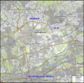
Hellbach (Emscher) et al Einzugsgebietskarte.png 2,483 × 2,470; 11.37 MB
-
Lage der Stadt Castrop-Rauxel in Deutschland.png 188 × 235; 5 KB
-
Messtischblaetter 4309-4410 Altbuergermeisterei Castrop um 1910.jpg 10,793 × 8,016; 20.85 MB
-
Messtischblaetter 4309-4410 Altbuergermeisterei Castrop um 1910.pdf 1,754 × 1,302; 15.49 MB
-
Messtischblatt 4409 Herne 1906.jpg 1,654 × 1,791; 929 KB
-
Reichskarte 100 Castrop-Rauxel.png 2,995 × 2,515; 18.41 MB


