Category:Maps of Azerbaijani-inhabited regions in Iran
Jump to navigation
Jump to search
Media in category "Maps of Azerbaijani-inhabited regions in Iran"
The following 13 files are in this category, out of 13 total.
-
 Azerbaijan Ethnic Map.png 2,397 × 2,052; 98 KB
-
 Azerbaijani-speaking population in Iran.jpg 5,264 × 3,722; 1.51 MB
-
 Azerbaijanis of Central Iran.PNG 652 × 600; 54 KB
-
 East Azerbaijan Province Ethnic Map.png 1,430 × 1,495; 43 KB
-
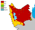
 Hamadan Province Ethnic Map.png 1,100 × 947; 37 KB
-

-

-
 Map of Azeris in Iran in 2005 per Hafeznia et al.jpg 1,100 × 850; 430 KB
-

-
 Qazvin Province Ethnic Map.png 1,141 × 671; 35 KB
-
 West Azerbaijan Province Ethnic Map Detailed.png 1,143 × 1,673; 58 KB
-
 İran'da Azerbaycan Türklerinin çoğunlukta olduğu eyaletler.png 896 × 820; 28 KB
-
 قزوین آزربایجان تورک.jpg 598 × 600; 104 KB


