Category:Königlich-Sächsische Triangulirung Station 13 Udohöhe
Jump to navigation
Jump to search
| (Wikidata) |
| Object location | | View all coordinates using: OpenStreetMap |
|---|
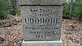
Triangulation Column, 1nd Order Station, the Royal Saxon Triangulation in Saxony 1862-1890  | |||||
| Upload media | |||||
| Instance of |
| ||||
|---|---|---|---|---|---|
| Part of | |||||
| Location | Oederan, Mittelsachsen, Saxony, Germany | ||||
| Street address |
| ||||
| Heritage designation | |||||
| Inception |
| ||||
 | |||||
Media in category "Königlich-Sächsische Triangulirung Station 13 Udohöhe"
The following 10 files are in this category, out of 10 total.
-
 Kgl.-sächs. Triangulirung, Station 13 Udohöhe (1).jpg 3,000 × 4,000; 4.39 MB
-
 Kgl.-sächs. Triangulirung, Station 13 Udohöhe (2).jpg 3,000 × 4,000; 4.28 MB
-
 Kgl.-sächs. Triangulirung, Station 13 Udohöhe (3).jpg 3,000 × 4,000; 3.87 MB
-
 Kgl.-sächs. Triangulirung, Station 13 Udohöhe (4).jpg 4,000 × 3,000; 4.6 MB
-
 Kgl.-sächs. Triangulirung, Station 13 Udohöhe (5).jpg 4,000 × 3,000; 4.24 MB
-
 Triangulationssäule Udohöhe, Detailaufnahme.jpg 1,920 × 1,080; 1.2 MB
-
 Triangulationssäule Udohöhe.jpg 1,080 × 1,920; 1.22 MB
-
 Udohoehe detail.jpg 2,048 × 1,360; 1.64 MB
-
 Udohoehe gross.jpg 752 × 2,048; 1.03 MB
-
 Udohöhe.jpg 1,920 × 1,080; 1.08 MB
.jpg)
.jpg)
.jpg)
.jpg)
.jpg)


