Category:Benchmarks (surveying)
Jump to navigation
Jump to search
Čeština: Nivelační značky.
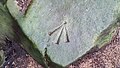
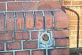
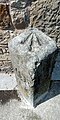
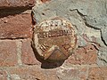
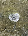
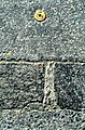
English: Benchmarks are geodetic markers to show altitudes and heights. They are used for levelling. They are not trig points, which are used for horizontal and 3-D geodesy, by triangulation, or now by GPS measurements
Svenska: Höjdfixpunkter är mätpunkter med känd höjd som används bland annat vid avvägning.
Français : Repères de nivellement
Deutsch: Höhenmarken
Polski: Repery niwelacyjne
point with known height used in surveying when levelling  | |||||
| Upload media | |||||
| Subclass of |
| ||||
|---|---|---|---|---|---|
| Facet of | |||||
| Different from | |||||
| |||||
Subcategories
This category has the following 6 subcategories, out of 6 total.
B
P
R
T
Pages in category "Benchmarks (surveying)"
This category contains only the following page.
Media in category "Benchmarks (surveying)"
The following 57 files are in this category, out of 57 total.
-
 Benchmark at St. Mary's Church Maynooth.jpg 4,032 × 2,016; 4.86 MB
-
 Benchmark beside North Gate.jpg 4,000 × 3,000; 6.49 MB
-
 Benchmark in Taipei 20151011.jpg 3,648 × 2,736; 3.84 MB
-
 Benchmark on rock near Llyn Crafnant.jpg 3,541 × 1,992; 2.15 MB
-
 Benchmark on Seichenkopf.JPG 3,840 × 2,160; 3.71 MB
-
 Benchmark on the wall.jpg 2,032 × 1,354; 671 KB
-
 Benchmark surveying on the river Piaśnica.jpg 2,976 × 3,968; 3.58 MB
-
 Benchmark-building wall.jpg 1,600 × 1,200; 419 KB
-
 Border point.svg 505 × 255; 6 KB
-
 Boundary marker 13 at Kickham Barracks.jpg 2,016 × 4,032; 4.62 MB
-
 Boundary marker with benchmark at Kickham Barracks.jpg 2,016 × 4,032; 4.76 MB
-
 China IMG 4106 (29452004440).jpg 2,736 × 3,648; 3.76 MB
-
 Christchurch bench mark.JPG 3,000 × 4,000; 3.74 MB
-
 Europa Bezugspegel.svg 1,200 × 1,000; 677 KB
-
 Fastmerke.jpg 2,848 × 2,136; 285 KB
-
 FikspunktKMS2012.jpg 2,592 × 1,552; 822 KB
-
 Fixpunkt.JPG 678 × 416; 38 KB
-
 Flush Bracket OSBM G2510- Leyland, Wigan Road.jpg 2,246 × 2,995; 7.49 MB
-
 GEOFOTO Igreja de Nossa Senhora da Conceição de Paraty Mirim 7384.jpg 6,000 × 4,000; 13.55 MB
-
 GI Fikspunkt Tranum Danmark.JPG 3,456 × 5,184; 5.46 MB
-
 Godthøbhøjene.jpg 5,760 × 3,840; 19.54 MB
-
 Height Benchmark Portland.jpg 2,448 × 3,264; 3.31 MB
-
 Hektometer hg.jpg 4,928 × 3,280; 4.05 MB
-
 Historischer Nivellements-Grenzpfeiler 5873 (Höhenfestpunkt).jpg 886 × 1,181; 1.44 MB
-
 Historischer Nivellements-Grenzpfeiler 6950 (Detailansicht).jpg 1,920 × 2,560; 2.49 MB
-
 Historischer Nivellements-Grenzpfeiler 6950 (Lageansicht).jpg 2,048 × 1,536; 1.26 MB
-
 Historischer Nivellements-Grenzpfeiler 8632 (Detailansicht).jpg 1,920 × 2,560; 3.52 MB
-
 Historischer Nivellements-Grenzpfeiler Nieuweschans (NL) - Bunde (DE).jpg 1,200 × 1,600; 571 KB
-
 IBGE Referência de Nível Salvador Bahia 2019-0609.jpg 1,744 × 1,163; 1.52 MB
-
 Kergu õigeusu kirik, lood.JPG 5,184 × 3,456; 9.29 MB
-
 Kompasrose med Sporvejsmuseets fikspunkt.jpg 2,560 × 1,920; 2.61 MB
-
 Marker 002.jpg 3,296 × 2,472; 1.16 MB
-
 Mg-P5.jpg 4,624 × 2,600; 2.95 MB
-

-
 Pierre-Niton-Geneva-1.jpg 581 × 300; 82 KB
-
 Point Reno highpoint marker.jpg 2,811 × 2,110; 1.51 MB
-
 Punkt osnowy - schemat.svg 505 × 255; 6 KB
-
 PylonBenchmarkNMKT.jpg 840 × 1,296; 471 KB
-
 Reper roboczy-pow pionowe.svg 488 × 414; 4 KB
-
 Repere nivellement IGN Be.jpg 472 × 354; 82 KB
-
 Rhymney St David - OS cut mark 5923193 89bb2004.jpg 680 × 1,024; 192 KB
-
 Roadside benchmark outside Leksand, Sweden.JPG 2,448 × 3,264; 5.26 MB
-
 Standard-højdemærke på Aarhus Domkirke 1.jpg 2,040 × 1,358; 4.34 MB
-
 Standard-højdemærke på Aarhus Domkirke 2.jpg 1,360 × 2,043; 4.15 MB
-
 Surveying mark.JPG 2,304 × 3,072; 1.31 MB
-
 Syuyumbike Tower (2022-06-01) 10.jpg 5,152 × 3,864; 7.39 MB
-
 Syuyumbike Tower (2022-06-01) 15.jpg 5,152 × 3,864; 7.41 MB
-
 Toppen af postament Kongsbjerg.jpg 2,178 × 2,796; 4.92 MB
-
 Trigonometrischer Punkt I. Ordnung (TP) auf dem Götzer Berg 1.JPG 3,240 × 4,320; 5.08 MB
-
 Trigonometrischer Punkt I. Ordnung (TP) auf dem Götzer Berg 2.JPG 3,240 × 4,320; 4.98 MB
-
 UF NHP1912.png 141 × 199; 46 KB
-
 Unterirdische Festlegung des Normalhöhenpunktes.png 410 × 572; 322 KB
-
 Vertical references in Europe.svg 575 × 444; 525 KB
-
 Vonsild, Vermessungsstein und Kilometerstein 07-0 (1).jpg 2,048 × 1,536; 814 KB
-
 Zermatt 1995 26.jpg 708 × 1,076; 1.23 MB
-
 Репер на горі Ірита-Кая. Крим.jpg 2,448 × 3,264; 1.95 MB
-
 বেঞ্চমার্ক - Benchmark.jpg 3,896 × 2,922; 5.77 MB


.jpg)


.jpg)
.jpg)
.jpg)
.jpg)
_-_Bunde_(DE).jpg)


_10.jpg)
_15.jpg)

_auf_dem_G%C3%B6tzer_Berg_1.JPG)
_auf_dem_G%C3%B6tzer_Berg_2.JPG)


.jpg)


