Category:July 2012 in the East Riding of Yorkshire
Jump to navigation
Jump to search
Ceremonial counties of England: Bedfordshire · Berkshire · Buckinghamshire · Cambridgeshire · Cheshire · Cornwall · Cumbria · Derbyshire · Devon · Dorset · Durham · East Riding of Yorkshire · East Sussex · Essex · Gloucestershire · Greater London · Greater Manchester · Hampshire · Herefordshire · Hertfordshire · Isle of Wight · Kent · Lancashire · Leicestershire · Lincolnshire · Merseyside · Norfolk · North Yorkshire · Northamptonshire · Northumberland · Nottinghamshire · Oxfordshire · Shropshire · Somerset · South Yorkshire · Staffordshire · Suffolk · Surrey · Tyne and Wear · Warwickshire · West Midlands · West Sussex · West Yorkshire · Wiltshire · Worcestershire
City-counties: Bristol ·
Former historic counties:
Other former counties:
City-counties: Bristol ·
Former historic counties:
Other former counties:
Deutsch: Bilder, die im Juli 2012 in the East Riding of Yorkshire aufgenommen worden sind. Bitte beachten Sie, dass dies weder das Datum des Uploads noch das Datum des Scannens eines Fotos ist.
English: Images/pictures taken in the East Riding of Yorkshire during July 2012. Note this is not the date of the upload, nor the date a photo was scanned.
Español: Fotografías o imágenes tomadas en the East Riding of Yorkshire durante julio 2012. No es la fecha de subida ni escaneo, sino la fecha en que las fotografías o imágenes se crearon.
Esperanto: Bildoj faritaj en the East Riding of Yorkshire en julio 2012. Tio ne estas la dato, kiam la bildoj estis alŝutitaj aŭ skanitaj.
Français : Photographies ou images prises en the East Riding of Yorkshire durant juillet 2012. Ce n'est pas la date du téléchargement ou du scan.
Galego: Fotografías ou imaxes tomadas en the East Riding of Yorkshire durante xullo 2012. Non é a data de subida nin escaneamento, senón a data na que se crearon as fotografías ou imaxes.
Italiano: Fotografie o immagini scattate a the East Riding of Yorkshire nel luglio 2012. Nota bene: la data non si riferisce né a quella di upload né a quella in cui la foto è stata digitalizzata.
Norsk bokmål: Bilder tatt i the East Riding of Yorkshire i løpet av juli 2012. Merk at dette ikke er datoen for opplasting, eller når et bilde har blitt skannet.
Norsk nynorsk: Bilete teke i the East Riding of Yorkshire i løpet av juli 2012. Merk at dette ikkje er datoen for opplasting, eller når eit bilete har vorte skanna.
Русский: Изображения, сделанные в the East Riding of Yorkshire в течение июль 2012 (не дата загрузки изображения).
Українська: Зображення, зроблені в the East Riding of Yorkshire протягом липень 2012. Зауважте, що це не дата завантаження чи дата сканування фотографії.
| July 2011 | ← | July 2012 | → | July 2013 | |||||||
| Jan | Feb | Mar | Apr | May | Jun | Jul | Aug | Sep | Oct | Nov | Dec |
| 32 | 9 | 29 | 47 | 18 | 57 | 35 | 48 | 36 | 27 | 26 | 16 |
|---|---|---|---|---|---|---|---|---|---|---|---|
Subcategories
This category has only the following subcategory.
Media in category "July 2012 in the East Riding of Yorkshire"
The following 34 files are in this category, out of 34 total.
-
 Bandstand in West Park (geograph 3025223).jpg 1,500 × 843; 1.12 MB
-
 Beverley Magistrates Court - panoramio.jpg 854 × 1,200; 280 KB
-
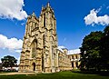
 Beverley Minster (12642875774).jpg 5,184 × 3,456; 8.8 MB
-
 Beverley Minster (23655270595).jpg 4,347 × 3,137; 10.4 MB
-
 Beverley Minster (7664265052).jpg 5,184 × 3,456; 10.16 MB
-
 Beverley Minster Ceiling (8684963632).jpg 4,852 × 2,891; 8.64 MB
-
 Beverley Minster Nave.jpg 3,276 × 5,115; 12.62 MB
-
 East Riding Treasure House, Beverley - panoramio.jpg 1,200 × 797; 373 KB
-
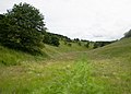
 Farm track back to the top of the dale (geograph 3021193).jpg 3,516 × 2,511; 1,020 KB
-
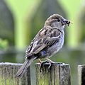 Female House Sparrow with insect (7728662094).jpg 1,632 × 1,635; 1.98 MB
-
 Half Moon, Skidby - panoramio.jpg 1,200 × 786; 407 KB
-
 Harper Dale runs to the left of the plantation (geograph 3021190).jpg 3,479 × 2,485; 1.03 MB
-
 Horse Dale heading towards Harper Dale (geograph 3021186).jpg 3,286 × 2,347; 1.16 MB
-
 Hull Road, Withernsea (geograph 3110190).jpg 1,024 × 719; 100 KB
-
 Looking into Holm Dale from Horse Dale (geograph 3021185).jpg 3,121 × 2,229; 847 KB
-
 Looking west along Horse Dale (geograph 3021188).jpg 3,629 × 2,592; 1.33 MB
-
 Main St, Skidby - panoramio.jpg 1,200 × 662; 327 KB
-
 Mark on St Nicholas's Church (geograph 3058036).jpg 3,264 × 2,448; 2.21 MB
-
 Memorial Avenue, Withernsea (geograph 3110154).jpg 1,600 × 1,190; 410 KB
-
 Memorial Avenue, Withernsea (geograph 3110165).jpg 1,600 × 1,164; 586 KB
-
 Memorial Avenue, Withernsea (geograph 3110188).jpg 1,600 × 1,179; 218 KB
-
 Ordnance Survey Cut Mark (geograph 3058029).jpg 3,264 × 2,448; 1.93 MB
-
 Ordnance Survey Flush Bracket 11374 (geograph 3058002).jpg 3,264 × 2,448; 1.86 MB
-
 Ordnance Survey Flush Bracket S6520 (geograph 3057992).jpg 3,264 × 2,448; 1.64 MB
-
 Ordnance Survey Flush Bracket S6521 (geograph 3058012).jpg 3,264 × 2,448; 2.37 MB
-
 Pier Towers, Withernsea (geograph 3110177).jpg 1,600 × 1,191; 286 KB
-
 Pier Towers, Withernsea (geograph 3110182).jpg 1,600 × 1,143; 337 KB
-
 Skidby Scarecrows 2012 - panoramio.jpg 1,200 × 800; 436 KB
-
 The Promenade, Withernsea (geograph 3110158).jpg 1,600 × 1,184; 250 KB
-
 The Promenade, Withernsea (geograph 3110161).jpg 1,600 × 1,191; 236 KB
-
 The Promenade, Withernsea (geograph 3110170).jpg 1,600 × 1,184; 245 KB
-
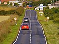 The Road to Withernsea (geograph 3042111).jpg 4,592 × 3,448; 4.05 MB
-
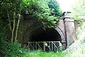 Weedleytunneljuly12.jpg 1,250 × 832; 379 KB
-
 Wheat field (geograph 3021195).jpg 3,370 × 2,407; 574 KB
.jpg)

.jpg)
.jpg)
.jpg)
.jpg)


.jpg)
.jpg)

.jpg)
.jpg)
.jpg)
.jpg)
.jpg)

.jpg)
.jpg)
.jpg)
.jpg)
.jpg)
.jpg)
.jpg)
.jpg)
.jpg)
.jpg)

.jpg)
.jpg)
.jpg)
.jpg)

.jpg)