Category:July 2009 in the East Riding of Yorkshire
Jump to navigation
Jump to search
Ceremonial counties of England: Bedfordshire · Berkshire · Buckinghamshire · Cambridgeshire · Cheshire · Cornwall · Cumbria · Derbyshire · Devon · Dorset · Durham · East Riding of Yorkshire · East Sussex · Essex · Gloucestershire · Greater London · Greater Manchester · Hampshire · Herefordshire · Hertfordshire · Isle of Wight · Kent · Lancashire · Leicestershire · Lincolnshire · Merseyside · Norfolk · North Yorkshire · Northamptonshire · Northumberland · Nottinghamshire · Oxfordshire · Shropshire · Somerset · South Yorkshire · Staffordshire · Suffolk · Surrey · Tyne and Wear · Warwickshire · West Midlands · West Sussex · West Yorkshire · Wiltshire · Worcestershire
City-counties: Bristol ·
Former historic counties:
Other former counties:
City-counties: Bristol ·
Former historic counties:
Other former counties:
Deutsch: Bilder, die im Juli 2009 in the East Riding of Yorkshire aufgenommen worden sind. Bitte beachten Sie, dass dies weder das Datum des Uploads noch das Datum des Scannens eines Fotos ist.
English: Images/pictures taken in the East Riding of Yorkshire during July 2009. Note this is not the date of the upload, nor the date a photo was scanned.
Español: Fotografías o imágenes tomadas en the East Riding of Yorkshire durante julio 2009. No es la fecha de subida ni escaneo, sino la fecha en que las fotografías o imágenes se crearon.
Esperanto: Bildoj faritaj en the East Riding of Yorkshire en julio 2009. Tio ne estas la dato, kiam la bildoj estis alŝutitaj aŭ skanitaj.
Français : Photographies ou images prises en the East Riding of Yorkshire durant juillet 2009. Ce n'est pas la date du téléchargement ou du scan.
Galego: Fotografías ou imaxes tomadas en the East Riding of Yorkshire durante xullo 2009. Non é a data de subida nin escaneamento, senón a data na que se crearon as fotografías ou imaxes.
Italiano: Fotografie o immagini scattate a the East Riding of Yorkshire nel luglio 2009. Nota bene: la data non si riferisce né a quella di upload né a quella in cui la foto è stata digitalizzata.
Norsk bokmål: Bilder tatt i the East Riding of Yorkshire i løpet av juli 2009. Merk at dette ikke er datoen for opplasting, eller når et bilde har blitt skannet.
Norsk nynorsk: Bilete teke i the East Riding of Yorkshire i løpet av juli 2009. Merk at dette ikkje er datoen for opplasting, eller når eit bilete har vorte skanna.
Русский: Изображения, сделанные в the East Riding of Yorkshire в течение июль 2009 (не дата загрузки изображения).
Українська: Зображення, зроблені в the East Riding of Yorkshire протягом липень 2009. Зауважте, що це не дата завантаження чи дата сканування фотографії.
| July 2008 | ← | July 2009 | → | July 2010 | |||||||
| Jan | Feb | Mar | Apr | May | Jun | Jul | Aug | Sep | Oct | Nov | Dec |
| 148 | 203 | 903 | 767 | 930 | 718 | 783 | 588 | 336 | 712 | 202 | 287 |
|---|---|---|---|---|---|---|---|---|---|---|---|
Subcategories
This category has the following 2 subcategories, out of 2 total.
Media in category "July 2009 in the East Riding of Yorkshire"
The following 200 files are in this category, out of 781 total.
(previous page) (next page)-
 32A Float, Winterton and Wind Farm - geograph.org.uk - 1392909.jpg 640 × 480; 115 KB
-
 A boat slipway at Hook, East Riding of Yorkshire.jpg 480 × 640; 92 KB
-
 A Family Day on Withernsea's Beach - geograph.org.uk - 1412921.jpg 640 × 480; 73 KB
-
 A Footpath west of Hook - geograph.org.uk - 1391364.jpg 480 × 640; 120 KB
-
 A former George Street Warehouse - geograph.org.uk - 1408422.jpg 640 × 480; 116 KB
-

-
 A hidden little jewel at Fordon^ - geograph.org.uk - 1401268.jpg 640 × 480; 123 KB
-
 A Quick Turnaround - geograph.org.uk - 1414475.jpg 640 × 480; 181 KB
-
 A Sea Wall to Infinity - geograph.org.uk - 1411264.jpg 640 × 511; 121 KB
-
 A seaside view^ - geograph.org.uk - 1404293.jpg 640 × 480; 68 KB
-
 A Second Childhood - geograph.org.uk - 1412920.jpg 640 × 509; 106 KB
-
 A steep descent^ - geograph.org.uk - 1420887.jpg 640 × 480; 72 KB
-
-
 A Train from Hull approaching Goole - geograph.org.uk - 1391345.jpg 480 × 640; 170 KB
-
 A Wheat Field just after Dawn - geograph.org.uk - 1412927.jpg 640 × 480; 142 KB
-
 Acres of cereals - geograph.org.uk - 1398263.jpg 640 × 480; 68 KB
-
 Aike East Riding of Yorkshire.jpg 1,600 × 1,200; 358 KB
-

-
 Along Ulrome Sands - geograph.org.uk - 1404167.jpg 640 × 480; 43 KB
-
 Amusement arcade, Hornsea - geograph.org.uk - 1419928.jpg 1,600 × 1,200; 360 KB
-
 Angus Farm - geograph.org.uk - 1395607.jpg 640 × 446; 50 KB
-
 Annoying Pattern - geograph.org.uk - 1412885.jpg 640 × 468; 108 KB
-

-
 Approach to Hartendale Gutter - geograph.org.uk - 1387762.jpg 640 × 480; 116 KB
-
 Approaching North Dale from Lang Dale - geograph.org.uk - 1402504.jpg 640 × 480; 125 KB
-
 Approaching The Belt - geograph.org.uk - 1408948.jpg 640 × 480; 77 KB
-

-
 Approaching Zigzag Plantation - geograph.org.uk - 1408962.jpg 640 × 480; 87 KB
-
 Arglam Lane and Arglam Wood - geograph.org.uk - 1395826.jpg 640 × 480; 71 KB
-
 Auburn beach, East Riding - geograph.org.uk - 1413893.jpg 640 × 480; 70 KB
-
 Aughton All Saints Church at Sunset - geograph.org.uk - 1414414.jpg 640 × 480; 71 KB
-
 Aughton Ings - geograph.org.uk - 1414407.jpg 640 × 480; 56 KB
-
 B1246 towards North Dalton - geograph.org.uk - 1414012.jpg 640 × 480; 90 KB
-
 B1246 towards North Dalton - geograph.org.uk - 1414036.jpg 640 × 480; 71 KB
-
 B1248 towards Bainton - geograph.org.uk - 1395408.jpg 640 × 480; 80 KB
-
 B1248 towards Tibthorpe - geograph.org.uk - 1395825.jpg 640 × 480; 83 KB
-
 B1248 towards Tibthorpe - geograph.org.uk - 1395840.jpg 640 × 480; 60 KB
-
 B1248 Towards Wetwang - geograph.org.uk - 1414503.jpg 640 × 480; 72 KB
-
 B1248 Towards Wharram le Street - geograph.org.uk - 1414488.jpg 640 × 480; 71 KB
-
 B1248 Towards Wharram le Street - geograph.org.uk - 1414493.jpg 640 × 480; 74 KB
-
 B1252 Towards Garton - geograph.org.uk - 1395927.jpg 640 × 480; 63 KB
-
 B1252 Towards Sledmere - geograph.org.uk - 1395934.jpg 640 × 480; 123 KB
-
 B1252 Towards Sledmere - geograph.org.uk - 1395943.jpg 640 × 480; 75 KB
-
 B1252 Towards Sledmere - geograph.org.uk - 1395952.jpg 640 × 480; 82 KB
-
 B1252 Towards Sledmere - geograph.org.uk - 1395960.jpg 640 × 480; 72 KB
-
 Backlit Footbridge - geograph.org.uk - 1414500.jpg 640 × 422; 59 KB
-
 Backlit Teasels - geograph.org.uk - 1414496.jpg 640 × 638; 73 KB
-
 Bainton railway station (site), Yorkshire (geograph 3519886).jpg 1,024 × 768; 263 KB
-
 Bank House Farm, Etton - geograph.org.uk - 1422317.jpg 640 × 480; 77 KB
-
 Barley being harvested - geograph.org.uk - 1396060.jpg 640 × 480; 61 KB
-
 Barley field, Huggate Wold - geograph.org.uk - 1398254.jpg 640 × 373; 52 KB
-
 Barley under a brooding sky - geograph.org.uk - 1399970.jpg 640 × 332; 45 KB
-
 Barmston Main Drain - geograph.org.uk - 1404282.jpg 640 × 480; 88 KB
-
 Barmston Main Drain - geograph.org.uk - 1404290.jpg 640 × 480; 89 KB
-
 Barmston Main Drain Outfall - geograph.org.uk - 1404198.jpg 640 × 464; 63 KB
-

-
 Beach - panoramio - Immanuel Giel.jpg 1,685 × 1,715; 324 KB
-
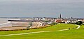 Beach of Bridlington 01.jpg 1,679 × 785; 404 KB
-
 Beach of Hornsea 01.jpg 1,789 × 1,697; 463 KB
-
 Beach of Hornsea 02.jpg 2,143 × 1,426; 431 KB
-
 Beach of Whitby.jpg 2,560 × 1,920; 1.75 MB
-
 Beacon Farm - geograph.org.uk - 1387678.jpg 640 × 480; 89 KB
-
 Beacon Farm - geograph.org.uk - 1414005.jpg 640 × 480; 100 KB
-
 Beacon Farm House - geograph.org.uk - 1387682.jpg 640 × 480; 111 KB
-
 Beacon Hill - geograph.org.uk - 1387692.jpg 640 × 480; 57 KB
-
 Beacon Hill - geograph.org.uk - 1387744.jpg 640 × 480; 80 KB
-
 Beacon Wood - geograph.org.uk - 1413994.jpg 640 × 480; 142 KB
-
 Bee on the Bank of Burstwick Drain - geograph.org.uk - 1409361.jpg 640 × 490; 96 KB
-
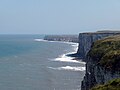 Bempton Cliffs.jpg 3,456 × 2,592; 946 KB
-
 Benches on Withernsea's Promenade - geograph.org.uk - 1412916.jpg 640 × 480; 100 KB
-
 Bethell's Swing Bridge - geograph.org.uk - 1410152.jpg 640 × 480; 78 KB
-
 Beverley and Barmston Drain - geograph.org.uk - 1410081.jpg 640 × 480; 78 KB
-
 Beverley Parks Crossing - geograph.org.uk - 1420959.jpg 640 × 445; 42 KB
-
 Bishop Burton Road, Cherry Burton - geograph.org.uk - 1422041.jpg 640 × 480; 91 KB
-
 Blanch Farm Farmland - geograph.org.uk - 1414143.jpg 640 × 480; 75 KB
-
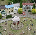
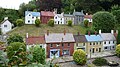
 Bondville Model Village 01.jpg 1,282 × 1,306; 268 KB
-
 Bondville Model Village 02.jpg 1,633 × 1,435; 503 KB
-
 Bondville Model Village 03.jpg 1,883 × 1,856; 935 KB
-
 Bondville Model Village 04.jpg 2,560 × 1,920; 2.41 MB
-
 Bondville Model Village 05.jpg 2,560 × 1,920; 2.54 MB
-
 Bondville Model Village 06.jpg 2,560 × 1,920; 2.32 MB
-
 Bondville Model Village 07.jpg 2,560 × 1,920; 2.44 MB
-
 Boothferry Borough Beacon - geograph.org.uk - 1414782.jpg 640 × 480; 79 KB
-
 Boulder clay cliffs - geograph.org.uk - 1404181.jpg 480 × 640; 113 KB
-
 Bridleway beside High Wood - geograph.org.uk - 1395429.jpg 640 × 480; 61 KB
-
 Bridleway from the Roman Road - geograph.org.uk - 1408927.jpg 640 × 480; 110 KB
-
 Bridleway junction at Rudston - geograph.org.uk - 1408770.jpg 480 × 640; 122 KB
-
 Bridleway near Summit House - geograph.org.uk - 1414103.jpg 640 × 480; 84 KB
-
 Bridleway near Tibthorpe - geograph.org.uk - 1395416.jpg 640 × 495; 123 KB
-
 Bridleway near Tibthorpe Grange - geograph.org.uk - 1395827.jpg 640 × 480; 89 KB
-
 Bridleway North of North Dalton - geograph.org.uk - 1414048.jpg 640 × 480; 62 KB
-
 Bridleway to Hutton Cranswick - geograph.org.uk - 1410124.jpg 640 × 480; 98 KB
-
 Bridleway to Moor Gate - geograph.org.uk - 1411075.jpg 640 × 480; 117 KB
-
 Bridleway towards Blanch Farm - geograph.org.uk - 1414138.jpg 640 × 480; 77 KB
-
 Bridleway towards Cottam - geograph.org.uk - 1396038.jpg 640 × 480; 79 KB
-
 Bridleway towards Cottam - geograph.org.uk - 1396053.jpg 640 × 480; 74 KB
-
 Bridleway towards Cowlam - geograph.org.uk - 1396045.jpg 640 × 480; 75 KB
-
 Bridleway towards Huggate - geograph.org.uk - 1395487.jpg 640 × 480; 114 KB
-
 Bridleway towards Huggate - geograph.org.uk - 1395516.jpg 640 × 480; 166 KB
-
 Bridleway towards Huggate - geograph.org.uk - 1395522.jpg 640 × 480; 105 KB
-
 Bridleway towards Huggate - geograph.org.uk - 1395534.jpg 640 × 480; 90 KB
-
 Bridleway towards Mill Farm - geograph.org.uk - 1414515.jpg 640 × 480; 77 KB
-
 Bridleway towards Mill Farm - geograph.org.uk - 1414527.jpg 640 × 480; 83 KB
-
 Bridleway towards Tibthorpe Wold - geograph.org.uk - 1395493.jpg 640 × 480; 65 KB
-
 Bridleway towards Wetwang Grange - geograph.org.uk - 1395894.jpg 640 × 480; 96 KB
-
 Bridleway, Garton Field - geograph.org.uk - 1395907.jpg 640 × 480; 83 KB
-

-
 Bridlington Old Town - geograph.org.uk - 1427253.jpg 640 × 487; 142 KB
-
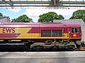
 Bridlington Station - geograph.org.uk - 1423895.jpg 640 × 480; 124 KB
-
 Bridlington Station - geograph.org.uk - 1423905.jpg 480 × 640; 145 KB
-
 Bridlington Station - geograph.org.uk - 1424369.jpg 640 × 479; 135 KB
-
 Bridlington Station - geograph.org.uk - 1428533.jpg 640 × 465; 143 KB
-
 Bridlington Station from walkway - geograph.org.uk - 1423910.jpg 640 × 480; 157 KB
-
 Bridlington Station from walkway - geograph.org.uk - 1423915.jpg 480 × 640; 133 KB
-
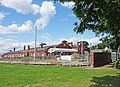
 Bridlington Town Centre - geograph.org.uk - 2252067.jpg 1,024 × 768; 265 KB
-
 Bridlington Town Hall - geograph.org.uk - 1427256.jpg 640 × 470; 154 KB
-
 Bridlington01.jpg 2,560 × 1,920; 2.45 MB
-
 Bridlington02.jpg 1,627 × 1,767; 626 KB
-
 Bridlington03.jpg 2,482 × 1,395; 798 KB
-
 Brind level crossing - geograph.org.uk - 1414455.jpg 640 × 480; 79 KB
-

-
 Brough Up Starter - geograph.org.uk - 1416827.jpg 482 × 640; 92 KB
-
 Burton Agnes Field - geograph.org.uk - 1409288.jpg 640 × 480; 71 KB
-
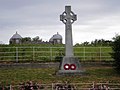 Burton Agnes War Memorial - geograph.org.uk - 1388179.jpg 640 × 480; 65 KB
-
 Burton Constable Hall - geograph.org.uk - 1411130.jpg 640 × 480; 64 KB
-
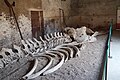 Burton Constable whale.JPG 3,008 × 2,000; 3.31 MB
-
 By Ashslack Wood, Kiplingcotes - geograph.org.uk - 1386893.jpg 640 × 426; 199 KB
-
 Bygot Wood - geograph.org.uk - 1422144.jpg 640 × 480; 67 KB
-
 Campey Lane, Melbourne - geograph.org.uk - 1396049.jpg 640 × 480; 82 KB
-
 Caravan site at Flamborough, East Riding of Yorkshire, England.jpg 640 × 480; 84 KB
-
 Carnaby Level Crossing - geograph.org.uk - 1412117.jpg 640 × 423; 46 KB
-
 Castlegate Green, Sledmere - geograph.org.uk - 1395966.jpg 640 × 480; 89 KB
-
 Centre House Farm - geograph.org.uk - 1414063.jpg 640 × 480; 69 KB
-

-
 Chalk Farm Lodge - geograph.org.uk - 1405068.jpg 640 × 480; 97 KB
-
 Chalk pit on Sixpenny Hill - geograph.org.uk - 1417115.jpg 640 × 480; 84 KB
-
 Cherry Burton Pond - geograph.org.uk - 1422066.jpg 640 × 480; 116 KB
-
 Cherry Burton railway station (site), Yorkshire (geograph 3578061).jpg 1,024 × 768; 261 KB
-
 Church Gate Hedon.jpg 640 × 480; 59 KB
-
 Church in Hornsea 01.jpg 2,560 × 1,920; 2.37 MB
-
 Church in Hornsea 02.jpg 2,560 × 1,920; 2.31 MB
-
 Church in Hornsea 03.jpg 2,311 × 1,471; 626 KB
-

-

-

-

-
 Coastal scenery at Flamborough - geograph.org.uk - 1387755.jpg 480 × 640; 113 KB
-
 Coastal scenery from High Holme - geograph.org.uk - 1419767.jpg 480 × 640; 83 KB
-
 Coastal scenery near Beacon Hill - geograph.org.uk - 1387752.jpg 640 × 480; 75 KB
-
 College Arms Bielby.jpg 640 × 480; 68 KB
-
 Columba palumbus - geograph.org.uk - 1408423.jpg 553 × 640; 97 KB
-
 Common Wold lane, near Kiplingcotes - geograph.org.uk - 1388868.jpg 640 × 571; 205 KB
-

-
 Construction Crane at Saltend - geograph.org.uk - 1384359.jpg 480 × 640; 46 KB
-
 Cottages Wold Newton - geograph.org.uk - 1385803.jpg 640 × 480; 59 KB
-
 Cottam Well Dale - geograph.org.uk - 1396040.jpg 640 × 480; 84 KB
-
 Countryside around Rudston - geograph.org.uk - 1408763.jpg 480 × 640; 132 KB
-
 Countryside around Rudston village - geograph.org.uk - 1408819.jpg 640 × 480; 85 KB
-
 Cow Dale - geograph.org.uk - 1399794.jpg 640 × 426; 64 KB
-
 Cowlam Well Dale - geograph.org.uk - 1396050.jpg 640 × 480; 84 KB
-
 Cowlam Well Dale - geograph.org.uk - 1396057.jpg 640 × 480; 83 KB
-
 Croom Dale Plantation - geograph.org.uk - 1414763.jpg 640 × 480; 130 KB
-
 Croome Farm - geograph.org.uk - 1414741.jpg 640 × 480; 84 KB
-
 Croome House Farm - geograph.org.uk - 1414729.jpg 640 × 480; 69 KB
-
 Croome House Farm Buildings - geograph.org.uk - 1414734.jpg 640 × 480; 70 KB
-
 Crop Field near Field House Farm - geograph.org.uk - 1395465.jpg 640 × 480; 91 KB
-
 Cross Bow Hill - geograph.org.uk - 1405093.jpg 640 × 480; 88 KB
-
 Cross Common Gate level crossing - geograph.org.uk - 1414449.jpg 640 × 409; 61 KB
-
 Cross Gate bend, near Goodmanham - geograph.org.uk - 1390361.jpg 640 × 426; 180 KB
-
 Cross Gate, near Goodmanham - geograph.org.uk - 1390358.jpg 640 × 426; 174 KB
-
 Crow Wood - geograph.org.uk - 1408674.jpg 640 × 480; 79 KB
-
 Dale view near Fordon - geograph.org.uk - 1401294.jpg 640 × 480; 65 KB
-
 Day's End - geograph.org.uk - 1391405.jpg 480 × 640; 62 KB
-
 Decision time^ - geograph.org.uk - 1401246.jpg 640 × 480; 60 KB
-

-
 Distillation Columns at Saltend - geograph.org.uk - 1384125.jpg 640 × 632; 76 KB
-
 Disused Railway Embankment - geograph.org.uk - 1414430.jpg 640 × 480; 95 KB
-
 Dog Walker on Withernsea Beach - geograph.org.uk - 1412919.jpg 640 × 481; 82 KB
-
 Drain on Thornton Ings - geograph.org.uk - 1396043.jpg 640 × 480; 90 KB
-
 Driffield Show 2009 Main Ring - geograph.org.uk - 1412327.jpg 640 × 346; 47 KB
-
 Duck Pond, North Dalton - geograph.org.uk - 1414075.jpg 640 × 480; 122 KB
-
 Dwarfed by the tree (4438499264).jpg 4,000 × 2,660; 11.02 MB
-
 Earthwork, Warren Dale - geograph.org.uk - 1396032.jpg 640 × 480; 105 KB
-
 East Gate Bridge at Rudston.jpg 640 × 480; 104 KB
-
 East Scar, North Landing - geograph.org.uk - 1419870.jpg 640 × 480; 87 KB
-
 Either Way in the Wheat - geograph.org.uk - 1390783.jpg 480 × 640; 190 KB
-

-

-
 Ellerby railway station (site), Yorkshire (geograph 3531622).jpg 1,024 × 768; 221 KB
-
 Entering Bielby - geograph.org.uk - 1416545.jpg 640 × 480; 61 KB
-
 Enthorpe railway line - geograph.org.uk - 1386866.jpg 447 × 640; 193 KB
-

-
 Entrance to Bygot House Farm - geograph.org.uk - 1422165.jpg 640 × 480; 112 KB
-
 Entrance to Cherry Burton Golf Club - geograph.org.uk - 1422088.jpg 640 × 480; 86 KB
-

-
 Entrance to Danebury Manor Farm - geograph.org.uk - 1385737.jpg 640 × 461; 62 KB
-
 Entrance to Dunkenhill Farm - geograph.org.uk - 1422457.jpg 640 × 480; 82 KB
-
 Entrance to Etton Fields Farm - geograph.org.uk - 1422349.jpg 640 × 480; 81 KB
-

-
 Entrance to Givendale House.jpg 640 × 480; 67 KB


,_Yorkshire_(geograph_3519886).jpg)


,_Yorkshire_(geograph_3578061).jpg)


.jpg)


_railway_station_(site),_Yorkshire_(geograph_3531604).jpg)
,_Yorkshire_(geograph_3531622).jpg)


