Category:Joint Operations Graphic Chile
Jump to navigation
Jump to search
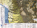
For most of the yellow areas are high resolution maps available. For white areas there is (Dec. 2011) no map available.

Subcategories
This category has only the following subcategory.
J
Media in category "Joint Operations Graphic Chile"
The following 31 files are in this category, out of 31 total.
-
 Chile.index.map h.jpg 2,328 × 704; 531 KB
-
 Chile.index.map v.jpg 704 × 2,328; 531 KB
-
 Sf-19-3-cerro paruma-bolivia-chile-1999.pdf 4,387 × 3,358; 10.19 MB
-
 Sf-19-3-cerro paruma-bolivia-chile.pdf 4,387 × 3,358; 10.2 MB
-
 Si-19-2-cerro aconcagua-argentina-chile.pdf 4,387 × 3,337; 8.87 MB
-
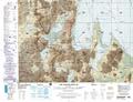
 Txu-oclc-224300691-se19-6.jpg 5,164 × 3,929; 10.27 MB
-
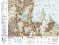
 Txu-oclc-224571173-se19-11.jpg 5,358 × 4,014; 8.72 MB
-
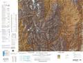
 Txu-oclc-224571173-se19-15.jpg 5,347 × 4,128; 8.65 MB
-
 Txu-oclc-224571173-si19-02.jpg 5,270 × 3,904; 7.17 MB
-
 Txu-oclc-224571178-se19-10.jpg 5,242 × 3,948; 6.42 MB
-
 Txu-oclc-224571178-se19-14.jpg 5,169 × 3,875; 7.19 MB
-
 Txu-oclc-224571178-sf19-02.jpg 5,243 × 3,994; 6.95 MB
-
 Txu-oclc-224571178-sf19-06.jpg 5,226 × 4,067; 8.08 MB
-
 Txu-oclc-224571178-sf19-07.jpg 5,228 × 3,969; 9.61 MB
-
 Txu-oclc-224571178-sf19-10.jpg 5,224 × 3,966; 8.84 MB
-
 Txu-oclc-224571178-sf19-14.jpg 5,225 × 3,971; 8.95 MB
-
 Txu-oclc-224571178-sf19-15.jpg 5,194 × 4,057; 8.16 MB
-
 Txu-oclc-224571178-sg19-02.jpg 5,330 × 3,962; 8.16 MB
-
 Txu-oclc-224571178-sg19-05.jpg 3,899 × 5,240; 3.41 MB
-
 Txu-oclc-224571178-sg19-06.jpg 5,212 × 3,963; 8.29 MB
-
 Txu-oclc-224571178-sg19-13.jpg 3,972 × 5,211; 5.02 MB
-
 Txu-oclc-224571178-sh19-01 (cropped).jpg 1,573 × 1,984; 1.9 MB
-
 Txu-oclc-224571178-sh19-01.jpg 3,961 × 5,200; 8 MB
-
 Txu-oclc-224571178-sh19-09.jpg 3,999 × 5,194; 9.52 MB
-
 Txu-oclc-224571178-si18-16.jpg 3,974 × 5,207; 5.46 MB
-
 Txu-oclc-224571178-sj18-04.jpg 5,228 × 3,960; 6.49 MB
-
 Txu-oclc-224571178-sj18-08.jpg 5,209 × 3,954; 8.82 MB
-
 Txu-oclc-224571178-sj18-12.jpg 5,226 × 3,966; 8.37 MB
-
 Txu-oclc-224571178-sj18-16.jpg 5,281 × 4,031; 7.81 MB
-
 Txu-pclmaps-oclc-22834566 q-26b.jpg 9,000 × 6,535; 9.95 MB
-
 Txu-pclmaps-oclc-22834566 q-26c.jpg 9,000 × 6,555; 14.1 MB


.jpg)


