Category:Images by Pauline E
Jump to navigation
Jump to search
English: The contributor to Geograph Britain and Ireland known as Pauline E, formerly Pauline Eccles.

|
The copyright holder of this file, Pauline E (Wikimedia), allows anyone to use it for any purpose, provided that the copyright holder is properly attributed. Redistribution, derivative work, commercial use, and all other use is permitted. |
Attribution:
Pauline E (Wikimedia)
|

Subcategories
This category has only the following subcategory.
N
- Norfolk images by Pauline E (31 F)
Media in category "Images by Pauline E"
The following 200 files are in this category, out of 304 total.
(previous page) (next page)-
 'Rocket' replica - geograph.org.uk - 3735697.jpg 2,000 × 1,500; 2.28 MB
-
 18th century boundary stone on Blakey Howe - geograph.org.uk - 3123091.jpg 768 × 1,024; 251 KB
-
 A bit of a thaw - geograph.org.uk - 2792968.jpg 1,024 × 768; 305 KB
-
 A seat with a view over the Vale of York - geograph.org.uk - 4125772.jpg 1,600 × 1,023; 529 KB
-
 A surfeit of signs in Pickering - geograph.org.uk - 1777215.jpg 640 × 426; 124 KB
-
 A tower and a tree - geograph.org.uk - 3687572.jpg 1,600 × 1,200; 1.5 MB
-
 Abbey ruins - geograph.org.uk - 2803709.jpg 1,024 × 746; 300 KB
-
 Abbey ruins - geograph.org.uk - 3681760.jpg 1,127 × 1,600; 1.82 MB
-
 Aglais io - Peacock butterfly in natural habitat - geograph.org.uk - 4105025.jpg 872 × 1,024; 246 KB
-
 All Saints Church, North Cave - geograph.org.uk - 1772875.jpg 640 × 480; 128 KB
-
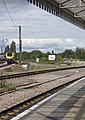
 Along the line to Beverley Station - geograph.org.uk - 1774976.jpg 640 × 480; 134 KB
-
 Ancient coffin lid, St Marys (geograph 1879637).jpg 1,365 × 2,048; 1.26 MB
-
 Approaching Stepin Turn - geograph.org.uk - 3122135.jpg 1,024 × 704; 127 KB
-
 B1228 at Elvington Lane - geograph.org.uk - 4104997.jpg 1,600 × 1,200; 527 KB
-
 Back end of a bus - geograph.org.uk - 2389431.jpg 1,024 × 768; 253 KB
-
 South transept, Beverley Minster - geograph.org.uk - 1774861.jpg 480 × 640; 129 KB
-
 Times of services at Beverley Minster - geograph.org.uk - 1774743.jpg 640 × 465; 135 KB
-
 Beverley Minster - geograph.org.uk - 1774828.jpg 640 × 480; 131 KB
-
 Black clouds over the A64 - geograph.org.uk - 3104465.jpg 1,024 × 672; 130 KB
-
 Blakey Howe - geograph.org.uk - 3123117.jpg 768 × 1,024; 377 KB
-
 Blakey Howe or Cockpit Hill - geograph.org.uk - 3123104.jpg 1,024 × 629; 284 KB
-
 Blakey Road - geograph.org.uk - 3121917.jpg 1,024 × 768; 278 KB
-
 Blue container - geograph.org.uk - 4104988.jpg 1,600 × 1,200; 697 KB
-
 Breakdown on the A64 - geograph.org.uk - 3104424.jpg 640 × 454; 66 KB
-
 Bridge over the River Derwent - geograph.org.uk - 4105019.jpg 2,000 × 1,500; 638 KB
-
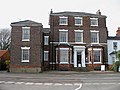
 Burn Hall Hotel - geograph.org.uk - 3352215.jpg 1,024 × 768; 263 KB
-
 Burnt remains - geograph.org.uk - 3687601.jpg 1,307 × 1,600; 2.44 MB
-
 Canada geese on ice floe - geograph.org.uk - 2802164.jpg 1,024 × 768; 189 KB
-
 Capsule on the Wheel of York - geograph.org.uk - 3104323.jpg 1,024 × 754; 177 KB
-
 Car park at Monks Cross - geograph.org.uk - 2341548.jpg 1,024 × 768; 206 KB
-
 Car park, Monks Cross - geograph.org.uk - 3379486.jpg 820 × 1,024; 252 KB
-
 Car park, The Farmer's Cart - geograph.org.uk - 3361841.jpg 1,024 × 765; 426 KB
-
 Car parking at the Designer Outlet, York - geograph.org.uk - 2435232.jpg 800 × 565; 182 KB
-
 Carriage, Pockerley Old Hall, Beamish Museum, 17 May 2011.jpg 269 × 225; 46 KB
-
 Castle Howard Road, a winter view - geograph.org.uk - 2792985.jpg 768 × 1,024; 409 KB
-
 Chaldron wagon, Beamish Museum, 17 May 2011 uncropped.jpg 1,024 × 768; 227 KB
-
 Chaldron wagon, Beamish Museum, 17 May 2011.jpg 707 × 527; 117 KB
-
 Chatterrow, Flamborough.jpg 1,600 × 1,200; 763 KB
-
 Church Avenue, Easingwold - geograph.org.uk - 3354652.jpg 1,024 × 768; 485 KB
-
 Church Close, Wheldrake - geograph.org.uk - 4105117.jpg 1,600 × 1,121; 334 KB
-
 Church Lane, Wheldrake - geograph.org.uk - 4105103.jpg 1,600 × 987; 360 KB
-
 Church of St John the Baptist and All Saints - geograph.org.uk - 3354659.jpg 1,024 × 768; 337 KB
-
 Church tower in winter sunshine - geograph.org.uk - 3354696.jpg 768 × 1,024; 386 KB
-
 Churchyard, Easingwold - geograph.org.uk - 3354668.jpg 1,024 × 768; 576 KB
-
 Clifford's Tower, York - geograph.org.uk - 3687560.jpg 1,600 × 1,137; 1.56 MB
-
 Clifton Long Reach - geograph.org.uk - 3104354.jpg 1,024 × 768; 226 KB
-
 Clock in Station Hall - geograph.org.uk - 3735712.jpg 1,505 × 2,000; 2.55 MB
-
 Coat of Arms of London and North Western Railway - geograph.org.uk - 3735691.jpg 1,024 × 1,024; 379 KB
-
 Coat of Arms, Lancashire and Yorkshire Railway - geograph.org.uk - 3735718.jpg 2,000 × 1,500; 2.1 MB
-
 Cobbled Highgate, Beverley - geograph.org.uk - 1773106.jpg 480 × 640; 108 KB
-
 Comma on Burdock near Pool Hide - geograph.org.uk - 4105074.jpg 1,600 × 1,200; 495 KB
-
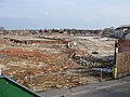
 Construction work on the Humber Bridge.jpg 640 × 469; 66 KB
-
 Corbel on the fireplace - geograph.org.uk - 2803702.jpg 1,024 × 812; 291 KB
-
 Creaking windpump, Wheldrake Ings - geograph.org.uk - 4105069.jpg 1,500 × 2,000; 822 KB
-
 Creaking, rusting wind pump - geograph.org.uk - 4105081.jpg 1,200 × 1,600; 252 KB
-
 Decorative tile on the former drill hall wall - geograph.org.uk - 2803663.jpg 1,024 × 954; 341 KB
-
 Derelict railway carriage - geograph.org.uk - 3739721.jpg 2,000 × 1,500; 2.24 MB
-
 Diesel hauled train on the North Yorks Moors Railway - geograph.org.uk - 2428160.jpg 2,048 × 1,536; 598 KB
-
 Drinking fountain, National Railway Museum - geograph.org.uk - 3735707.jpg 1,614 × 2,000; 2.32 MB
-
 Dry stone wall, Blakey Ridge - geograph.org.uk - 3123315.jpg 1,024 × 768; 311 KB
-
 Duck swims across grid line - geograph.org.uk - 1772904.jpg 640 × 480; 150 KB
-
 Dusk at Monks Cross (geograph 3355309).jpg 768 × 1,024; 344 KB
-
 Easingwold Library - geograph.org.uk - 3354882.jpg 768 × 1,024; 386 KB
-
 Eastgate, Beverley - geograph.org.uk - 1775040.jpg 640 × 480; 146 KB
-
 Edward VII pillar box, York - geograph.org.uk - 3104302.jpg 768 × 1,024; 205 KB
-
 Elephant loose in Stockton on The Forest - geograph.org.uk - 3710000.jpg 2,000 × 1,451; 2.06 MB
-
 Elephant runs in First Yorkshire Marathon - geograph.org.uk - 3709995.jpg 1,024 × 724; 615 KB
-
 Elgar sculpture and Enigma Fountain - geograph.org.uk - 1335971.jpg 480 × 640; 124 KB
-
 End of Long Street - geograph.org.uk - 3355027.jpg 1,024 × 716; 233 KB
-
 Entering Fridaythorpe (geograph 3110637).jpg 640 × 437; 96 KB
-
 Entrance to Elvington Industrial Estate - geograph.org.uk - 4105011.jpg 800 × 600; 152 KB
-
 Entrance to Keldholme Priory (geograph 2348952).jpg 1,024 × 768; 378 KB
-
 Entrance to the former drill hall - geograph.org.uk - 2803667.jpg 768 × 1,024; 296 KB
-

-
 Entrance to the stables, Town, Beamish Museum, 17 May 2011.jpg 768 × 1,024; 193 KB
-
 Eurostar mock-up, NRM - geograph.org.uk - 3739743.jpg 2,000 × 1,459; 2.13 MB
-
 Evesham Methodist Church.jpg 1,024 × 748; 348 KB
-
 Exhibit in Station Hall - geograph.org.uk - 3735676.jpg 2,000 × 2,000; 2.98 MB
-
 Farmland off Elvington Lane - geograph.org.uk - 4104995.jpg 1,600 × 985; 419 KB
-
 FE21 Codonger Too entering Whitby harbour (geograph 3661119).jpg 1,600 × 1,200; 473 KB
-
 Field access under the North Yorks Moors Railway - geograph.org.uk - 2606138.jpg 1,024 × 768; 250 KB
-
 Fine buildings along Spring Street - geograph.org.uk - 3355105.jpg 1,024 × 768; 244 KB
-
 Flat farmland off Elvington Lane - geograph.org.uk - 4105005.jpg 800 × 555; 95 KB
-
 Flint Mill cottages, Beamish Museum, 17 May 2011.jpg 1,024 × 768; 292 KB
-
 Folks heading for the National Railway Museum - geograph.org.uk - 3735668.jpg 2,000 × 1,393; 2.01 MB
-
 Footbridge, Pickering Station - geograph.org.uk - 1777267.jpg 640 × 480; 134 KB
-
 Footpath into Farndale - geograph.org.uk - 3122176.jpg 800 × 502; 119 KB
-
 Former school, North Cave - geograph.org.uk - 1772879.jpg 640 × 458; 129 KB
-
 Former town hall, Easingwold (geograph 3354992).jpg 768 × 1,024; 301 KB
-
 Former town hall, Easingwold (geograph 3355051).jpg 1,024 × 768; 283 KB
-
 Foss Walk - geograph.org.uk - 3373797.jpg 1,024 × 768; 341 KB
-
 Foss Walk - geograph.org.uk - 3374936.jpg 1,024 × 768; 269 KB
-
 Foss Walk approaching the sub station - geograph.org.uk - 3374922.jpg 1,024 × 768; 219 KB
-

-
 Fountain and statue of William Etty, Exhibition Square - geograph.org.uk - 3681794.jpg 1,600 × 1,600; 671 KB
-
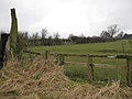
 Free range pigs - geograph.org.uk - 3361856.jpg 1,024 × 765; 319 KB
-
 French-looking tower - geograph.org.uk - 1224167.jpg 480 × 640; 96 KB
-
 Futurist Theatre, Scarborough.jpg 1,024 × 768; 228 KB
-
 Glass canopy, York station - geograph.org.uk - 2556088.jpg 2,048 × 1,536; 539 KB
-
 Graceful curve - geograph.org.uk - 2556155.jpg 768 × 1,024; 182 KB
-
 Heading north to Castleton - geograph.org.uk - 3122030.jpg 1,024 × 741; 171 KB
-
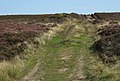
 Heather still blooming - geograph.org.uk - 3125354.jpg 1,024 × 702; 170 KB
-
 Helmsley Town Hall.jpg 1,024 × 789; 226 KB
-
 High point of the moor - geograph.org.uk - 3123756.jpg 640 × 463; 82 KB
-
 HMS York docks in Cardiff - geograph.org.uk - 470858.jpg 640 × 492; 323 KB
-
 Home Farm ducks, Beamish Museum, 17 May 2011.jpg 739 × 1,024; 188 KB
-
 Home Farm larder, Beamish Museum, 17 May 2011.jpg 1,024 × 768; 179 KB
-
 Home Farm scullery, Beamish Museum, 17 May 2011.jpg 768 × 1,024; 198 KB
-
 Hood Hill and the Vale of York - geograph.org.uk - 4125907.jpg 1,600 × 1,200; 618 KB
-
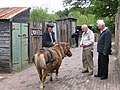
 Horse and hay cart, Beamish Museum, 17 May 2011.jpg 575 × 448; 123 KB
-
 In memory of John Skaife - geograph.org.uk - 3355017.jpg 1,516 × 2,326; 1.28 MB
-
 Information panel inside Tower Hide - geograph.org.uk - 4105048.jpg 3,465 × 2,480; 1.02 MB
-
 Inscription on the boundary stone - geograph.org.uk - 3123750.jpg 1,024 × 768; 362 KB
-
 Interior of the Shinkansen 0 Series (geograph 3735731).jpg 2,000 × 1,500; 2.13 MB
-
 Judges Lodgings - geograph.org.uk - 2803686.jpg 768 × 1,024; 307 KB
-
 Junction of Church Hill and Spring Street - geograph.org.uk - 3355112.jpg 1,024 × 768; 336 KB
-
-
 Just checking - geograph.org.uk - 3121950.jpg 1,024 × 768; 227 KB
-
 K6 phonebox, Uppleby - geograph.org.uk - 3355127.jpg 1,024 × 768; 329 KB
-
 Ladygate, Beverley - geograph.org.uk - 1773056.jpg 625 × 640; 151 KB
-
 Leeman Road subway - geograph.org.uk - 3735662.jpg 665 × 1,024; 170 KB
-
 Left turn to Church Houses - geograph.org.uk - 3123800.jpg 1,024 × 716; 140 KB
-
 Level crossing gates re-opening at Kirkham - geograph.org.uk - 2916519.jpg 1,024 × 768; 287 KB
-
 Level crossing, Flemingate - geograph.org.uk - 1774951.jpg 640 × 480; 114 KB
-
 Level crossing, Kirkham - geograph.org.uk - 2916499.jpg 1,024 × 689; 303 KB
-
 Lichened old wall (geograph 1840630).jpg 1,024 × 683; 356 KB
-
 Lifeboat crew at work.jpg 1,024 × 732; 332 KB
-

-
 Little Blakey Howe, round barrow - geograph.org.uk - 3123743.jpg 1,024 × 768; 259 KB
-
 Little Lane - geograph.org.uk - 3355039.jpg 1,024 × 768; 337 KB
-
 Little Lane, Easingwold - geograph.org.uk - 3355037.jpg 1,024 × 759; 312 KB
-
 Lone pine beside Blakey Road - geograph.org.uk - 3121941.jpg 1,024 × 768; 285 KB
-
 Lone tree by the A64 - geograph.org.uk - 3107535.jpg 426 × 600; 99 KB
-
 Longhorn Cattle near Woolhope - geograph.org.uk - 722590.jpg 640 × 454; 173 KB
-
 Longley House, Easingwold - geograph.org.uk - 3354644.jpg 1,024 × 768; 282 KB
-
 Lord Nelson pub, Flemingate - geograph.org.uk - 1774916.jpg 640 × 480; 94 KB
-
 Ludlow Castle, the outer bailey - geograph.org.uk - 1744604.jpg 640 × 427; 119 KB
-
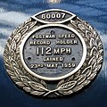
 Mallard nameplate - geograph.org.uk - 3739713.jpg 2,000 × 1,500; 2.43 MB
-
 Malton signal box and level crossing - geograph.org.uk - 2752694.jpg 1,024 × 768; 233 KB
-
 Market Cross, Easingwold - geograph.org.uk - 3354974.jpg 1,024 × 768; 301 KB
-
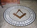 Masonic Lodge mosaic, Town, Beamish Museum, 17 May 2011.jpg 1,024 × 768; 279 KB
-
 Memorial plaque, Clifford's Tower - geograph.org.uk - 3687577.jpg 2,467 × 1,414; 2.67 MB
-
 Minster Garth Guest House - geograph.org.uk - 1774806.jpg 640 × 480; 141 KB
-
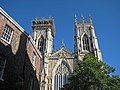 Minster towers - geograph.org.uk - 3681802.jpg 1,600 × 1,200; 608 KB
-
 Minster view near Bootham Bar - geograph.org.uk - 3681783.jpg 1,600 × 1,131; 1.9 MB
-
 Model Railway - geograph.org.uk - 3735714.jpg 2,000 × 1,374; 2.44 MB
-
-
 Monk Bar car park - geograph.org.uk - 3681739.jpg 1,024 × 669; 229 KB
-
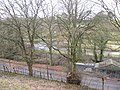
 Monk Bridge - geograph.org.uk - 2802136.jpg 1,024 × 768; 256 KB
-
 Moorland road to Castleton - geograph.org.uk - 3123764.jpg 1,024 × 768; 236 KB
-
 Moorland track, Blakey Ridge - geograph.org.uk - 3125320.jpg 1,024 × 690; 288 KB
-
 Moorland track, Rotten Hill - geograph.org.uk - 3123707.jpg 1,024 × 708; 327 KB
-
 Motorcyclist on a moorland road - geograph.org.uk - 3121963.jpg 1,024 × 736; 165 KB
-
 Nature reserve path, parallel to the River Derwent - geograph.org.uk - 4105040.jpg 1,600 × 1,200; 767 KB
-

-
 Nesting swans, Walkington pond - geograph.org.uk - 1772909.jpg 516 × 640; 224 KB
-
 New Inn. Easingwold - geograph.org.uk - 3354647.jpg 1,024 × 736; 264 KB
-
 New roadside refuges - geograph.org.uk - 3107533.jpg 1,024 × 670; 215 KB
-
 New roof on old barn, Capler Camp - geograph.org.uk - 1355244.jpg 640 × 480; 139 KB
-
 Newcastle bound from York - geograph.org.uk - 2556024.jpg 723 × 1,024; 170 KB
-

-

-
 North Yorks Moors Railway notice board - geograph.org.uk - 1777240.jpg 442 × 640; 122 KB
-
 North Yorks Moors Railway, Goathland - geograph.org.uk - 2427521.jpg 768 × 1,024; 308 KB
-
 Old North Riding of Yorks County Council sign - geograph.org.uk - 2627857.jpg 1,574 × 2,048; 436 KB
-
 Old street sign, Beverley - geograph.org.uk - 1773080.jpg 640 × 366; 113 KB
-
 Out and about - geograph.org.uk - 2803694.jpg 1,024 × 768; 395 KB
-
 Out of town shopping - geograph.org.uk - 2341562.jpg 1,024 × 768; 259 KB
-
 Paddock off York Road - geograph.org.uk - 3436599.jpg 1,600 × 1,200; 461 KB
-
 Park and Ride, Monks Cross - geograph.org.uk - 3739752.jpg 2,000 × 1,306; 1.91 MB
-
 Pasture by the Foss Walk - geograph.org.uk - 3373803.jpg 1,024 × 768; 336 KB
-
 Pedestrian walkway - geograph.org.uk - 2341567.jpg 799 × 1,024; 261 KB
-
 Pedestrian walkway, Designer Outlet, York - geograph.org.uk - 2435227.jpg 777 × 1,024; 239 KB
-
 Pickering Beck - geograph.org.uk - 1772732.jpg 640 × 480; 152 KB
-
 Pickering Trout Lake - geograph.org.uk - 1778086.jpg 640 × 480; 216 KB
-
 Pit pony, Beamish (geograph 2426438).jpg 1,024 × 768; 243 KB
-
 Pit pony, Beamish Museum, 17 May 2011.jpg 397 × 613; 115 KB
-
 Pit Village, Beamish Museum, 17 May 2011.jpg 1,024 × 768; 212 KB
-
 Plan of the National Railway Museum - geograph.org.uk - 3735671.jpg 2,000 × 1,796; 2.27 MB
-
 Plaque on Sir Nigel Gresley - geograph.org.uk - 3739732.jpg 2,000 × 2,000; 3.16 MB
-
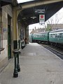
 Platform buildings, Pickering Station - geograph.org.uk - 1772742.jpg 640 × 480; 161 KB
-
 Platform, Pickering station, view North - geograph.org.uk - 1772729.jpg 640 × 480; 141 KB
-
 Platform, Pickering station, view South - geograph.org.uk - 1777258.jpg 480 × 640; 111 KB
-
 Pockerley Old Hall estate, Beamish Museum, 17 May 2011.jpg 1,024 × 725; 423 KB
-
 Pockerley Old Hall horse troughs & coach house, Beamish Museum, 17 May 2011.jpg 768 × 1,024; 398 KB
-
 Pockerley Old Hall, Beamish Museum, 17 May 2011.jpg 1,024 × 768; 213 KB
-
 Pockerley tram stop, Beamish Museum, 17 May 2011 (2).jpg 1,024 × 768; 259 KB
-
 Pockerley tram stop, Beamish Museum, 17 May 2011.jpg 1,024 × 768; 309 KB
-
 Pockerley Waggonway entrance wall, Beamish Museum, 17 May 2011.jpg 2,048 × 1,162; 740 KB
-
 Polygonia c-album - Comma butterfly on Burdock - geograph.org.uk - 4105032.jpg 1,309 × 1,600; 631 KB
-
 Pool at Wheldrake Ings - geograph.org.uk - 4104860.jpg 1,600 × 1,065; 311 KB
-
 Power lines crossing a harvested field - geograph.org.uk - 4105002.jpg 1,600 × 1,200; 519 KB
-
 Property with a view over Rosedale - geograph.org.uk - 3123123.jpg 1,024 × 768; 424 KB
-
 Puffing Billy, Pockerley Waggonway yard, Beamish Museum, 17 May 2011.jpg 1,024 × 768; 235 KB
-

-
 Puffing Billy, Pockerley Waggonway, Beamish Museum, 17 May 2011 (3).jpg 666 × 667; 179 KB
-
 Puffing Billy, Pockerley Waggonway, Beamish Museum, 17 May 2011.jpg 800 × 1,024; 215 KB
-
 Rain clouds over York Station - geograph.org.uk - 2556053.jpg 2,048 × 1,536; 369 KB
-
 Razed to the ground - geograph.org.uk - 1776793.jpg 640 × 480; 144 KB
-
 Re-painted advert - geograph.org.uk - 3681753.jpg 1,600 × 1,200; 1.97 MB


.jpg)


.jpg)


.jpg)

.jpg)


.jpg)


.jpg)
.jpg)


.jpg)


.jpg)


.jpg)


.jpg)


.jpg)
.jpg)


