Category:Ickenham
Jump to navigation
Jump to search
area in the London Borough of Hillingdon, Greater London, England  | |||||
| Upload media | |||||
| Instance of | |||||
|---|---|---|---|---|---|
| Location | London Borough of Hillingdon, Greater London, London, England | ||||
 | |||||
Main Wikipedia article: Ickenham.
Subcategories
This category has the following 10 subcategories, out of 10 total.
C
- Compass Theatre (2 F)
I
- Ickenham Library (4 F)
- Ickenham Marsh (6 F)
- Ickenham Pump (8 F)
P
R
- RAF West Ruislip (25 F)
S
- Swakeleys House (29 F)
Media in category "Ickenham"
The following 55 files are in this category, out of 55 total.
-
 (Part of) Ickenham Green - geograph.org.uk - 4882496.jpg 640 × 480; 85 KB
-
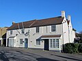 4, High Road, Ickenham - geograph.org.uk - 4818154.jpg 640 × 480; 67 KB
-
-
 B466 Ickenham Road - geograph.org.uk - 1385605.jpg 640 × 480; 76 KB
-
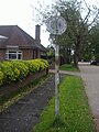
 Bus stop in Long Lane Ickenham - geograph.org.uk - 3548813.jpg 640 × 480; 87 KB
-
 Compasstheatrepanorama.jpg 5,184 × 1,516; 4.48 MB
-
-

-
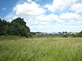
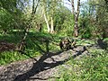
 Footpath along the edge of the field - geograph.org.uk - 3548836.jpg 480 × 640; 79 KB
-
 Footpath to Harvill Road - geograph.org.uk - 3559778.jpg 640 × 480; 92 KB
-
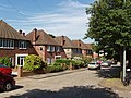
 Housing development, Heacham Avenue - geograph.org.uk 3041973.jpg 640 × 480; 116 KB
-
 Ickenham - geograph.org.uk - 207027.jpg 640 × 480; 113 KB
-
 Ickenham Festival in the grounds of Swakeleys House (cropped).JPG 1,167 × 749; 227 KB
-
 Ickenham Festival in the grounds of Swakeleys House.JPG 2,576 × 1,932; 1.26 MB
-
 Ickenham Pond - 53276829792.jpg 3,888 × 2,592; 5.51 MB
-
 Ickenham pond - April 2011.JPG 2,576 × 1,932; 2.41 MB
-
 Ickenham Pond 2023-05-14.jpg 3,888 × 2,592; 5.45 MB
-
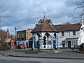
 Ickenham Pump - geograph.org.uk - 89802.jpg 640 × 480; 117 KB
-

-
 Ickenham village (2) - geograph.org.uk - 4818160.jpg 640 × 480; 114 KB
-
 Ickenham village (3) - geograph.org.uk - 4886475.jpg 640 × 480; 75 KB
-
 Ickenham village - geograph.org.uk - 4818124.jpg 640 × 480; 109 KB
-
 Ickenham Village Pond - geograph.org.uk - 207010.jpg 640 × 480; 151 KB
-
 Ickenham village pond - geograph.org.uk - 4818167.jpg 640 × 480; 142 KB
-
 Ickenham, Swakeleys - geograph.org.uk - 577757.jpg 640 × 480; 172 KB
-
 IckenhamRFC shirt.jpg 274 × 235; 13 KB
-

-
 Ivy House Road from Swakeleys Road - geograph.org.uk - 3505587.jpg 2,048 × 1,536; 1.6 MB
-
 Ivyhouse Road, Ickenham - geograph.org.uk - 4891456.jpg 3,790 × 2,300; 1.99 MB
-

-

-
 Mown and baled hay - geograph.org.uk - 3559750.jpg 640 × 480; 118 KB
-
 Old Fashioned Signpost, Ickenham - geograph.org.uk - 4891401.jpg 3,780 × 2,888; 2.37 MB
-

-
 Pynchester Moat, Ickenham 2.JPG 2,576 × 1,932; 2.58 MB
-
 Pynchester Moat, Ickenham.JPG 2,576 × 1,932; 2.59 MB
-
 RAF West Ruislip.png 556 × 454; 422 KB
-
 River Pinn - Ickenham - April 2011.jpg 2,576 × 1,932; 2.17 MB
-
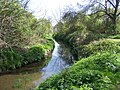
 River Pinn in Ickenham - geograph.org.uk - 577625.jpg 640 × 480; 148 KB
-
 River Pinn, Ickenham - April 2011.JPG 2,576 × 1,932; 2.42 MB
-

-
 Ruislip, Glovers Grove - geograph.org.uk - 577763.jpg 640 × 480; 109 KB
-
 Scale Model of Ickenham Park.jpg 3,888 × 2,592; 9.16 MB
-
 St Giles Church Ickenham - geograph.org.uk - 3548789.jpg 640 × 480; 120 KB
-
 Swakeleys Drive, Ickenham - geograph.org.uk - 4891376.jpg 1,600 × 1,105; 422 KB
-
 Swakeleys House - geograph.org.uk - 744061.jpg 640 × 480; 142 KB
-
 Swakeleys Lake.jpg 2,576 × 1,932; 2.03 MB
-
 Swakeleys name sign.JPG 2,576 × 1,932; 1.48 MB
-
 Swakeleys Park Diamond Jubilee Garden.JPG 2,576 × 1,932; 1.94 MB
-
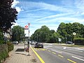
 Swakeleys Road, Ickenham - geograph.org.uk - 20120.jpg 640 × 480; 134 KB
-
 Swakeleys Road, Ickenham - geograph.org.uk - 2976632.jpg 800 × 600; 97 KB
-
-
 The River Pinn at Ickenham - geograph.org.uk - 3548778.jpg 480 × 640; 109 KB
-
 UB-postcode-area versus traditional terms.svg 589 × 587; 671 KB
-
 Witney Close, Ickenham - geograph.org.uk - 4891386.jpg 1,024 × 675; 150 KB
_Ickenham_Green_-_geograph.org.uk_-_4882496.jpg)


.JPG)


_-_geograph.org.uk_-_4818160.jpg)
_-_geograph.org.uk_-_4886475.jpg)


