Category:London Borough of Hillingdon
Jump to navigation
Jump to search
Boroughs of London: City of London · City of Westminster · Barking and Dagenham · Barnet · Bexley · Brent · Bromley · Camden · Croydon · Ealing · Enfield · Greenwich · Hackney · Hammersmith and Fulham · Haringey · Harrow · Havering · Hillingdon · Hounslow · Islington · Kensington and Chelsea · Kingston · Lambeth · Lewisham · Merton · Newham · Redbridge · Richmond · Southwark · Sutton · Tower Hamlets · Waltham Forest · Wandsworth
borough in the London Region in England    | |||||
| Upload media | |||||
| Instance of | |||||
|---|---|---|---|---|---|
| Location | Greater London, London, England | ||||
| Legislative body |
| ||||
| Executive body |
| ||||
| Head of government |
| ||||
| Inception |
| ||||
| Population |
| ||||
| Area |
| ||||
| official website | |||||
 | |||||
Subcategories
This category has the following 20 subcategories, out of 20 total.
Media in category "London Borough of Hillingdon"
The following 200 files are in this category, out of 3,652 total.
(previous page) (next page)-
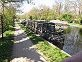
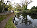
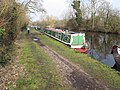
 "Calamity j'aime" narrowboat on Grand Union Canal - geograph.org.uk - 5752674.jpg 3,648 × 2,736; 3.04 MB
-
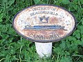 "District of Beaconsfield - Canal Way" sign at boundary - geograph.org.uk - 5754031.jpg 1,824 × 1,365; 759 KB
-
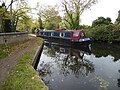
 "Iquitos" narrowboat on Grand Union Canal - geograph.org.uk - 5754020.jpg 3,648 × 2,736; 3.09 MB
-
 "Iris Kate" narrowboat on Grand Union Canal - geograph.org.uk - 5752689.jpg 3,648 × 2,736; 3.38 MB
-
 "Jasmine II" narrowboat on Grand Union Canal - geograph.org.uk - 5752748.jpg 3,648 × 2,736; 3.87 MB
-
 "Kara Sea" narrowboat on Grand Union Canal - geograph.org.uk - 5752737.jpg 3,648 × 2,736; 3.53 MB
-
-
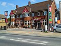 "The Six Bells" on Station Road - geograph.org.uk - 3638889.jpg 800 × 600; 142 KB
-
 "The Waters Edge" - geograph.org.uk - 3470644.jpg 800 × 600; 134 KB
-
 "Tui, New Zealand" narrowboat on Grand Union Canal - geograph.org.uk - 5752765.jpg 3,648 × 2,736; 4.07 MB
-
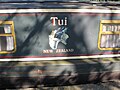 "Tui, New Zealand", decorative name panel of narrowboat - geograph.org.uk - 5752778.jpg 3,648 × 2,736; 2.11 MB
-
 16th Century Gatehouse, West Drayton - geograph.org.uk - 5600929.jpg 1,600 × 1,067; 503 KB
-
 183 - 191 (odds) West End Road - geograph.org.uk - 4145791.jpg 640 × 428; 86 KB
-

-
 2016, a year on Geograph (Day 226) - geograph.org.uk - 5072342.jpg 640 × 480; 82 KB
-
 4 The Square, Stockley Park - geograph.org.uk - 4783756.jpg 2,048 × 1,536; 1.53 MB
-
 70 Years of Heathrow Lies - geograph.org.uk - 5601714.jpg 3,642 × 2,272; 2.19 MB
-
 747 through the fence - geograph.org.uk - 4931484.jpg 640 × 471; 133 KB
-
 A better place to live - geograph.org.uk - 1967999.jpg 640 × 480; 94 KB
-
 A bit boggy - geograph.org.uk - 5560275.jpg 640 × 426; 139 KB
-
-
 A British Airways Building at Heathrow Airport - geograph.org.uk - 6041360.jpg 4,020 × 2,250; 964 KB
-
 A charter train traverses the Colnbrook Branch - geograph.org.uk - 2786348.jpg 683 × 1,024; 289 KB
-

-
 A field of Moorcroft Farm - geograph.org.uk - 5708225.jpg 4,000 × 3,000; 4.84 MB
-
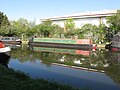
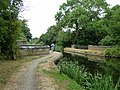
 A footbridge over the Slough Arm of the Grand Union Canal - geograph.org.uk - 5958763.jpg 4,000 × 3,000; 5.06 MB
-
 A footbridge over the Slough Arm of the Grand Union Canal - geograph.org.uk - 5958771.jpg 4,000 × 3,000; 4.95 MB
-
 A garden on the Grand Union Canal - geograph.org.uk - 6163126.jpg 4,000 × 3,000; 4.87 MB
-
 A green next to West End Road - geograph.org.uk - 5770210.jpg 4,000 × 3,000; 4.64 MB
-
 A lake at Stockley Park - geograph.org.uk - 5708229.jpg 4,000 × 3,000; 4.62 MB
-
 A lake at Stockley Park - geograph.org.uk - 5708231.jpg 4,000 × 3,000; 4.74 MB
-
 A lake at Stockley Park - geograph.org.uk - 5708240.jpg 4,000 × 3,000; 4.91 MB
-
 A Lake in the Park - geograph.org.uk - 2682118.jpg 3,904 × 2,232; 2.07 MB
-
 A lighthouse at sunset - geograph.org.uk - 3178621.jpg 640 × 480; 78 KB
-
 A lighthouse in Ruislip^ - geograph.org.uk - 5559007.jpg 640 × 426; 72 KB
-
 A lighthouse^ - geograph.org.uk - 5395559.jpg 640 × 426; 48 KB
-
-
 A narrow boat on the Slough Arm of the Grand Union Canal - geograph.org.uk - 5958761.jpg 4,000 × 3,000; 4.5 MB
-
 A narrow boat on the Slough Arm of the Grand Union Canal - geograph.org.uk - 5958762.jpg 4,000 × 3,000; 4.78 MB
-
 A path off Harvil Road - geograph.org.uk - 2976623.jpg 800 × 600; 92 KB
-
 A pile of aggregate - geograph.org.uk - 6053112.jpg 1,024 × 681; 86 KB
-
 A reedy Fray's River - geograph.org.uk - 5487505.jpg 640 × 480; 162 KB
-
 A rounded street tree - geograph.org.uk - 4146624.jpg 640 × 480; 127 KB
-
 A Small Crescent, Ivyhouse Road - geograph.org.uk - 4891467.jpg 3,744 × 2,773; 2.24 MB
-
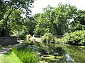
 A Small Woodland Pond - geograph.org.uk - 5976782.jpg 4,500 × 3,000; 4.06 MB
-
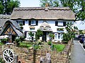 A Thatched Cottage - geograph.org.uk - 2007107.jpg 3,072 × 2,304; 2.18 MB
-
 A touch of colour - geograph.org.uk - 2881097.jpg 640 × 480; 156 KB
-
 A track across the Heathrow Conservation Site - geograph.org.uk - 3095942.jpg 1,500 × 1,000; 228 KB
-
 A truck leaves Heathrow cargo terminal - geograph.org.uk - 5577336.jpg 640 × 428; 113 KB
-
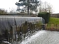 A waterfall at Stockley Park - geograph.org.uk - 5707266.jpg 4,000 × 3,000; 4.69 MB
-

-
 A30 - geograph.org.uk - 5595788.jpg 640 × 426; 64 KB
-
-
 A312 at the Ossie Garvin Roundabout - geograph.org.uk - 4639563.jpg 800 × 598; 118 KB
-
 A4 - geograph.org.uk - 4727712.jpg 640 × 388; 56 KB
-
 A4 at Longford, looking east - geograph.org.uk - 5221277.jpg 640 × 427; 76 KB
-
 A4 at Longford, looking west - geograph.org.uk - 5221280.jpg 640 × 427; 78 KB
-
 A4 at Sipson Way - geograph.org.uk - 5793157.jpg 4,288 × 2,848; 1.37 MB
-
 A4 Bath Road, heading east - geograph.org.uk - 5748431.jpg 640 × 480; 139 KB
-
 A4 bridge, M25 - geograph.org.uk - 4673957.jpg 640 × 426; 51 KB
-
 A4 crossing Wraysbury River - geograph.org.uk - 5773890.jpg 2,848 × 4,288; 1.67 MB
-
 A4 slip road Speedbird Way - geograph.org.uk - 2620598.jpg 3,460 × 2,520; 1.58 MB
-
 A4, Bath Rd - geograph.org.uk - 4727707.jpg 640 × 453; 59 KB
-

-
 A4, westbound - geograph.org.uk - 4727701.jpg 640 × 426; 69 KB
-
 A4, westbound - geograph.org.uk - 5098751.jpg 640 × 426; 77 KB
-
 A4, westbound - geograph.org.uk - 5098754.jpg 640 × 426; 68 KB
-
 A4, westbound - geograph.org.uk - 5098759.jpg 640 × 426; 63 KB
-
 A4007 - geograph.org.uk - 5552101.jpg 640 × 426; 73 KB
-
 A4007 - geograph.org.uk - 5552279.jpg 640 × 426; 77 KB
-
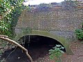
 A4007 bridge over Grand Union Canal - geograph.org.uk - 5552110.jpg 640 × 426; 66 KB
-
 A4007 Bridge, Grand Union Canal - geograph.org.uk - 5552281.jpg 640 × 426; 75 KB
-
 A4020 - geograph.org.uk - 5551849.jpg 640 × 426; 69 KB
-
 A4020 - geograph.org.uk - 5551855.jpg 640 × 426; 78 KB
-
 A4020 - geograph.org.uk - 5551879.jpg 640 × 425; 60 KB
-
 A408 at Sipson - geograph.org.uk - 5793075.jpg 3,614 × 2,361; 928 KB
-
 A408 entrance to Prologis Park - geograph.org.uk - 3418838.jpg 3,261 × 2,572; 962 KB
-
 A408 Sipson Road - geograph.org.uk - 2505548.jpg 640 × 480; 129 KB
-
 A408 Sipson Road - geograph.org.uk - 2505550.jpg 640 × 480; 118 KB
-
-
 About to land at Heathrow - geograph.org.uk - 6041376.jpg 1,600 × 1,036; 266 KB
-
 Acacia House, Harmondsworth (geograph 5757862).jpg 3,729 × 2,551; 1.45 MB
-
-
 Accommodation Lane - geograph.org.uk - 5774295.jpg 4,288 × 2,848; 1.55 MB
-
 Accommodation Lane - geograph.org.uk - 5774373.jpg 2,848 × 4,288; 2.7 MB
-
 Accommodation Lane approaching the A4 - geograph.org.uk - 5773822.jpg 4,288 × 2,848; 2.39 MB
-
 Accommodation Lane at Willow Piggeries - geograph.org.uk - 5774192.jpg 4,288 × 2,848; 2.39 MB
-
 Accommodation Lane, Harmondsworth - geograph.org.uk - 5775011.jpg 2,848 × 4,288; 1.55 MB
-
 Accommodation Lane, Harmondsworth Moor - geograph.org.uk - 5755881.jpg 2,840 × 3,774; 2.37 MB
-
-
 Advert, Ruislip Underground Station - geograph.org.uk - 5441818.jpg 640 × 485; 102 KB
-

-
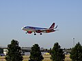
 Aer Lingus planes, Heathrow - geograph.org.uk - 5988794.jpg 1,600 × 1,200; 255 KB
-
-
-

-

-
 Aggregate - geograph.org.uk - 5558787.jpg 640 × 426; 57 KB
-
 Aggregate pile - geograph.org.uk - 5397831.jpg 640 × 426; 48 KB
-
 Aggregate Shed - geograph.org.uk - 5377877.jpg 640 × 426; 63 KB
-
 Aggregate works (Tarmac) - geograph.org.uk - 6026367.jpg 1,024 × 681; 94 KB
-
 Aggregate Works - geograph.org.uk - 5665626.jpg 640 × 426; 43 KB
-
 Air Jordan Plane, Terminal 3 - geograph.org.uk - 4727721.jpg 640 × 426; 62 KB
-
 Air Malta Airbus, Heathrow Airport - geograph.org.uk - 6272179.jpg 1,024 × 768; 115 KB
-
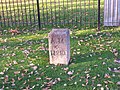 Air Ministry boundary marker No. 10 - geograph.org.uk - 3220226.jpg 1,024 × 768; 345 KB
-
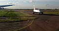 Aircraft on taxiway, Heathrow airport - geograph.org.uk - 5646419.jpg 1,502 × 803; 100 KB
-
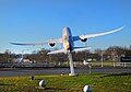 Aircraft on the Roundabout - geograph.org.uk - 6046026.jpg 4,876 × 3,401; 1.94 MB
-
 Aircraft taxi-ing - geograph.org.uk - 6021780.jpg 1,024 × 681; 67 KB
-
 Airliner lands at Heathrow near Longford houses - geograph.org.uk - 6203432.jpg 3,648 × 2,736; 2.25 MB
-
 Airport apron, Heathrow Airport - geograph.org.uk - 6026044.jpg 1,024 × 681; 72 KB
-
 Airport apron, Heathrow Airport terminal 4 - geograph.org.uk - 6026048.jpg 1,024 × 681; 69 KB
-
 Airport buildings, Heathrow - geograph.org.uk - 6213728.jpg 1,200 × 854; 155 KB
-
 Airport buildings, Heathrow - geograph.org.uk - 6213746.jpg 2,517 × 1,225; 365 KB
-
 Airworld - geograph.org.uk - 5098661.jpg 640 × 426; 41 KB
-
 Alandale Drive at the junction of Dale Close - geograph.org.uk - 4757508.jpg 2,304 × 1,728; 857 KB
-
 Alandale Drive, Northwood Hills - geograph.org.uk - 4757509.jpg 2,304 × 1,728; 870 KB
-
 All Saints' Church North Hillingdon - geograph.org.uk - 5372717.jpg 640 × 480; 94 KB
-
 Alleyway off Trevor Crescent, Ruislip Gardens - geograph.org.uk - 4454101.jpg 2,304 × 1,728; 819 KB
-
 Allonby Drive off Glovers Grove - geograph.org.uk - 6230794.jpg 3,648 × 2,736; 3.31 MB
-
 Allotments, Harmondsworth - geograph.org.uk - 5775032.jpg 4,288 × 2,848; 2.12 MB
-
 Allotments, Ickenham Green - geograph.org.uk - 4885542.jpg 640 × 480; 122 KB
-
 Along here for Slough - geograph.org.uk - 2169404.jpg 640 × 426; 196 KB
-
 Along the Celandine Route in Eastcote - geograph.org.uk - 5977679.jpg 4,516 × 3,000; 4.11 MB
-
 Along the Grand Union Canal at Harefield - geograph.org.uk - 5279647.jpg 800 × 594; 146 KB
-
 Along Tudor Way - geograph.org.uk - 5615791.jpg 3,750 × 2,516; 1.3 MB
-
 Alongside Bath Road - geograph.org.uk - 5815098.jpg 4,000 × 3,000; 4.95 MB
-
 Alongside Bath Road - geograph.org.uk - 5815105.jpg 4,000 × 3,000; 4.84 MB
-
-
 An aqueduct on the Slough Arm of the Grand Union Canal - geograph.org.uk - 5958766.jpg 4,000 × 3,000; 4.97 MB
-
 An entrance to Heathrow - geograph.org.uk - 4728441.jpg 640 × 368; 51 KB
-
 An impressive tree on Charville Lane West - geograph.org.uk - 5707218.jpg 4,000 × 3,000; 4.73 MB
-
 An old ford on the River Colne - geograph.org.uk - 5958539.jpg 4,000 × 3,000; 4.58 MB
-
 An old quarry seen across the Grand Union Canal - geograph.org.uk - 6163255.jpg 4,000 × 3,000; 4.99 MB
-
 An Older House on Bury Street - geograph.org.uk - 4100498.jpg 640 × 480; 74 KB
-
 Anemometer by Northolt airfield - geograph.org.uk - 1831299.jpg 3,648 × 2,736; 2.04 MB
-
 Angle Close - Uxbridge - geograph.org.uk - 6231248.jpg 3,648 × 2,736; 4.08 MB
-
 Angus Drive at the junction with The Fairway - geograph.org.uk - 3051281.jpg 1,600 × 1,200; 569 KB
-
 Anti-clockwise M25 near Heathrow - geograph.org.uk - 3725566.jpg 640 × 480; 264 KB
-

-
-
 Apartments along the canal - geograph.org.uk - 2169408.jpg 640 × 426; 191 KB
-
 Apartments and houses on Pembroke Road - geograph.org.uk - 2880994.jpg 640 × 480; 214 KB
-
 Apartments next to the Grand Union Canal - geograph.org.uk - 4627154.jpg 800 × 596; 129 KB
-
 Apartments, Engineer's Wharf - geograph.org.uk - 3979003.jpg 640 × 430; 62 KB
-

-
 Approach to Copper Mill Lock - geograph.org.uk - 2633105.jpg 3,648 × 2,664; 1.17 MB
-
 Approach to Heathrow T5 - geograph.org.uk - 3213367.jpg 640 × 480; 53 KB
-
 Approaching a roundabout on Field End Road - geograph.org.uk - 4860745.jpg 1,024 × 768; 119 KB
-
 Approaching Black Jack's Lock - geograph.org.uk - 2630475.jpg 2,048 × 1,536; 596 KB
-
 Approaching Copper Mill Lock - geograph.org.uk - 6163199.jpg 4,000 × 3,000; 4.75 MB
-
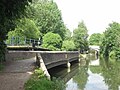
 Approaching Cowley Lock from the south - geograph.org.uk - 3470646.jpg 800 × 600; 149 KB
-
 Approaching Envoy Roundabout - geograph.org.uk - 5595808.jpg 640 × 426; 51 KB
-
 Approaching Junction 14 - geograph.org.uk - 4440727.jpg 640 × 458; 61 KB
-
-
 Approaching Springwell Lock - geograph.org.uk - 5430345.jpg 1,600 × 1,200; 806 KB
-
 Apron north of Terminal 3, Heathrow - geograph.org.uk - 3873882.jpg 1,600 × 899; 166 KB
-
-
 Aqueduct over Fray's River - geograph.org.uk - 4326257.jpg 640 × 480; 136 KB
-
 Aqueduct over the Colne - geograph.org.uk - 2085082.jpg 640 × 460; 124 KB
-
 Aqueduct over Yeading Brook - geograph.org.uk - 3135881.jpg 640 × 480; 134 KB
-
 Aqueduct, Slough Arm, Grand Union Canal - geograph.org.uk - 4326164.jpg 640 × 480; 188 KB
-
 Arch on Tudor Way - geograph.org.uk - 5615805.jpg 2,466 × 3,220; 1.56 MB
-
 Area of scrub beyond the River Crane - geograph.org.uk - 5806829.jpg 4,000 × 3,000; 4.77 MB
-
 Argyle House, Northwood Hills - geograph.org.uk - 3660377.jpg 4,320 × 3,240; 3.97 MB
-
 Arkady, narrowboat near Harefield - geograph.org.uk - 4860769.jpg 3,648 × 2,736; 4.49 MB
-
 Arora Hotel - Heathrow - geograph.org.uk - 4458167.jpg 3,579 × 2,661; 4.33 MB
-
 Arora Hotel, Heathrow - geograph.org.uk - 6046212.jpg 4,702 × 3,172; 2.31 MB
-
 Arora Hotel, Heathrow - geograph.org.uk - 6209081.jpg 3,001 × 1,811; 585 KB
-
-
 Arriving on time^ - geograph.org.uk - 2800424.jpg 640 × 468; 30 KB
-
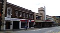 Art Deco building in Uxbridge - geograph.org.uk - 4050335.jpg 640 × 360; 48 KB
-

-
-
 Ascending out of the Colne Valley - geograph.org.uk - 5566857.jpg 640 × 426; 130 KB
-
 Ascending out of the Colne Valley - geograph.org.uk - 5566860.jpg 640 × 426; 113 KB
-
 Asda, Ruislip - geograph.org.uk - 5712516.jpg 640 × 426; 56 KB
-
 Ashford Avenue, Yeading - geograph.org.uk - 4753116.jpg 4,000 × 2,664; 2.12 MB
-
 ASK Italian, Uxbridge - geograph.org.uk - 5451127.jpg 640 × 426; 64 KB
-
 At the end of Tudor Way - geograph.org.uk - 5615786.jpg 3,888 × 2,592; 2.55 MB
-
 Atrium building, Oxford Road, Uxbridge - geograph.org.uk - 5956256.jpg 1,024 × 753; 202 KB
-
 Austin's Lane - geograph.org.uk - 6224822.jpg 3,648 × 2,736; 4.84 MB
-
 Austin's Lane Junction with Saint Giles Avenue - geograph.org.uk - 6225811.jpg 3,648 × 2,736; 3.36 MB
-
 Austin's Lane towards Railway Bridge - geograph.org.uk - 6225817.jpg 3,648 × 2,736; 5.31 MB
-
 Austin's Lane, Ickenham - geograph.org.uk - 5668732.jpg 4,000 × 3,000; 4.42 MB
-
 Austin's Lane, Ickenham - geograph.org.uk - 5670405.jpg 4,000 × 3,000; 4.9 MB
-
 Autumn by the Chiltern Main Line - geograph.org.uk - 5322116.jpg 640 × 426; 102 KB
-
 Autumn by the Chiltern Main Line - geograph.org.uk - 5322124.jpg 640 × 426; 98 KB
-
 Autumn colours - geograph.org.uk - 5322121.jpg 640 × 426; 72 KB
-
 Autumn Colours in the Park - geograph.org.uk - 5600943.jpg 3,888 × 2,592; 4.12 MB
-
 Autumn colours, Chiltern Main Line - geograph.org.uk - 5322123.jpg 640 × 426; 88 KB
-
 Autumn in Warrender Park - geograph.org.uk - 5976726.jpg 4,784 × 2,998; 3.04 MB
-
 Autumnal colours - geograph.org.uk - 5322126.jpg 640 × 426; 62 KB
-
 Autumnal magnificence on Freemans Lane - geograph.org.uk - 3651238.jpg 800 × 634; 167 KB
-
 Avenue of trees from Swakeleys main gate - geograph.org.uk - 4678597.jpg 3,648 × 2,736; 4.9 MB
-
 Axis House on Bath Road - geograph.org.uk - 2805740.jpg 800 × 600; 88 KB
-
 B467 - geograph.org.uk - 5448608.jpg 640 × 426; 82 KB
-
 B467 Slip Road - geograph.org.uk - 4365961.jpg 1,600 × 1,046; 471 KB
-
 B483 - geograph.org.uk - 5448616.jpg 640 × 426; 64 KB
-
 Back gardens in North Hillingdon - geograph.org.uk - 5442208.jpg 640 × 426; 79 KB
-


_West_End_Road_-_geograph.org.uk_-_4145791.jpg)

_-_geograph.org.uk_-_5072342.jpg)


_Between_Hatton_Cross_%5E_Terminal_4_-_geograph.org.uk_-_5749264.jpg)


.jpg)


_-_geograph.org.uk_-_6026367.jpg)


_over_the_River_Colne_-_geograph.org.uk_-_5516220.jpg)


