Category:Grade II listed buildings in Rutland
Jump to navigation
Jump to search
Ceremonial counties of England: Bedfordshire · Berkshire · Buckinghamshire · Cambridgeshire · Cheshire · Cornwall · Cumbria · Derbyshire · Devon · Dorset · Durham · East Riding of Yorkshire · East Sussex · Essex · Gloucestershire · Greater London · Greater Manchester · Hampshire · Herefordshire · Hertfordshire · Kent · Lancashire · Leicestershire · Lincolnshire · Merseyside · Norfolk · North Yorkshire · Northamptonshire · Northumberland · Nottinghamshire · Oxfordshire · Rutland · Shropshire · Somerset · South Yorkshire · Staffordshire · Suffolk · Surrey · Tyne and Wear · Warwickshire · West Midlands · West Sussex · West Yorkshire · Wiltshire · Worcestershire
City-counties: Bristol · City of London
Former historic counties: Westmorland ·
Other former counties:
City-counties: Bristol · City of London
Former historic counties: Westmorland ·
Other former counties:
Wikimedia category | |||||
| Upload media | |||||
| Instance of | |||||
|---|---|---|---|---|---|
| |||||
Subcategories
This category has the following 14 subcategories, out of 14 total.
4
- Wisteria Hotel, Oakham (2 F)
F
K
- Ketton Windmill (3 F)
L
M
- Morcott Windmill (5 F)
O
- Oakham level crossing signal box (20 F)
W
- Welland Viaduct (40 F)
Media in category "Grade II listed buildings in Rutland"
The following 48 files are in this category, out of 48 total.
-
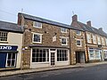 16 Church Street, Oakham.jpg 4,000 × 3,000; 2.86 MB
-
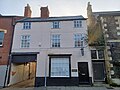 4 Mill Street, Oakham.jpg 4,000 × 3,000; 2.92 MB
-
 6 Back Lane, South Luffenham - geograph.org.uk - 4911279.jpg 1,280 × 960; 381 KB
-
 6 Back Lane, South Luffenham - geograph.org.uk - 5539668.jpg 5,108 × 3,478; 6.88 MB
-
 72-78 High Street, Oakham.jpg 4,000 × 3,000; 2.71 MB
-
 9 Glaston Road, Bisbrooke - geograph.org.uk - 4946336.jpg 960 × 1,280; 490 KB
-
 Barn at 22 Well Close, Edith Weston - geograph.org.uk - 4849024.jpg 1,280 × 902; 328 KB
-
 Barn on Orchard Close - geograph.org.uk - 4826030.jpg 1,280 × 945; 362 KB
-
 Barn on Top Lane, Bisbrooke - geograph.org.uk - 4946340.jpg 1,280 × 960; 555 KB
-
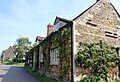
 Barn range, Belmesthorpe House - geograph.org.uk - 4787719.jpg 1,280 × 871; 246 KB
-
 Barns at Jubilee Close - geograph.org.uk - 4849022.jpg 1,280 × 960; 375 KB
-
 Barrow, Rutland - geograph.org.uk - 41059.jpg 640 × 480; 108 KB
-
 Dovecote - geograph.org.uk - 160193.jpg 480 × 640; 97 KB
-
 Buildings on the green, Market Overton - geograph.org.uk - 4796042.jpg 1,280 × 840; 263 KB
-
 Church of St Mary, Edith Weston - geograph.org.uk - 4839400.jpg 960 × 1,280; 567 KB
-
 Churchyard wall, All Saints' Church, Oakham.jpg 4,000 × 3,000; 3.2 MB
-
 Cottages on Back Lane, South Luffenham - geograph.org.uk - 4911280.jpg 1,280 × 960; 417 KB
-
 Cottages, South Luffenham (geograph 7379057).jpg 1,024 × 768; 189 KB
-
 Dovecot, Belmesthorpe - geograph.org.uk - 4787726.jpg 1,280 × 1,280; 393 KB
-
 Dovecote at the hall (geograph 5936979).jpg 4,014 × 6,032; 6.56 MB
-
 Dovecote, Home Farm - geograph.org.uk - 4826067.jpg 931 × 1,280; 444 KB
-
 Edith Weston Cross - geograph.org.uk - 4840018.jpg 1,280 × 960; 520 KB
-
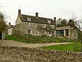
 Former Belmesthorpe House and attached barn - geograph.org.uk - 4787734.jpg 1,280 × 938; 262 KB
-

-
 Garden room at Manor Farmhouse, North Luffenham - geograph.org.uk - 4849121.jpg 1,280 × 974; 414 KB
-
 Gate, Exton Park (Geograph 3487144 by Bob Harvey).jpg 4,320 × 3,240; 5.52 MB
-

-
 Gazebo and garden wall at The Manor House - geograph.org.uk - 4796044.jpg 960 × 1,280; 381 KB
-
 Houses on Glaston Road, Bisbrooke - geograph.org.uk - 4944171.jpg 1,280 × 960; 475 KB
-
 Lilac Cottage, Belmesthorpe - geograph.org.uk - 4787721.jpg 1,280 × 949; 344 KB
-
 Normanton Park stable block - geograph.org.uk - 4839913.jpg 1,280 × 960; 323 KB
-
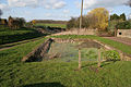
 Pond, Listed Grade II - geograph.org.uk - 4946552.jpg 1,280 × 960; 551 KB
-
 School House, Edith Weston - geograph.org.uk - 4839954.jpg 1,280 × 928; 370 KB
-
 South Luffenham Hall, the garden wall - geograph.org.uk - 4912921.jpg 1,280 × 960; 456 KB
-
 Stable block at The Grange, Edith Weston - geograph.org.uk - 4839933.jpg 1,280 × 960; 401 KB
-
 The Grange, Edith Weston - geograph.org.uk - 4839944.jpg 1,280 × 946; 281 KB
-
 The Grange, South Luffenham - geograph.org.uk - 4911264.jpg 1,280 × 886; 534 KB
-
 The Maltings, Belmesthorpe - geograph.org.uk - 4787723.jpg 1,280 × 960; 360 KB
-
 The Manor House, Market Overton - geograph.org.uk - 4796037.jpg 1,280 × 897; 343 KB
-
 The Old Dovecote, North Luffenham - geograph.org.uk - 4849085.jpg 1,280 × 960; 495 KB
-
 The Orchard House, Back Lane, South Luffenham - geograph.org.uk - 4911281.jpg 1,280 × 960; 430 KB
-
 The Rutland Gallery.jpg 4,032 × 1,908; 3.14 MB
-
 Tinwell Forge - geograph.org.uk - 213952.jpg 640 × 427; 63 KB
-
 Village pond at Glaston - geograph.org.uk - 364733.jpg 640 × 427; 121 KB
-
 Village Pond, Glaston - geograph.org.uk - 364737.jpg 640 × 427; 110 KB
-
 Village pump (geograph 7410155).jpg 4,097 × 6,205; 6.63 MB
-
 Waggoners Cottage, Belmesthorpe - geograph.org.uk - 4787730.jpg 1,280 × 969; 243 KB
-
 West Farmhouse, South Luffenham - geograph.org.uk - 4911271.jpg 1,280 × 960; 258 KB


.jpg)

.jpg)


.jpg)


.jpg)

