Category:Grade II listed buildings in Devon
Jump to navigation
Jump to search
Ceremonial counties of England: Bedfordshire · Berkshire · Buckinghamshire · Cambridgeshire · Cheshire · Cornwall · Cumbria · Derbyshire · Devon · Dorset · Durham · East Riding of Yorkshire · East Sussex · Essex · Gloucestershire · Greater London · Greater Manchester · Hampshire · Herefordshire · Hertfordshire · Kent · Lancashire · Leicestershire · Lincolnshire · Merseyside · Norfolk · North Yorkshire · Northamptonshire · Northumberland · Nottinghamshire · Oxfordshire · Rutland · Shropshire · Somerset · South Yorkshire · Staffordshire · Suffolk · Surrey · Tyne and Wear · Warwickshire · West Midlands · West Sussex · West Yorkshire · Wiltshire · Worcestershire
City-counties: Bristol · City of London
Former historic counties: Westmorland ·
Other former counties:
City-counties: Bristol · City of London
Former historic counties: Westmorland ·
Other former counties:
Wikimedia category | |||||
| Upload media | |||||
| Instance of | |||||
|---|---|---|---|---|---|
| |||||
Subcategories
This category has the following 52 subcategories, out of 52 total.
9
- Old Town Hall, Newton Abbot (1 F)
B
- Bath House, Ilfracombe (8 F)
- Belmont Hospital (Tiverton) (5 F)
- Broadclyst Windmill (9 F)
- Brutus Stone (3 F)
- Byes Toll House (9 F)
C
- Coronation Boathouse (3 F)
F
- Fishers Bridge Mills (9 F)
- Old Town Hall, Crediton (2 F)
G
- Bradninch Guildhall (2 F)
H
- Hatherleigh National School (3 F)
- Hope Cove Lifeboat Station (4 F)
L
- Lee Abbey, Lynton (27 F)
N
- New (Corn) Mill, North Bovey (4 F)
- North Tawton Town Hall (3 F)
O
- Old Town Hall, Ilfracombe (2 F)
P
R
- Royal Castle Hotel, Lynton (4 F)
S
- Seale-Hayne College (7 F)
- Stoke Canon Signal Box (5 F)
T
- Teignmouth lighthouse (28 F)
- The Market House, Chagford (9 F)
- Thorverton Mill (2 F)
- Tipton Mill (5 F)
- Totnes engine house (13 F)
- Totnes Signal Box (9 F)
- The Town Pump, Chulmleigh (5 F)
W
- Weycroft Mill (7 F)
Media in category "Grade II listed buildings in Devon"
The following 200 files are in this category, out of 339 total.
(previous page) (next page)-
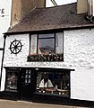 12 Broad Street, Ilfracombe.jpg 3,095 × 3,527; 2.76 MB
-
 13 and 15 Bridge Street, Hatherleigh.jpg 3,579 × 2,614; 3.46 MB
-
 2 High Street, Topsham.jpg 5,568 × 3,712; 10.19 MB
-
 6 Church Street - Sidmouth Devon 2010.JPG 3,627 × 2,418; 1.49 MB
-
 A3072 to Highampton (geograph 4011708).jpg 1,920 × 1,363; 408 KB
-
 Across Dittisham Mill Creek (geograph 5337768).jpg 3,071 × 1,683; 899 KB
-
 All Saints Church, Eggesford, South Devon.jpg 4,446 × 3,228; 5.07 MB
-
 Aller Farm (geograph 3974662).jpg 1,920 × 1,328; 702 KB
-
 Always a subject for 'Geograph' - geograph.org.uk - 4720498.jpg 3,568 × 2,368; 4.25 MB
-
 Andrews Cottage, Belstone (geograph 6727298).jpg 1,024 × 768; 212 KB
-
 Arsenic calciners, Devon Great Consols.jpg 3,600 × 2,760; 5.16 MB
-
 Ashton Mill, 2000 (geograph 5560845).jpg 600 × 910; 123 KB
-
 Ashwell House (geograph 6029374).jpg 4,288 × 2,848; 1.91 MB
-
 Attwill's Almshouses.jpg 4,144 × 5,520; 9.03 MB
-
 Babbacombe Cliff Hotel.JPG 2,448 × 3,264; 2.22 MB
-
 Baptist Hostel, Buckland Monachorum.jpg 3,296 × 2,848; 3.36 MB
-
-
-
 Barnstaple (Devon, UK), Pannier Market -- 2013 -- 1.jpg 4,000 × 2,584; 6.35 MB
-
 Barnstaple (Devon, UK), Pannier Market -- 2013 -- 5.jpg 2,478 × 3,200; 4.5 MB
-
 Barnstaple and North Devon Museum 2017.jpg 3,882 × 2,529; 1.04 MB
-
 Barnstaple Pannier Marker Exterior.jpg 2,576 × 1,536; 1,004 KB
-
 Barton Cottage, Langford, near Cullompton.jpg 5,312 × 2,988; 5.59 MB
-
 Barton Farm (geograph 3621285).jpg 640 × 439; 91 KB
-
 Battery observation post.jpg 640 × 508; 48 KB
-
 Bench, Daccombe (geograph 6422914).jpg 4,288 × 2,848; 2.19 MB
-
 Bennett's Cross and Birch Tor.jpg 3,784 × 2,848; 3.75 MB
-
 Bickington Road.jpg 4,896 × 2,752; 6.27 MB
-
 Blackpool (geograph 4156186).jpg 1,920 × 1,440; 1.02 MB
-
 Bonds (geograph 3623361).jpg 1,600 × 1,055; 986 KB
-
 Brannam Pottery entrance 2018.jpg 3,000 × 4,000; 1.47 MB
-
 Brannam Pottery kiln 2018.jpg 1,775 × 3,032; 969 KB
-
 Braunton Marsh Round Linhay - geograph.org.uk - 2990371.jpg 640 × 480; 122 KB
-

-

-
 Bridge Buildings Barnstaple 2017.jpg 3,522 × 2,071; 984 KB
-
 Bridge Buildings Barnstaple.jpg 3,686 × 2,323; 1,023 KB
-
 Bridge Cottage (geograph 5950229).jpg 4,071 × 3,055; 4.61 MB
-
 Brightley Mill Farm (geograph 3637288).jpg 640 × 454; 85 KB
-
 Broadclyst (2022-01-23) 25.jpg 5,568 × 3,712; 16.45 MB
-
 Broadclyst church and cross.jpg 2,287 × 3,142; 1,015 KB
-
 Broadclyst Windmill.jpg 640 × 480; 96 KB
-
 Brooke rajahs graves at Sheepstor.JPG 2,136 × 2,848; 1.41 MB
-
 Brookes graves in Sheepstor.jpg 3,832 × 2,848; 4.99 MB
-
 Buckland Brewer, Buckland Mill - geograph.org.uk - 2680556.jpg 640 × 420; 318 KB
-
 Bucks Cabin, Bucks Mills (geograph 3951716).jpg 1,280 × 851; 283 KB
-
 Burrator Dam (north side).jpg 2,856 × 1,802; 2.33 MB
-
 Burrator Dam Dec 2009.jpg 4,015 × 2,692; 5.56 MB
-
 Burrator Dam.jpg 3,008 × 2,000; 2.91 MB
-
 Canonteign Barton - geograph.org.uk - 2156419.jpg 640 × 427; 421 KB
-
 Castle Hill House, Axminster - geograph.org.uk - 1059615.jpg 640 × 480; 77 KB
-
 Castle Hotel, Woolacombe.jpg 4,000 × 3,000; 2.14 MB
-
 Cat, Northlew (geograph 4006115).jpg 1,920 × 2,554; 888 KB
-
 Cattle pasture near Trittencott Cross (geograph 5082849).jpg 3,003 × 1,684; 1.13 MB
-
 Caute Cottage (geograph 5790845).jpg 640 × 378; 76 KB
-
 Celtic Cross (7099428299).jpg 3,000 × 4,000; 4.34 MB
-
 Chagford houses (geograph 5944225).jpg 4,320 × 3,240; 4.78 MB
-
 Chagford houses (geograph 5945174).jpg 4,320 × 3,240; 3.85 MB
-
 Chawleigh village school - geograph.org.uk - 107864.jpg 640 × 426; 95 KB
-
 Church Cottage (geograph 5950296).jpg 4,320 × 3,240; 4.5 MB
-
 Church Cottage, Coldridge (geograph 4311627).jpg 1,920 × 1,184; 544 KB
-
 Church Cottage, Upottery (geograph 6736310).jpg 1,024 × 768; 101 KB
-
 Church Cottages, East Buckland (geograph 6435267).jpg 3,264 × 1,832; 2.43 MB
-
 Circular cattle shelter, Braunton Marsh - geograph.org.uk - 5386181.jpg 1,024 × 768; 219 KB
-
 Circular linhay on Braunton Marsh - geograph.org.uk - 5210825.jpg 1,600 × 1,067; 472 KB
-
 Circular Linhay.jpg 640 × 480; 91 KB
-

-
 Cliff path wall to Battery, Lundy.jpg 5,184 × 3,456; 5.45 MB
-
 Clock Tower, North Tawton, Devon - geograph.org.uk - 448502.jpg 640 × 480; 77 KB
-
 Club House, Honestone Street, Bideford - geograph.org.uk - 1083874.jpg 640 × 480; 206 KB
-
 Coburg Terrace, Ilfracombe, looking up Fore Street.jpg 4,000 × 3,000; 2.4 MB
-
 Coburg Terrace, Ilfracombe.jpg 4,000 × 3,000; 2.08 MB
-
 Coham - geograph.org.uk - 2260071.jpg 2,288 × 1,712; 879 KB
-
 Collabear Farm (geograph 6324839).jpg 3,125 × 1,717; 1.01 MB
-
 Colleton Mill Farm (geograph 5305957).jpg 2,633 × 1,719; 876 KB
-
 Combe Raleigh Church - geograph.org.uk - 333688.jpg 640 × 480; 133 KB
-
 Combe Raleigh churchyard - geograph.org.uk - 46450.jpg 640 × 480; 118 KB
-
 Communications in Goveton (geograph 6378854).jpg 4,288 × 2,848; 1.54 MB
-
 Cottage and mission chapel, Langford near Cullompton.jpg 5,312 × 2,988; 4.96 MB
-
 Cottage at Chulmleigh (geograph 3622572).jpg 465 × 640; 88 KB
-
 Cottage being rethatched, North Bovey (geograph 5805325).jpg 4,275 × 2,679; 1.18 MB
-
 Cottage in Craddock - geograph.org.uk - 4840667.jpg 1,024 × 849; 194 KB
-
 Cottage in Sherford (geograph 5980427).jpg 2,273 × 3,261; 833 KB
-
 Cottage near Gittisham (geograph 3721561).jpg 1,920 × 1,440; 497 KB
-
 Cottage near Halswell (geograph 3778166).jpg 1,920 × 1,295; 369 KB
-
 Cottage under repair, Cheriton Cross (geograph 6739698).jpg 1,024 × 768; 101 KB
-
 Cottage, Atherington (geograph 6147571).jpg 4,204 × 2,529; 921 KB
-
 Cottage, Brightley - geograph.org.uk - 1875667.jpg 1,024 × 683; 121 KB
-
 Cottage, High Bickington (geograph 5215740).jpg 2,775 × 1,695; 650 KB
-
 Cottages at Daccombe (geograph 4278272).jpg 1,920 × 1,252; 433 KB
-
 Cottages at Luppitt - geograph.org.uk - 3098653.jpg 3,888 × 2,592; 3.59 MB
-
 Cottages at Pethybridge (geograph 6249663).jpg 3,847 × 2,721; 1.89 MB
-
 Cottages at Ponsworthy (geograph 3566160).jpg 1,556 × 1,929; 1.81 MB
-
 Cottages at Sherford (geograph 5975132).jpg 3,220 × 1,745; 858 KB
-
 Cottages at Weare Giffard (geograph 6511195).jpg 4,238 × 2,793; 1.3 MB
-
 Cottages in Alswear (geograph 5279100).jpg 1,252 × 1,666; 479 KB
-
 Cottages in High Bickington (geograph 5215641).jpg 2,017 × 2,857; 965 KB
-
 Cottages, Chittlehamholt (geograph 3635758).jpg 512 × 640; 56 KB
-
 Cottages, Higher Brimley (geograph 3723878).jpg 2,048 × 1,536; 721 KB
-
 Cottages, Kingscott (geograph 5306789).jpg 3,072 × 2,048; 1.31 MB
-
 Cottages, Kingston Plain (geograph 6286938).jpg 3,625 × 2,196; 1.21 MB
-
 Cottages, Park Lane, Crediton (geograph 7078437).jpg 1,024 × 768; 143 KB
-
 Cottages. Church Street, Morchard Bishop (geograph 6729480).jpg 1,024 × 768; 159 KB
-
 Craddock , Old Post Office Cottages - geograph.org.uk - 3032729.jpg 4,288 × 2,848; 6.5 MB
-
 Craddock hamlet - geograph.org.uk - 5071337.jpg 3,456 × 2,304; 3.56 MB
-
 Crammers farmhouse (geograph 4519059).jpg 1,920 × 2,424; 863 KB
-
 Crossroads, Harracott (geograph 6150725).jpg 3,997 × 2,671; 1.04 MB
-
 Croyde Manor - geograph.org.uk - 6126289.jpg 1,024 × 768; 258 KB
-
 Croyde Manor gates.jpg 3,456 × 2,304; 2.27 MB
-
 Croyde Manor.jpg 3,456 × 2,304; 1.88 MB
-
 Dawlish StGregory Hoare.jpg 768 × 768; 366 KB
-
 Dawlish WestCliff22.jpg 768 × 960; 322 KB
-
 Dawlish WestCliff26.jpg 768 × 960; 261 KB
-
 Dean Street, Crediton (geograph 7078159).jpg 1,024 × 766; 132 KB
-
 Devon House, Bovey Tracey - geograph.org.uk - 1738305.jpg 640 × 480; 150 KB
-
 Ducks Lake Cottage, near Iddesleigh - geograph.org.uk - 1135415.jpg 480 × 640; 91 KB
-
 Dunkeswell Abbey Gate - geograph.org.uk - 3003574.jpg 1,000 × 662; 617 KB
-
 Dunkeswell Abbey Gatehouse ruins and Cottage.jpg 6,000 × 4,000; 12.55 MB
-
 Dunsford post office collection (geograph 5233754).jpg 1,024 × 768; 136 KB
-
 Egypt Cottage, Chulmleigh (geograph 3622351).jpg 640 × 453; 77 KB
-
 End of Hole Court - geograph.org.uk - 5320504.jpg 800 × 600; 118 KB
-
 Entrance to Attwill's Almshouses.jpg 4,144 × 5,520; 10.72 MB
-
 Entrance to Tunnels Beaches Ilfracombe.jpg 2,664 × 4,000; 2.64 MB
-
 Exeter - Entrance gate to Southernhay 20181027.jpg 4,104 × 2,736; 5.2 MB
-
 Exeter - Statue of Lord Iddesleigh 20151024.jpg 3,648 × 5,472; 9.68 MB
-
 Exmouth - Sea wall.jpg 5,472 × 3,648; 6.51 MB
-
 Farmhouse, South Whilborough - geograph.org.uk - 1196008.jpg 640 × 480; 113 KB
-
 Farmland at Spycott (geograph 3636192).jpg 640 × 480; 85 KB
-
 Ferry View, Dittisham (geograph 5339779).jpg 2,389 × 1,715; 726 KB
-
 Fice's Well - geograph.org.uk - 1473934.jpg 640 × 427; 145 KB
-
 Field near Knowle Cross (geograph 6141021).jpg 4,288 × 2,848; 1.76 MB
-
 Flickr seattlecamera 282 (9985111593).jpg 4,000 × 3,000; 2.9 MB
-
 Fore Street, Morchard Bishop (geograph 6729750).jpg 1,024 × 768; 211 KB
-
 Former farmhouse, West Blakewell (geograph 6435519).jpg 3,113 × 1,760; 998 KB
-
 Former South East Gunners Barracks (Building 1), Wyvern Barracks.jpg 4,175 × 2,783; 8.9 MB
-
 Fosterville Cottages (geograph 5315567).jpg 2,757 × 1,794; 978 KB
-
 Foxworthy (geograph 3567088).jpg 640 × 402; 71 KB
-
 Foxworthy Barn (geograph 6250207).jpg 4,288 × 2,848; 2.3 MB
-
 Galmpton Windmill.jpg 512 × 640; 131 KB
-
 Garden Summerhouse, Huntsham, Devon.jpg 2,048 × 1,536; 1.02 MB
-
 Gates and Gate Piers Barnstaple.jpg 4,000 × 3,000; 3.87 MB
-
 Gateway to Nethercott House - geograph.org.uk - 1135177.jpg 640 × 480; 114 KB
-
 Gittisham (geograph 3721311).jpg 1,874 × 1,445; 381 KB
-
 Glebe Cottage (geograph 6430582).jpg 1,024 × 678; 886 KB
-
 Glebe House, Morchard Bishop (geograph 6729588).jpg 1,024 × 768; 154 KB
-
 Green, Lustleigh (geograph 6252622).jpg 2,720 × 3,436; 1.66 MB
-
 Gulliford Meeting Burial Ground Perimeter Wall And 3 Tomb Chests To Jervis, Lee And Stogdon.jpg 5,568 × 3,712; 13.71 MB
-
 Halses, Newton St Cyres (geograph 4737630).jpg 1,920 × 1,440; 616 KB
-
 Headland Warren Farm (geograph 5937421).jpg 4,320 × 3,240; 4.08 MB
-
 Heaton Court Barton.jpg 2,600 × 1,960; 1.96 MB
-
 Hexworthy Farmhouse (geograph 5352639).jpg 3,072 × 2,048; 1.45 MB
-
 High Street, Honiton (2022-11-04) 32.jpg 3,712 × 5,568; 13.81 MB
-
 Higher Chuggaton (geograph 4763178).jpg 1,920 × 1,280; 850 KB
-
 Holbeam (geograph 6414336).jpg 3,709 × 2,164; 945 KB
-
 Home Farm, West Chilla - geograph.org.uk - 490289.jpg 640 × 480; 134 KB
-
 Homestead Cottage, Bickington.jpg 4,526 × 3,357; 11.78 MB
-
 Hoops Cottage (geograph 6199569).jpg 3,722 × 2,689; 1.71 MB
-
 House near Thorn - geograph.org.uk - 3001902.jpg 640 × 465; 96 KB
-
 Houses at Haccombe (geograph 5213085).jpg 3,062 × 1,846; 1.52 MB
-
 Houses in Goveton (geograph 6370442).jpg 4,265 × 2,685; 1.52 MB
-
 Houses opposite Dunsford church (geograph 5233730).jpg 1,024 × 768; 118 KB
-
 HST under footbridge at Dawlish Warren.jpg 3,350 × 2,664; 2.51 MB
-
 Lych gate, Huish - geograph.org.uk - 569660.jpg 485 × 640; 80 KB
-
 Ipplepen buildings (geograph 6199806).jpg 4,319 × 3,239; 2.36 MB
-
 Iron railings and gates to south entrance of Morebath Church.jpg 3,000 × 4,000; 4.23 MB
-
 Ivy Cottage, Diptford (geograph 6274200).jpg 3,848 × 2,777; 2.01 MB
-
 Jubilee Cross, Buckland Monachorum.jpg 2,848 × 3,976; 4.58 MB
-
 Junction, Abbotskerswell (geograph 7075662).jpg 4,608 × 3,072; 1.1 MB
-
 Junction, Chulmleigh (geograph 3622756).jpg 640 × 459; 69 KB
-
 Junction, Strete (geograph 4161279).jpg 1,920 × 1,236; 507 KB
-
 Granary, Kelly - geograph.org.uk - 422094.jpg 480 × 640; 107 KB
-
 Kenn Valley (geograph 6064929).jpg 2,905 × 1,475; 598 KB
-
 Kenton 2021-04-08 IMG 09.jpg 5,568 × 3,712; 13.5 MB
-
 Kingford Mill (geograph 5177097).jpg 2,668 × 1,773; 1.01 MB
-
 Kingscott Hill (geograph 5306775).jpg 3,072 × 2,048; 967 KB
-
 Kingskerswell buildings (geograph 6190722).jpg 3,413 × 2,559; 2.5 MB
-
 Kingskerswell buildings (geograph 6194847).jpg 3,874 × 2,906; 2.14 MB
-
 Kingswear Castle, Torpedo Battery and houses.jpg 3,968 × 2,848; 4.23 MB
-
 Kingswear Daymark from Little Dartmouth.jpg 2,758 × 2,126; 1.15 MB
-
 Ladywell at Pilton.jpg 1,552 × 2,592; 2.01 MB
-
 Lane past Sletchcott (geograph 4442218).jpg 1,920 × 1,440; 1.02 MB
-

-
 The Old Schoolroom, Lee, Devon.jpg 2,368 × 3,000; 2.55 MB
-
 Lifton Hall Hotel, Lifton (geograph 3634625).jpg 1,024 × 683; 826 KB
-
 Linhay and fold walls, Braunton Marsh 01.jpg 4,000 × 3,000; 3.23 MB
-
 Linhay and fold walls, Braunton Marsh 02.jpg 4,000 × 3,000; 3.73 MB
-

-
 Listed Building Sign at Bozomzeal - geograph.org.uk - 1028743.jpg 447 × 640; 186 KB
-
 Listed building, Bovey Tracey (geograph 2356944).jpg 640 × 480; 65 KB
-
 Listed buildings, Abbotskerswell (geograph 7075286).jpg 3,453 × 2,294; 946 KB
-
 Listed buildings, Brimley (geograph 5782194).jpg 4,045 × 2,746; 1.11 MB
-
 Listed cottage near Merton Mill (geograph 5790347).jpg 3,537 × 2,291; 1.28 MB
-
 Listed cottage, Bickington (geograph 6132980).jpg 3,556 × 2,587; 1.26 MB
-
 Listed cottage, Daccombe (geograph 6423086).jpg 4,288 × 2,848; 2.27 MB
-
 Listed cottage, Milton Damerel (geograph 4927542).jpg 1,920 × 1,280; 670 KB
-
 Listed cottages, Frogmore (geograph 5979336).jpg 4,011 × 2,585; 1.49 MB
-
 Listed cottages, Frogmore (geograph 5979416).jpg 4,288 × 2,848; 1.23 MB
-
 Listed cottages, Stoke Gabriel (geograph 6382055).jpg 4,288 × 2,848; 1.13 MB
-
 Listed Gates Tiverton Cemetery.jpg 3,182 × 2,736; 2.01 MB
-
 Lodge Cottage, Waddeton (geograph 5734546).jpg 3,765 × 2,580; 1.26 MB


.jpg)
.jpg)

.jpg)

.jpg)

.jpg)
.jpg)


,_Pannier_Market_--_2013_--_1.jpg)
,_Pannier_Market_--_2013_--_5.jpg)


.jpg)

.jpg)


.jpg)
.jpg)


.jpg)
.jpg)
_25.jpg)


.jpg)
.jpg)


.jpg)
.jpg)
.jpg)
.jpg)
.jpg)
.jpg)

.jpg)
.jpg)
.jpg)
.jpg)


.jpg)
.jpg)


.jpg)

.jpg)
.jpg)

.jpg)
.jpg)
.jpg)
.jpg)
.jpg)

.jpg)
.jpg)

.jpg)
.jpg)
.jpg)
.jpg)
.jpg)
.jpg)
.jpg)
.jpg)
.jpg)
.jpg)
.jpg)
.jpg)


.jpg)
.jpg)


.jpg)


.jpg)
.jpg)


.jpg)
.jpg)

.jpg)
.jpg)
.jpg)
.jpg)
,_Wyvern_Barracks.jpg)
.jpg)
.jpg)
.jpg)


.jpg)
.jpg)
.jpg)
.jpg)

.jpg)
.jpg)

.jpg)
_32.jpg)
.jpg)
.jpg)


.jpg)

.jpg)
.jpg)
.jpg)


.jpg)

.jpg)

.jpg)
.jpg)
.jpg)

.jpg)

.jpg)
.jpg)
.jpg)
.jpg)


.jpg)


.jpg)


.jpg)
.jpg)
.jpg)
.jpg)
.jpg)
.jpg)
.jpg)
.jpg)
.jpg)
.jpg)

.jpg)