Category:Gates in Nottinghamshire
Jump to navigation
Jump to search
Ceremonial counties of England: Bedfordshire · Berkshire · Buckinghamshire · Cambridgeshire · Cheshire · Cornwall · Cumbria · Derbyshire · Devon · Dorset · Durham · East Riding of Yorkshire · East Sussex · Essex · Gloucestershire · Greater London · Greater Manchester · Hampshire · Herefordshire · Hertfordshire · Kent · Lancashire · Leicestershire · Lincolnshire · Merseyside · Norfolk · North Yorkshire · Northamptonshire · Northumberland · Nottinghamshire · Oxfordshire · Rutland · Shropshire · Somerset · South Yorkshire · Staffordshire · Suffolk · Surrey · Tyne and Wear · Warwickshire · West Midlands · West Sussex · West Yorkshire · Wiltshire · Worcestershire
City-counties: Bristol · City of London
Former historic counties:
Other former counties:
City-counties: Bristol · City of London
Former historic counties:
Other former counties:
Subcategories
This category has the following 12 subcategories, out of 12 total.
Media in category "Gates in Nottinghamshire"
The following 200 files are in this category, out of 298 total.
(previous page) (next page)-
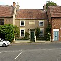
 40 And 42, Albert Street, Mansfield Woodhouse.jpg 3,840 × 2,160; 4.18 MB
-
 5-barred gate (with additions) - geograph.org.uk - 750201.jpg 640 × 480; 279 KB
-
 A glimpse of Welham Hall - geograph.org.uk - 4197004.jpg 1,280 × 945; 677 KB
-
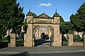
 Abbey Gates Lodge, Nottingham.jpg 4,032 × 3,024; 5.56 MB
-
 All Saints' church - geograph.org.uk - 1158774.jpg 640 × 426; 84 KB
-
 All Saints' Churchyard, Winthorpe.jpg 1,024 × 768; 331 KB
-
 Allotment gate - geograph.org.uk - 1465912.jpg 640 × 479; 96 KB
-
 Wesleyan Church, Annesley Woodhouse - geograph.org.uk - 895149.jpg 640 × 485; 70 KB
-
 Aspley Pentecostal Church - geograph.org.uk - 911150.jpg 640 × 480; 62 KB
-
 Basford Cemetery entrance - geograph.org.uk - 4122864.jpg 1,280 × 989; 362 KB
-
 Basford Manor - geograph.org.uk - 2143907.jpg 800 × 595; 551 KB
-
 Bestwood Pumping Station - geograph.org.uk - 1952936.jpg 854 × 1,280; 353 KB
-
 Bleasby church - geograph.org.uk - 1535942.jpg 640 × 479; 162 KB
-
 Blidworth Church postbox and churchyard gate - geograph.org.uk - 4015727.jpg 1,280 × 960; 466 KB
-
-

-

-
 Bunkers Hill Lodge And Attached Gateway, Welbeck Estate, near Cuckney.jpg 4,032 × 3,024; 4.14 MB
-
 Camelia House in Wollaton Park (11).JPG 4,608 × 3,440; 4.14 MB
-
 Carlton Hall - geograph.org.uk - 2879735.jpg 640 × 427; 132 KB
-
 Castlegate view - geograph.org.uk - 3214018.jpg 640 × 427; 152 KB
-
 Cattle Market gates - geograph.org.uk - 822389.jpg 640 × 480; 248 KB
-
 Cattle market gates - geograph.org.uk - 822427.jpg 482 × 640; 225 KB
-
 Cattle market gates - geograph.org.uk - 822445.jpg 640 × 480; 203 KB
-
 Church gate - geograph.org.uk - 109749.jpg 640 × 427; 147 KB
-
-
 Church of St George, Barton in Fabis.jpg 640 × 480; 96 KB
-
 Church of St Laurence, Norwell - geograph.org.uk - 4096186.jpg 1,280 × 910; 535 KB
-
 Church of St Oswald, Dunham on Trent - geograph.org.uk - 4140989.jpg 960 × 1,280; 343 KB
-
 Church of St Oswald, Dunham on Trent - geograph.org.uk - 4140990.jpg 960 × 1,280; 478 KB
-
 Church of the Holy Rood, Ossington - geograph.org.uk - 4103698.jpg 1,280 × 1,280; 531 KB
-

-
 Churchyard entrance and war memorial, Caunton - geograph.org.uk - 3093991.jpg 3,456 × 2,304; 5.67 MB
-
 Churchyard Entrance, Blyth.jpg 1,280 × 960; 579 KB
-
 Churchyard Entrance, St Peter and St Paul's Church, Mansfield.jpg 1,280 × 960; 493 KB
-
 Churchyard gate, Costock - geograph.org.uk - 750308.jpg 480 × 640; 222 KB
-
 Churchyard gates - geograph.org.uk - 789891.jpg 640 × 427; 92 KB
-
 Churchyard gates - geograph.org.uk - 832254.jpg 640 × 427; 90 KB
-

-

-
 Churchyard gateway, Laxton - geograph.org.uk - 4116966.jpg 1,280 × 1,280; 335 KB
-
 Churchyard wall and gateway, North Wheatley - geograph.org.uk - 4191201.jpg 1,280 × 878; 481 KB
-
 Churchyard wall, Sturton le Steeple - geograph.org.uk - 4189749.jpg 1,280 × 960; 456 KB
-
 Clayworth Church - panoramio.jpg 1,536 × 2,048; 779 KB
-
 Clinton House, Southwell.jpg 1,280 × 1,280; 565 KB
-
 Commerce Square - geograph.org.uk - 1771476.jpg 959 × 1,280; 426 KB
-
 St Mary's Church, Norton Lane, Cuckney (1).jpg 3,553 × 3,030; 1.98 MB
-
 St Marys Church Norton Cuckney Notts IMG 2246.JPG 2,256 × 1,504; 1.35 MB
-
 Daybrook Alms Houses - geograph.org.uk - 857094.jpg 1,280 × 853; 402 KB
-
 Decorative Gateposts - geograph.org.uk - 973176.jpg 640 × 480; 116 KB
-
 Disused gate, Bentinck Colliery - geograph.org.uk - 87243.jpg 480 × 640; 105 KB
-
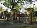
 East entrance to the Arboretum, Nottingham.jpg 1,280 × 960; 527 KB
-
 East Gateway, Newstead Abbey.jpg 1,280 × 960; 580 KB
-
 East Lodge, Welbeck Abbey.jpg 4,945 × 3,439; 3.49 MB
-
 Electric pylons near Warsop - geograph.org.uk - 16897.jpg 640 × 425; 70 KB
-
 Elm Avenue - geograph.org.uk - 544302.jpg 640 × 427; 80 KB
-
 Embankment Gates - geograph.org.uk - 985424.jpg 640 × 480; 165 KB
-
 End of the track - geograph.org.uk - 1334880.jpg 640 × 479; 170 KB
-
 Entrance gates to Clumber Park - geograph.org.uk - 3450768.jpg 800 × 533; 111 KB
-
 Entrance to Forest Recreation Ground. Mount Hooton Road, Nottingham.jpg 1,280 × 897; 544 KB
-
 Entrance to Hill House, Southwell.jpg 1,280 × 960; 535 KB
-
 Entrance to Holy Trinity Church, Lenton.jpg 640 × 480; 151 KB
-
 Entrance to Lime Tree Avenue, Wollaton Park - geograph.org.uk - 3852462.jpg 1,280 × 960; 395 KB
-
 Entrance to Manor Farm - geograph.org.uk - 4188777.jpg 1,280 × 960; 495 KB
-
 Entrance to Thoresby Estate - geograph.org.uk - 2694035.jpg 640 × 480; 83 KB
-
 Entrance to Waterloo Promenade, Mount Hooton Road, Nottingham.jpg 1,280 × 960; 467 KB
-
 Entrance to Woodyard looking north at Wollaton Park, Nottingham, England.jpg 4,608 × 3,018; 9.7 MB
-
 Entrance to Woodyard looking north-west at Wollaton Park, Nottingham, England.jpg 4,608 × 2,844; 9.67 MB
-
 Entrance to Woodyard looking south at Wollaton Park, Nottingham, England.jpg 4,608 × 2,898; 8.68 MB
-
 Entrance, Brackenhurst Hall.jpg 1,280 × 960; 457 KB
-
 Entrance, King Edward VI Grammar School, Retford.jpg 1,280 × 832; 484 KB
-
 Entrances to Waterloo Promenade, Southey Street, Nottingham.jpg 1,280 × 960; 590 KB
-
 Field gate - geograph.org.uk - 1145347.jpg 640 × 479; 103 KB
-
 Field gate - geograph.org.uk - 905463.jpg 640 × 427; 68 KB
-
 Fisherman's car park north of Holme - geograph.org.uk - 1120304.jpg 640 × 480; 59 KB
-
 Footpath and Gate - geograph.org.uk - 172359.jpg 640 × 480; 90 KB
-
 Footpath at Edwalton - geograph.org.uk - 229031.jpg 480 × 640; 191 KB
-
 Footpath from Church Lane - geograph.org.uk - 503260.jpg 640 × 427; 85 KB
-

-

-
 Footpath off the A614 Old Rufford Road - geograph.org.uk - 1207857.jpg 640 × 480; 103 KB
-
 Former Gateway to Blyth Hall.jpg 1,280 × 960; 649 KB
-
 Former Lodge, Babworth Hall.jpg 640 × 480; 120 KB
-
 Gate and pylons - geograph.org.uk - 1537045.jpg 640 × 460; 57 KB
-
 Gate and Railings, 24 and 26 Low Pavement, Nottingham.jpg 1,280 × 938; 383 KB
-
 Gate and Railings, Churchill House, Nottingham.jpg 1,280 × 1,280; 669 KB
-
 Gate into field - geograph.org.uk - 585953.jpg 640 × 389; 83 KB
-
 Gate piers at Staunton Hall.jpg 3,456 × 2,304; 4.16 MB
-
 Gate Piers, Bunny Park.jpg 1,600 × 1,065; 784 KB
-
 Gate Piers, Malvern House.jpg 1,024 × 768; 525 KB
-

-
 Gate to farmland - geograph.org.uk - 1183213.jpg 640 × 480; 127 KB
-
-
 Gate with initials. - geograph.org.uk - 511433.jpg 640 × 480; 125 KB
-
 Gated Community Barrier - geograph.org.uk - 54408.jpg 616 × 462; 102 KB
-

-
 Gatehouse to Kelham Hall - geograph.org.uk - 1110295.jpg 640 × 480; 80 KB
-
 Gateposts at Welham Hall - geograph.org.uk - 4197010.jpg 939 × 1,280; 797 KB
-
 Gates at 54 Moorgreen.jpg 960 × 1,280; 504 KB
-
 Gates at Lenton Priory - geograph.org.uk - 3060566.jpg 1,280 × 960; 267 KB
-
 Gates, Elton on the Hill - geograph.org.uk - 4158490.jpg 640 × 631; 301 KB
-
 Gateway And Boundary Wall At Memorial Nurses' Home.jpg 1,930 × 1,447; 667 KB
-
 Gateway And Boundary Wall At Wollaton House, Wollaton Village, Notts (1).jpg 4,032 × 3,024; 3.06 MB
-
 Gateway to Ragnall churchyard - geograph.org.uk - 4141677.jpg 1,280 × 960; 353 KB
-
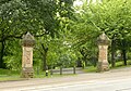
 Gateway to The Arboretum, Nottingham.jpg 1,280 × 960; 508 KB
-
 Gateway to the Friary - geograph.org.uk - 3113150.jpg 1,280 × 960; 383 KB
-
 Gateway, Church of St Nicholas, Tuxford - geograph.org.uk - 4126806.jpg 1,280 × 960; 370 KB
-
 Gateway, Easthorpe Lodge, Southwell.jpg 1,280 × 960; 554 KB
-
 Gateway, Hardwick Hall, Southwell.jpg 1,280 × 960; 498 KB
-
 Gateway, Langar Hall.jpg 640 × 479; 117 KB
-
 Gateway, Nottingham High School.jpg 1,280 × 853; 292 KB
-
 Gateway, Oxton Church.jpg 1,280 × 960; 486 KB
-
 Gateway, Southwell Minster (2).jpg 1,280 × 1,052; 413 KB
-
 Gateway, Southwell Minster.jpg 1,280 × 960; 499 KB
-
 Gateway, St Andrew's URC, Nottingham.jpg 960 × 1,280; 472 KB
-
 Gateway, The Old Rectory, Plumtree.jpg 1,280 × 960; 308 KB
-
 Gateway, Westhorpe Hall.jpg 1,280 × 960; 508 KB
-
 Gringley on the hill church. - geograph.org.uk - 1738359.jpg 480 × 640; 74 KB
-
 Hall Gates - geograph.org.uk - 503236.jpg 640 × 427; 109 KB
-
 Hartley Road and St Peter's Church gate - geograph.org.uk - 4674239.jpg 1,024 × 1,024; 1.57 MB
-
 West tower of Hawksworth Parish Church.jpg 4,000 × 6,000; 7.44 MB
-
 Highfields Gate 9208.JPG 3,264 × 2,448; 3.17 MB
-
 Highfields Gate 9212.JPG 3,264 × 2,448; 2.68 MB
-
 Highfields Gate 9215.JPG 2,448 × 3,264; 2.56 MB
-
 Highfields Gate 9216.JPG 3,264 × 2,448; 2.78 MB
-
 Highfields Park Gates 9144.JPG 3,264 × 2,448; 4.23 MB
-
 Highfields Park Gates 9145.JPG 3,264 × 2,448; 3.95 MB
-
 Highfields Park Gates 9146.JPG 3,264 × 2,448; 3.85 MB
-
 Highfields Park Gates 9151.JPG 3,264 × 2,448; 4.26 MB
-
 Highfields Park, west entrance - geograph.org.uk - 680865.jpg 640 × 480; 130 KB
-
 Honing House, Southwell.jpg 1,280 × 960; 422 KB
-
 Railway Pit - geograph.org.uk - 1536294.jpg 640 × 479; 67 KB
-
 Security precautions - geograph.org.uk - 1536305.jpg 640 × 479; 173 KB
-
 In Deep Water - geograph.org.uk - 521498.jpg 640 × 480; 92 KB
-
 Ineffective gate - geograph.org.uk - 679832.jpg 640 × 480; 138 KB
-
 Jubilee Cottage - geograph.org.uk - 1385950.jpg 476 × 640; 72 KB
-
 Keepers Cottage - geograph.org.uk - 1761630.jpg 640 × 480; 99 KB
-
 King George V Park, Aspley - geograph.org.uk - 1067926.jpg 640 × 480; 93 KB
-
 Kingston Hall lodge and gateway - geograph.org.uk - 3838638.jpg 1,280 × 995; 310 KB
-
 Moorhouse Chapel - geograph.org.uk - 149949.jpg 640 × 427; 84 KB
-
 Locked Gates - geograph.org.uk - 414242.jpg 640 × 427; 75 KB
-
 Long Distance footpath - geograph.org.uk - 1465925.jpg 640 × 479; 123 KB
-
 Main Gate, Mansfield Cemetery.jpg 960 × 1,280; 426 KB
-
 Boundary Wall And Gates At Bridge Street Methodist Church (1).jpg 3,036 × 4,048; 1.88 MB
-
 Mansfield Christian Community Centre, Rufford Ave (3).jpg 3,036 × 4,048; 4.7 MB
-
 Boundary Wall And Gates At Nottingham Road Methodist Church (1).jpg 4,048 × 3,036; 5.47 MB
-
 Boundary Wall And Gates At Nottingham Road Methodist Church (3).jpg 4,048 × 3,036; 4.1 MB
-
 Boundary Wall And Gates At Nottingham Road Methodist Church (5).jpg 3,036 × 4,048; 5.21 MB
-
 Mapperley Road, Malvern House - geograph.org.uk - 4549794.jpg 1,024 × 1,024; 1.31 MB
-
 The St George's in the Meadows, 9977.JPG 3,264 × 2,448; 4.2 MB
-
 Bailey bridge with gate. - geograph.org.uk - 529012.jpg 640 × 480; 177 KB
-
 Misterton railway station (site), Nottinghamshire (geograph 3216641).jpg 800 × 600; 128 KB
-
 Mud - geograph.org.uk - 607903.jpg 640 × 427; 127 KB
-
 Newark Cemetery Gates - geograph.org.uk - 3655930.jpg 640 × 427; 353 KB
-
 North Gate, Boughton Pumping Station.jpg 1,280 × 912; 491 KB
-
 Nottingham (2021-05-28) 06.jpg 5,568 × 3,712; 14.88 MB
-
 Nottingham - NG11 (Wilford Village) - geograph.org.uk - 2974895.jpg 800 × 580; 166 KB
-
 Nottingham - NG3 (Bellevue) - geograph.org.uk - 2997031.jpg 800 × 600; 176 KB
-
 Nottingham Castle, evening sunlight - geograph.org.uk - 4550599.jpg 1,024 × 732; 832 KB
-
 Nottingham RailwayStation SouthwestPortal.jpg 1,145 × 1,280; 713 KB
-
 Nottingham University West Entrance - geograph.org.uk - 64199.jpg 640 × 480; 115 KB
-

-
 Old crossing gate - geograph.org.uk - 932246.jpg 640 × 427; 123 KB
-
 Ornate gate - geograph.org.uk - 563801.jpg 640 × 480; 164 KB
-
 Ossington Hall gates - geograph.org.uk - 2480494.jpg 640 × 427; 131 KB
-
 Papplewick churchyard gates - geograph.org.uk - 4014439.jpg 1,280 × 960; 439 KB
-
 Parish church (3) - geograph.org.uk - 5344227.jpg 4,320 × 3,240; 4.07 MB
-
 Parish Church, Church Warsop, Notts. - geograph.org.uk - 4803406.jpg 3,319 × 2,436; 1.95 MB
-
 Private track to Roman Bank - geograph.org.uk - 877492.jpg 640 × 374; 57 KB
-

-
 Railings and gate at Crown Cottage - geograph.org.uk - 4190009.jpg 1,280 × 908; 387 KB
-
 Ratcliffe-on-Soar, Holy Trinity - geograph.org.uk - 224288.jpg 432 × 285; 24 KB
-

-
 Rustic Gateway, Collingham.jpg 1,024 × 683; 354 KB
-

-
 Rusty tanker on farmland - geograph.org.uk - 460931.jpg 640 × 480; 80 KB
-
 Shireoaks Chapel - geograph.org.uk - 427854.jpg 640 × 480; 108 KB
-
 Signpost to Sherwood Forest - geograph.org.uk - 124037.jpg 640 × 417; 81 KB
-
 South Lodge, Newstead Abbey.jpg 1,280 × 960; 583 KB
-
 South Scarle Church - geograph.org.uk - 1720514.jpg 800 × 544; 137 KB
-
 St Helens Church Gates. Stapleford.jpg 4,608 × 3,456; 5.51 MB
-
 St Mary's Church, Colston Bassett 3D-35486887876.jpg 7,296 × 2,736; 3.74 MB
-
 St Mary's Church, Norton Lane, Cuckney (2).jpg 4,014 × 3,022; 2.9 MB
-
 St Mary's Church, Norton Lane, Cuckney (25).jpg 3,903 × 3,048; 2.59 MB
-
 St Mary's School, boys' entrance - geograph.org.uk - 3444941.jpg 1,200 × 1,200; 2.22 MB
-
 St Peters church in summer - geograph.org.uk - 333968.jpg 640 × 480; 126 KB
-
 St. Katherine's Church - Teversal - geograph.org.uk - 762014.jpg 640 × 480; 124 KB
-
 St. Peter's Church, Widmerpool (geograph 1042783).jpg 640 × 438; 108 KB
-
 St.Mary and All Saints' church tower - geograph.org.uk - 372300.jpg 427 × 640; 64 KB
-
 St.Mary's churchyard gates - geograph.org.uk - 588834.jpg 640 × 427; 140 KB
-
 St.Peter's church gate - geograph.org.uk - 547139.jpg 427 × 640; 78 KB
-
 St.Peter's church, Clayworth - geograph.org.uk - 209012.jpg 640 × 427; 91 KB
-
-
 Staunton Hall Lodge and gates - geograph.org.uk - 3935573.jpg 1,280 × 960; 380 KB
-
 St Anne Sutton 1.jpg 2,848 × 2,136; 1.52 MB
-
 Swingate Reservoir entrance - geograph.org.uk - 616551.jpg 628 × 419; 42 KB
-
 Thane Road Bridge - geograph.org.uk - 680602.jpg 640 × 480; 86 KB
-
 The Boots Company, Beeston - geograph.org.uk - 678661.jpg 640 × 418; 79 KB
-
 The Boots Company, Beeston - geograph.org.uk - 678665.jpg 640 × 419; 117 KB
-
 The churchyard gate at Clayworth - geograph.org.uk - 2744521.jpg 1,024 × 768; 247 KB

_-_geograph.org.uk_-_750201.jpg)


.jpg)
.jpg)
.jpg)

.JPG)


.jpg)
.jpg)


.jpg)


.jpg)


.jpg)


.jpg)
.jpg)
.jpg)
.jpg)
.jpg)


,_Nottinghamshire_(geograph_3216641).jpg)


_06.jpg)
_-_geograph.org.uk_-_2974895.jpg)
_-_geograph.org.uk_-_2997031.jpg)


_-_geograph.org.uk_-_5344227.jpg)


.jpg)
.jpg)


.jpg)


