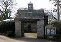
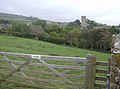
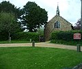
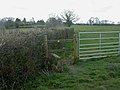
Category:Gates in Dorset
Jump to navigation
Jump to search
Ceremonial counties of England: Bedfordshire · Berkshire · Buckinghamshire · Cambridgeshire · Cheshire · Cornwall · Cumbria · Derbyshire · Devon · Dorset · Durham · East Riding of Yorkshire · East Sussex · Essex · Gloucestershire · Greater London · Greater Manchester · Hampshire · Herefordshire · Hertfordshire · Kent · Lancashire · Leicestershire · Lincolnshire · Merseyside · Norfolk · North Yorkshire · Northamptonshire · Northumberland · Nottinghamshire · Oxfordshire · Rutland · Shropshire · Somerset · South Yorkshire · Staffordshire · Suffolk · Surrey · Tyne and Wear · Warwickshire · West Midlands · West Sussex · West Yorkshire · Wiltshire · Worcestershire
City-counties: Bristol · City of London
Former historic counties:
Other former counties:
City-counties: Bristol · City of London
Former historic counties:
Other former counties:
Subcategories
This category has the following 7 subcategories, out of 7 total.
B
- Gates in Bridport (5 F)
N
S
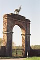
- Stag Gate, Charborough Park (13 F)
- Gates in Swanage (1 F)
W
- Gates in Weymouth, Dorset (1 F)
Media in category "Gates in Dorset"
The following 200 files are in this category, out of 318 total.
(previous page) (next page)-
 "Bunny" field from Coombe Lane - geograph.org.uk - 1589650.jpg 640 × 480; 106 KB
-
 2010-04-05 Studland Village Hall.jpg 1,869 × 1,295; 628 KB
-
 5 Tips Firing Point, Povington - geograph.org.uk - 384791.jpg 640 × 480; 93 KB
-
 Abbotsbury Church - geograph.org.uk - 438030.jpg 640 × 477; 84 KB
-
 Above the Piddle Valley - geograph.org.uk - 865873.jpg 640 × 480; 138 KB
-
 Above Tyneham - geograph.org.uk - 1521752.jpg 640 × 455; 95 KB
-
 Access Gate to Durdle Door - geograph.org.uk - 844198.jpg 640 × 480; 76 KB
-
 Access to Nature Reserve - geograph.org.uk - 1365948.jpg 640 × 480; 104 KB
-
 Africa Wood - geograph.org.uk - 1032672.jpg 640 × 426; 101 KB
-
 St James Alderholt - geograph.org.uk - 1296589.jpg 640 × 543; 115 KB
-
 St James' Church, Alderholt. - geograph.org.uk - 48326.jpg 640 × 480; 149 KB
-
 Alderholt, parish church of St. James - geograph.org.uk - 500355.jpg 429 × 640; 84 KB
-
 Alderholt, stile - geograph.org.uk - 1245411.jpg 640 × 480; 78 KB
-
 Alderholt, stile - geograph.org.uk - 1245567.jpg 640 × 480; 112 KB
-
 All Saints Church, Langton Long - geograph.org.uk - 295127.jpg 600 × 450; 110 KB
-
 An entrance to Lulworth range - geograph.org.uk - 587797.jpg 640 × 480; 118 KB
-
 Anderson Manor - geograph.org.uk - 1374412.jpg 480 × 640; 116 KB
-
 Ashley Farm, St Leonards and St Ives - geograph.org.uk - 181319.jpg 640 × 481; 115 KB
-
 Ballard Down , Public Footpath and Gate - geograph.org.uk - 1712264.jpg 3,264 × 2,448; 3.33 MB
-
 Barn Near Compton Valence - geograph.org.uk - 1072932.jpg 640 × 443; 91 KB
-
 Beaminster, church tower - geograph.org.uk - 1369588.jpg 480 × 640; 62 KB
-

-
 Beautiful Footpath Entrance - geograph.org.uk - 1425693.jpg 640 × 480; 110 KB
-
 Bere Regis - Lane End - geograph.org.uk - 1562211.jpg 640 × 480; 104 KB
-
 Bere Regis, gate or stile^ - geograph.org.uk - 1268385.jpg 640 × 480; 144 KB
-

-
 Birdsmoorgate, postbox № DT6 68 - geograph.org.uk - 935807.jpg 640 × 480; 96 KB
-

-
 Blackney, Venn Farm - geograph.org.uk - 935802.jpg 640 × 470; 102 KB
-

-
 Bournemouth, Berry Court Car Park - geograph.org.uk - 635968.jpg 640 × 480; 114 KB
-

-
 Bridleway as seen from the Roman road - geograph.org.uk - 529302.jpg 623 × 493; 73 KB
-
 Bridleway from Warren Barn - geograph.org.uk - 621348.jpg 640 × 477; 70 KB
-
 Bridleway gate - geograph.org.uk - 865827.jpg 640 × 480; 126 KB
-
 Bridleway gates, Ailwood Down - geograph.org.uk - 1026340.jpg 640 × 427; 106 KB
-
 Bridleway south of Long Barrow Farm - geograph.org.uk - 437849.jpg 640 × 477; 94 KB
-
 Bridleway to Cowdon Hill - geograph.org.uk - 1157050.jpg 640 × 480; 144 KB
-
 Bridleway to Cowpound Wood - geograph.org.uk - 1177021.jpg 640 × 480; 221 KB
-

-
 Bridleway towards River Stour - geograph.org.uk - 1252212.jpg 640 × 480; 93 KB
-
 Bridleway, Ashley Barn - geograph.org.uk - 1174781.jpg 640 × 480; 166 KB
-
 Bridleway, to Wears Hill, Dorset - geograph.org.uk - 1735854.jpg 1,024 × 768; 169 KB
-
 Broken Gate - geograph.org.uk - 1702556.jpg 640 × 480; 68 KB
-
 Broken gate, Athelhampton - geograph.org.uk - 1177092.jpg 640 × 481; 236 KB
-
 Bull^ Keep Out^ - geograph.org.uk - 1318428.jpg 640 × 437; 71 KB
-

-
 Cerne Abbas flood storage reservoir - geograph.org.uk - 1403433.jpg 640 × 480; 345 KB
-
 Churchyard Gate - geograph.org.uk - 1233118.jpg 640 × 480; 105 KB
-
 Cliff Path, West Bay - geograph.org.uk - 1022934.jpg 640 × 471; 48 KB
-
 Corfe Castle, footpath - geograph.org.uk - 1337808.jpg 640 × 480; 94 KB
-
 Countryside near Well Bottom - geograph.org.uk - 1113156.jpg 640 × 398; 107 KB
-
 Cow Squeeze in Eye Mead - geograph.org.uk - 1189259.jpg 640 × 480; 113 KB
-
 Cows at Kingston Russell stone circle - geograph.org.uk - 437963.jpg 640 × 477; 67 KB
-
 Dewlish Park Gates - geograph.org.uk - 113384.jpg 640 × 480; 182 KB
-

-
 Entering Compton Valence - geograph.org.uk - 437808.jpg 640 × 477; 107 KB
-
 Entrance gate to Redbridge Manor - geograph.org.uk - 417836.jpg 640 × 480; 77 KB
-

-
 Entrance to Catherston Manor - geograph.org.uk - 413754.jpg 640 × 480; 189 KB
-
 Entrance to Chilfrome House - geograph.org.uk - 429139.jpg 640 × 477; 154 KB
-
 Entrance to Holton Lee - geograph.org.uk - 453342.jpg 640 × 480; 115 KB
-
 Entrance to Hooke Park - geograph.org.uk - 1029969.jpg 640 × 426; 125 KB
-

-
 Entrance to Max Gate, Dorchester - geograph.org.uk - 294843.jpg 600 × 450; 120 KB
-
 Entrance to Meadow Nature Reserve - geograph.org.uk - 1230413.jpg 640 × 480; 90 KB
-
 Entrance to Melplash Court - geograph.org.uk - 462561.jpg 640 × 480; 200 KB
-

-
 Farm gate near Ashmore - geograph.org.uk - 1347600.jpg 640 × 480; 121 KB
-
 Farm track and hedge near Cheselbourne - geograph.org.uk - 663366.jpg 640 × 480; 117 KB
-
 Farm track towards Cokers Frome - geograph.org.uk - 786655.jpg 640 × 360; 42 KB
-
 Farmland on Fitzworth Heath - geograph.org.uk - 493811.jpg 640 × 480; 97 KB
-
 Is it a church or a home, Farrington - geograph.org.uk - 371354.jpg 640 × 480; 162 KB
-
 Farrington, former church - geograph.org.uk - 505266.jpg 640 × 429; 86 KB
-
 Fences and gates below Swyre Head - geograph.org.uk - 1634079.jpg 640 × 480; 77 KB
-

-
 Field and gate west of Hampton Barn - geograph.org.uk - 242743.jpg 640 × 480; 136 KB
-
 Field Gate near Church Knowle - geograph.org.uk - 715483.jpg 640 × 480; 165 KB
-

-
 Field Gateway, Tolpuddle - geograph.org.uk - 892325.jpg 640 × 426; 98 KB
-
-
 Five-legged animal - geograph.org.uk - 456589.jpg 429 × 640; 56 KB
-
 Flooding at Bear Mead - geograph.org.uk - 1187398.jpg 640 × 480; 89 KB
-
 Flowers for charity - geograph.org.uk - 1498301.jpg 480 × 640; 110 KB
-

-
 Footpath from Vermin Lane - geograph.org.uk - 457066.jpg 640 × 480; 99 KB
-
 Footpath Gate, Courtyard Craft Centre - geograph.org.uk - 1438196.jpg 640 × 455; 134 KB
-
-
 Footpath leaving Kimmeridge - geograph.org.uk - 769700.jpg 480 × 640; 135 KB
-
 Footpath near Fleet village - geograph.org.uk - 539486.jpg 640 × 474; 71 KB
-
 Forest Lane - geograph.org.uk - 1767868.jpg 640 × 480; 165 KB
-
 Frosty Gate Post On College Down - geograph.org.uk - 1113137.jpg 640 × 399; 65 KB
-
 Frosty Gateway near Nether Cerne - geograph.org.uk - 1113188.jpg 640 × 455; 146 KB
-
 Gate and chair in All Saints Churchyard - geograph.org.uk - 454829.jpg 640 × 480; 154 KB
-
 Gate and Drive of Kingston Russell House - geograph.org.uk - 1125207.jpg 640 × 463; 107 KB
-
 Gate and maize field below Pilsdon Pen - geograph.org.uk - 562087.jpg 640 × 480; 149 KB
-
 Gate at Swyre Head - geograph.org.uk - 535414.jpg 640 × 480; 84 KB
-
 Gate between Beach Coppice and Hyde Wood - geograph.org.uk - 769246.jpg 480 × 640; 139 KB
-

-
 Gate on Bow's Hill - geograph.org.uk - 1113187.jpg 640 × 428; 109 KB
-
 Gate on the Bridleway - geograph.org.uk - 1443666.jpg 426 × 640; 124 KB
-
 Gate on the Ridgeway - geograph.org.uk - 1523070.jpg 640 × 455; 89 KB
-
-
 Gate to St Mary's Church, Chettle - geograph.org.uk - 1040091.jpg 640 × 480; 106 KB
-
 Gate, Brockington Down - geograph.org.uk - 687904.jpg 640 × 435; 101 KB
-
 Gate, Child Okeford - geograph.org.uk - 1747125.jpg 480 × 640; 166 KB
-
 Gate, Knowle Hill - geograph.org.uk - 1523525.jpg 640 × 455; 76 KB
-
 Gate, Ridgeway Hill - geograph.org.uk - 1523105.jpg 640 × 455; 75 KB
-
 Gate, St Laurence's Church, Affpuddle - geograph.org.uk - 1175017.jpg 480 × 640; 193 KB
-
 Gate, St Mary's Church - geograph.org.uk - 1174355.jpg 480 × 640; 169 KB
-
 Gate, St Mary's Church, West Stour - geograph.org.uk - 1155538.jpg 480 × 640; 217 KB
-
 Gateposts, Bredy, Dorset. - geograph.org.uk - 1125796.jpg 640 × 428; 111 KB
-
 Gates at Littlebredy. - geograph.org.uk - 1218648.jpg 640 × 412; 70 KB
-
 Gates of Wootton Fitzpaine Cemetery - geograph.org.uk - 421776.jpg 474 × 640; 158 KB
-
 Gates to Melplash Court - geograph.org.uk - 1032830.jpg 640 × 426; 97 KB
-
 Gates, Sturminster Marshall (geograph 2712142).jpg 640 × 480; 93 KB
-
 Gateway and drive to Lewcombe - geograph.org.uk - 1215160.jpg 640 × 480; 127 KB
-
 Gateway and fields near Puncknowle - geograph.org.uk - 1125784.jpg 640 × 428; 96 KB
-
 Gateway at Abbott's Wootton - geograph.org.uk - 476575.jpg 640 × 480; 132 KB
-
 Gateway Holt Hill - geograph.org.uk - 1206896.jpg 640 × 428; 84 KB
-
 Gateway near Litton Cheney - geograph.org.uk - 1125420.jpg 640 × 417; 74 KB
-
 Gateway near Long Bredy - geograph.org.uk - 1125059.jpg 640 × 458; 136 KB
-
 Gateway to Pipsford Farm - geograph.org.uk - 1029979.jpg 640 × 426; 79 KB
-
 Gateway, Compton Valence. - geograph.org.uk - 1073393.jpg 640 × 443; 96 KB
-
 Gateway, Cowgrove - geograph.org.uk - 1438117.jpg 640 × 455; 143 KB
-
 Gateway, Hawkins Farm. - geograph.org.uk - 1206897.jpg 640 × 428; 80 KB
-
 Gateway, SW coast path. - geograph.org.uk - 1092250.jpg 640 × 444; 135 KB
-
 Gillingham, finger-post at Wyke - geograph.org.uk - 1435898.jpg 640 × 480; 139 KB
-
 Gussage St Michael, gate - geograph.org.uk - 1434031.jpg 640 × 480; 95 KB
-
 Gussage St Michael, pumping station - geograph.org.uk - 1434081.jpg 640 × 480; 93 KB
-
 Hammoon, parish church of St. Paul - geograph.org.uk - 506486.jpg 640 × 429; 109 KB
-
 Parish Church of St Catherine - Haydon - geograph.org.uk - 386252.jpg 640 × 480; 135 KB
-

-
 Hewood, postbox No. TA20 216 - geograph.org.uk - 1383122.jpg 640 × 480; 98 KB
-
 Hilfield Manor - geograph.org.uk - 489774.jpg 640 × 480; 162 KB
-

-
 I need sunglasses Larry^ - geograph.org.uk - 1178585.jpg 640 × 480; 87 KB
-
 Ilsington Farm - geograph.org.uk - 554786.jpg 480 × 640; 193 KB
-

-
 Junction for Osmington - geograph.org.uk - 618605.jpg 640 × 477; 87 KB
-
 Kimmeridge, the old school - geograph.org.uk - 1126491.jpg 640 × 480; 93 KB
-
 St. Stephen's, Kingston Lacey, Dorset - geograph.org.uk - 150894.jpg 640 × 481; 123 KB
-
 Kingston Lacy Estate Boundary gate - geograph.org.uk - 317489.jpg 480 × 640; 116 KB
-
 Kingston Lacy House - geograph.org.uk - 1295511.jpg 640 × 480; 96 KB
-
 Lamperts Farm Dairy - geograph.org.uk - 979972.jpg 640 × 426; 69 KB
-
 Lecher Water valley - geograph.org.uk - 4720160.jpg 1,920 × 1,232; 727 KB
-
 Lift Handle to Open Gate - geograph.org.uk - 1575460.jpg 640 × 480; 125 KB
-

-
 Llsington - geograph.org.uk - 882112.jpg 640 × 426; 104 KB
-
 Lodge Gate Entrance to Rew Manor - geograph.org.uk - 402409.jpg 640 × 480; 156 KB
-
 Lulworth area - geograph.org.uk - 1564556.jpg 640 × 320; 57 KB
-
 Lulworth area - geograph.org.uk - 1564708.jpg 640 × 480; 146 KB
-
 Lulworth area - geograph.org.uk - 1564771.jpg 640 × 480; 121 KB
-
 Lulworth Ranges - geograph.org.uk - 1442350.jpg 640 × 480; 126 KB
-

-
 Lynch Farm - geograph.org.uk - 528113.jpg 623 × 493; 63 KB
-
 St Aldhelm's Chapel, Lytchett Heath - geograph.org.uk - 164231.jpg 600 × 399; 91 KB
-
 Mapperton, eagle detail - geograph.org.uk - 517676.jpg 640 × 429; 37 KB
-

-
 Melbury House and Church - geograph.org.uk - 1272021.jpg 640 × 419; 319 KB
-
 Melbury Park south gates - geograph.org.uk - 438422.jpg 640 × 477; 127 KB
-
 Melbury Park south gates - geograph.org.uk - 438425.jpg 640 × 477; 75 KB
-
 Motala crossing - geograph.org.uk - 1334617.jpg 640 × 480; 131 KB
-
 Motala gate - geograph.org.uk - 1334587.jpg 640 × 530; 107 KB
-
 Muddy gate at Holly Farm - geograph.org.uk - 1218869.jpg 640 × 428; 112 KB
-
 Muddy Gateway near Shipton Gorge - geograph.org.uk - 1125807.jpg 428 × 640; 109 KB
-
 Muscliff, beware of the cattle - geograph.org.uk - 734936.jpg 640 × 480; 110 KB
-
 Newly aligned bridleway off Holme Lane - geograph.org.uk - 1167994.jpg 640 × 480; 237 KB
-
 North of Knowle Hill - geograph.org.uk - 1523540.jpg 640 × 455; 96 KB
-
 Old Farm Track near Piddlehinton - geograph.org.uk - 1116980.jpg 640 × 428; 82 KB
-
 Old school gateway - geograph.org.uk - 1690997.jpg 640 × 480; 122 KB
-
 On White Horse Hill - geograph.org.uk - 616023.jpg 640 × 477; 78 KB
-
 Our Wedding (2011-04-02 11.17.36GB-472) (5868703665).jpg 5,616 × 3,744; 17.97 MB
-
 Path, towards Langdon Hill - geograph.org.uk - 1454425.jpg 640 × 480; 108 KB
-
 Permissive path North of Swyre Head - geograph.org.uk - 763320.jpg 430 × 640; 78 KB
-
 Puddletown Down - geograph.org.uk - 663387.jpg 640 × 480; 54 KB
-
 Puncknowle, playing field - geograph.org.uk - 935105.jpg 640 × 480; 102 KB
-
 Rear Entrance to Woodsford Castle - geograph.org.uk - 798776.jpg 640 × 426; 125 KB
-
 Ridgeway Gate - geograph.org.uk - 1632865.jpg 640 × 480; 76 KB
-
 Ridgeway to Corfe Castle - geograph.org.uk - 1523328.jpg 640 × 455; 88 KB
-
 Roadside Lake at Forston - geograph.org.uk - 462423.jpg 640 × 480; 135 KB
-
 Roadside produce stall - geograph.org.uk - 1366387.jpg 640 × 480; 413 KB
-
 Sadborow, postbox No. TA20 455 - geograph.org.uk - 1383104.jpg 640 × 480; 95 KB
-
 Sandbanks, Poole-14675364998.jpg 3,840 × 2,160; 2.27 MB
-
 Sandbanks, Poole-14675447127.jpg 3,840 × 2,160; 2.15 MB
-
 Sandbanks, Poole-14859503474.jpg 3,840 × 2,160; 2.5 MB
-
 Sandbanks, Poole-14861645512.jpg 3,840 × 2,160; 2.09 MB
-
 Sandbanks, Poole-14881848183.jpg 3,840 × 2,160; 2.18 MB
-
 Sandford near Wareham - geograph.org.uk - 1557171.jpg 640 × 480; 51 KB
-
 Sandford Orcas church - geograph.org.uk - 38492.jpg 640 × 429; 142 KB
-
 Scotland Farm - geograph.org.uk - 1772496.jpg 640 × 480; 206 KB
-
 Sessions Gate - geograph.org.uk - 1052717.jpg 640 × 480; 123 KB
-
 Shapwick, gateway to Badbury Rings - geograph.org.uk - 1152933.jpg 640 × 480; 92 KB
-

-
 Sharford Bridge - geograph.org.uk - 99847.jpg 640 × 480; 175 KB
-
 Sheep in Scratchy Bottom - geograph.org.uk - 763310.jpg 640 × 430; 96 KB
-
 Sherborne golf course - geograph.org.uk - 487219.jpg 640 × 477; 72 KB
-
 Snow at Bear Mead - geograph.org.uk - 1187387.jpg 640 × 480; 60 KB
-
 South West Coast Path - geograph.org.uk - 897116.jpg 640 × 480; 84 KB
-


.jpg)


_(5868703665).jpg)


