Category:Aerial photographs of Saarland
Jump to navigation
Jump to search
Federal states of Germany:
Deutsch: Diese Kategorie dient zur Sammlung von Luftbildaufnahmen aus dem Saarland.
English: Aerial photographs of Saarland
Subcategories
This category has the following 6 subcategories, out of 6 total.
Media in category "Aerial photographs of Saarland"
The following 13 files are in this category, out of 13 total.
-
 Aerial photograph 2014-03-29 Saarland.JPG 1,024 × 682; 192 KB
-
 Aerial photograph 2014-03-30 Saarland.JPG 1,024 × 682; 223 KB
-
 Aerial photograph 2014-03-31 Saarland.JPG 1,024 × 682; 245 KB
-
 Annotated Photo Enlargement -5011 - ND. Würzbach - NARA - 100385297.jpg 6,600 × 8,679; 4.29 MB
-
 Annotated Photo Enlargement -5013 - ND. Würzbach - NARA - 100385299.jpg 6,600 × 8,711; 4.65 MB
-
 Annotated Photo Enlargement -5018 - Walhausen - NARA - 100385285.jpg 6,600 × 8,671; 4.38 MB
-
 Annotated Photo Enlargement -5025 - Blies River - NARA - 100385303.jpg 6,600 × 8,691; 4.15 MB
-
 Annotated Photo Enlargement -5027 - Lautzkirchen - NARA - 100385305.jpg 6,600 × 8,677; 4.19 MB
-
 Annotated Photo Enlargement -5029 - Ballweiler - NARA - 100385307.jpg 6,600 × 8,692; 4.12 MB
-
 Bärenfels bei Scheiden.jpg 5,472 × 3,648; 13.29 MB
-
 Naturdenkmal Unnereichen bei Tholey.jpg 4,000 × 3,000; 12.13 MB
-
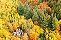
 Saarschleife Autumn 2020.jpg 5,100 × 3,400; 12.52 MB
-
 Teufelsfels Waldhölzbach.jpg 5,472 × 3,648; 22.26 MB


